
November 28, 2022
North Annapurna Glacier, Nepal Retreat and Lake Development
Posted by Mauri Pelto
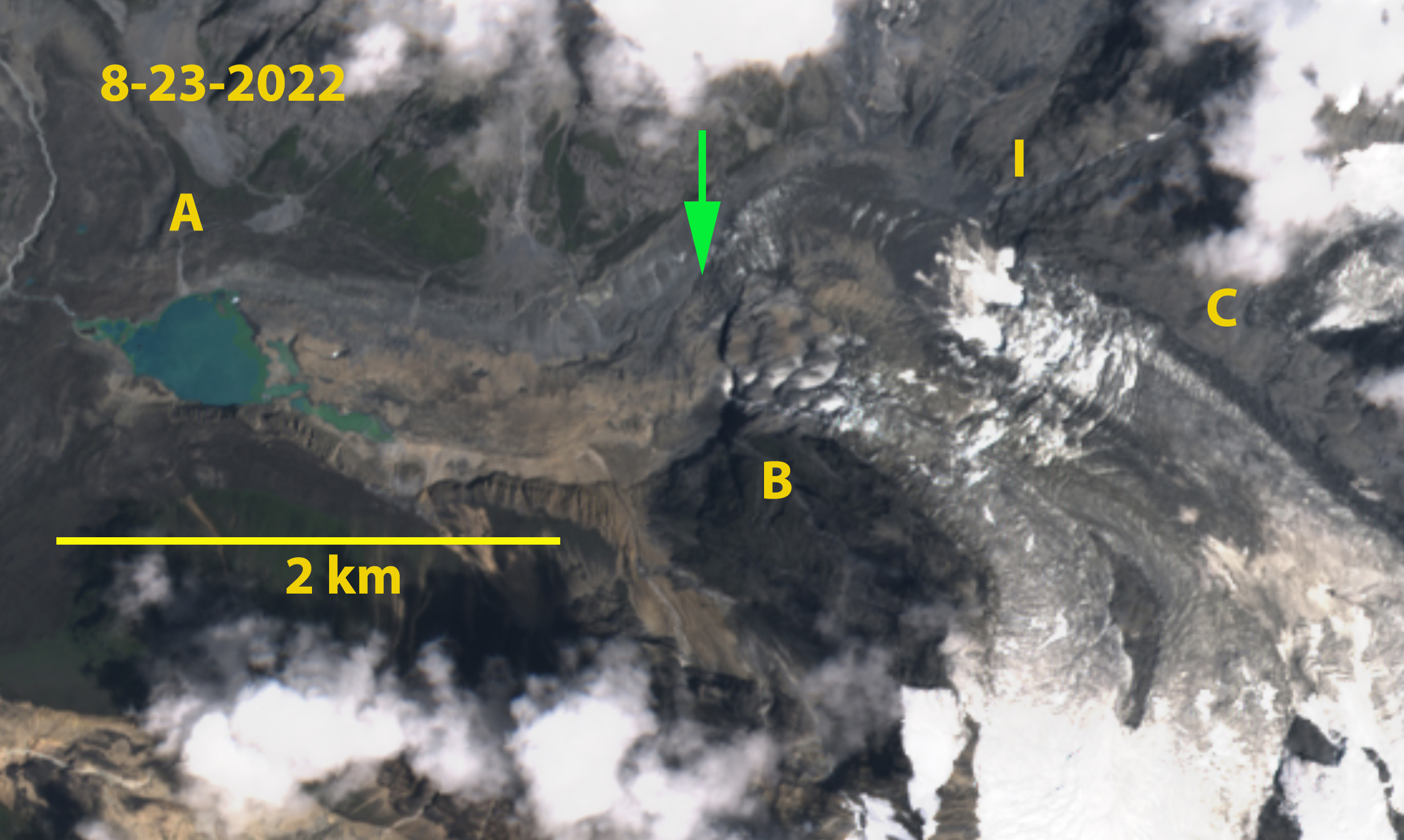
North Annapurna Glacier in August 2022 Sentinel image. A=North Annapurna Base Camp, I=icefall base, B= Prominent Knob, C=tributary that has separated by 2022. The green arrow marks the end of the active ice which is now 1.5 km upglacier of the terminus. Note Diki Cho (lake) is relatively free of icebergs that were plentiful in 2018.
North Annapurna Glacier drains the northeast side of Annapurna (8091 m). The North Annapurna climbers base camp (NABC) for the original ascent in 1950 was opened to trekking in 2020 via the new Maurice Herzog Trail. The NABC is located near the terminus of the North Annapurna Glacier, when first located there was no lake at the terminus of the glacier. Today glacier thinning and retreat has led to development of DikiCho. The glacier has also become stagnant in its lower reaches. Here we examine Landsat imagery from 1988-2022 to identify the long term changes, and Sentinel imagery from 2018-2022 along with trekking images from 2020-2021 to look at the lake development in details.
North Annapurna Glacier in 1988 and 2022 Landsat images. Yellow arrow indicates 2022 terminus location. A=North Annapurna Base Camp, I=icefall base, B= Prominent Knob, C=tributary that has separated.
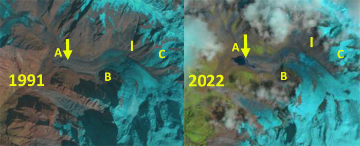
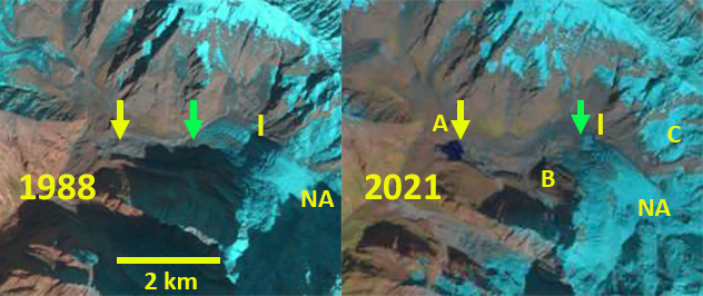
In 1988 North Annapurna Glacier extended to the end of what has become Diki Cho (lake) and into the main north/south valley of the Miristi Khola. The tributary at Point C connects to the glacier above the icefall. The area of active blue ice extends 1.5 km beyond the icefall, including a series of ogives. The only evident change is the increase debris cover below the icefall. In 2001 the first sign of a lake at the terminus is evident and active blue ice extends beyond Point B. By 2018 Diki Cho has expanded to an area of 0.15 km² and has considerable stranded icebergs amidst the lake. The area of active ice ends just below Point B. By 2021 most of the ice amidst Diki Cho has melted. Tributary C no longer connects to the main glacier and the zone of blue ice extends just beyond the base of the icefall. The wam summer of 2022 led to further lake expansion particularly along the southern margin of the glacier, with an area of 0.27 km². The lower 1.5 km of the glacier is stagnant. North Annapurna Glacier has retreated 600 m from 1988-2022. The lower 1.5 km of the glacier is no longer being actively fed by the glacier and will be lost, though with thick debris cover this will not happen quickly. This section of the glacier also has a low surface gradient indicating that lake expansion will continue. The retreat here has been slower than at Lumding Glacier or Barun Glacier, but is increasing in the last decade.
North Annapurna Glacier in 1991 and 2022 Landsat images. Yellow arrow indicates 2021 terminus location and green arrow the end of the blue ice. A=North Annapurna Base Camp, I=icefall base, B= Prominent Knob, C=tributary that has separated.
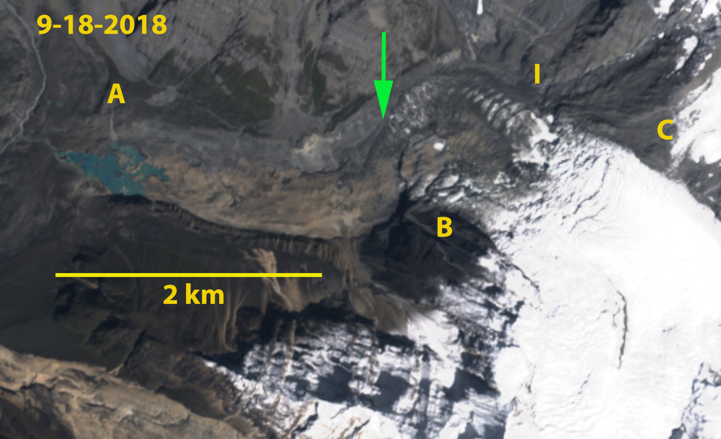
North Annapurna Glacier in August 2018 Sentinel image. A=North Annapurna Base Camp, I=icefall base, B= Prominent Knob, C=tributary that has separated. The green arrow marks the end of the active ice which is now 1.5 km upglacier of the terminus. Note Diki Cho has many icebergs.
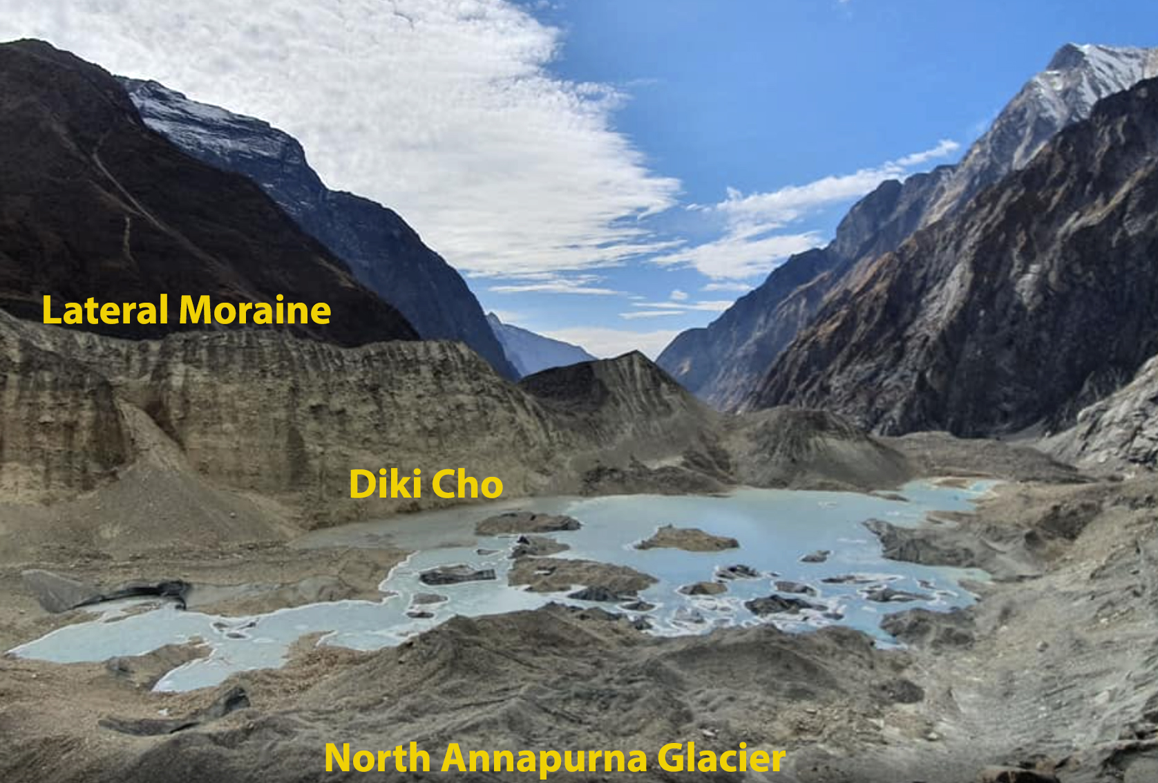
Annotated image of Diki Cho from near the North Annapurna Base Camp, image from Nepal Trek Hub.
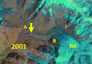
North Annapurna Glacier in 2001 Landsat image. Yellow arrow indicates 2021 terminus location and green arrow the end of the blue ice. A=North Annapurna Base Camp, I=icefall base, B= Prominent Knob, C=tributary that is separating.
 Dean of Academic Affairs at Nichols College and Professor of Environmental Science at Nichols College in Massachusetts since 1989. Glaciologist directing the North Cascade Glacier Climate Project since 1984. This project monitors the mass balance and behavior of more glaciers than any other in North America.
[…] Source link […]