
November 7, 2022
Bara Shigri Glacier, India Separation of Tributaries
Posted by Mauri Pelto
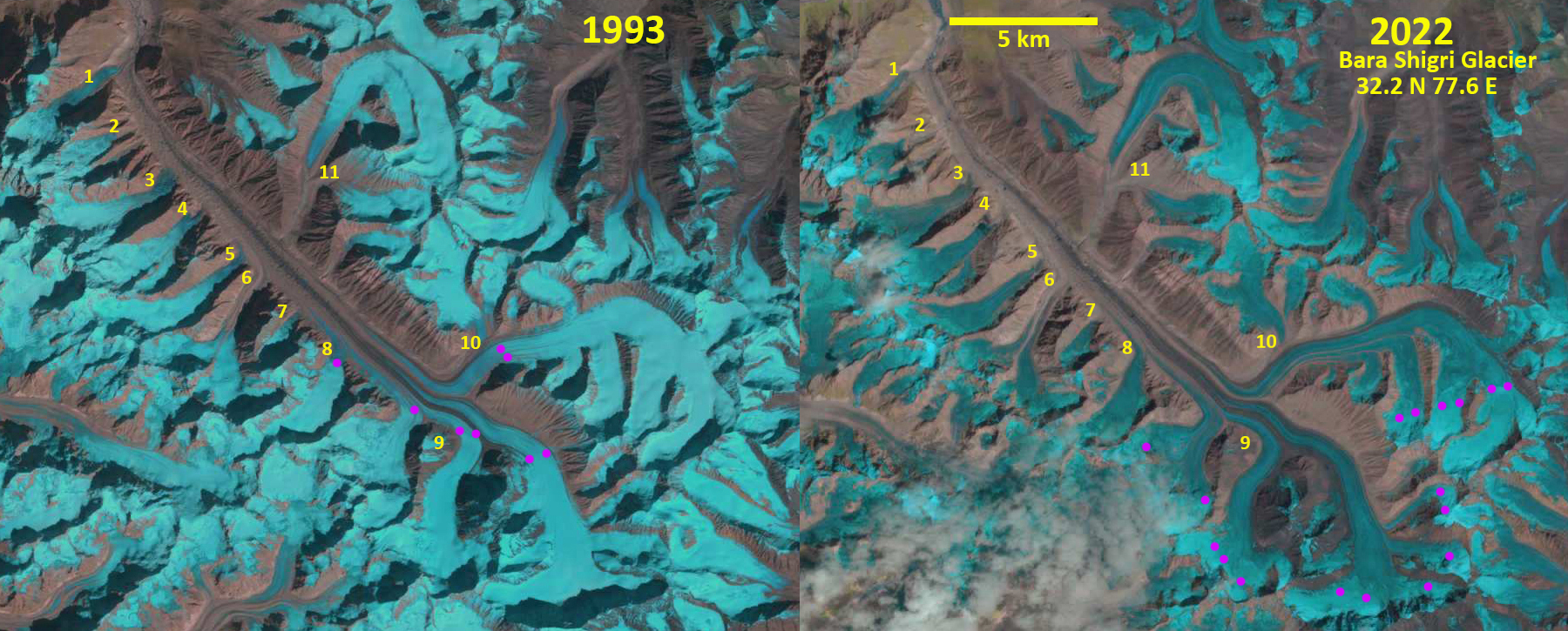
Bara Shigri Glacier in 1993 and 2022 Landsat images indicating the separation of a number of tributaries. Purple dots mark the snowline 1993=5050 m and 2022=5600 m.
Bara Shigri Glacier, India is in Chandra Valley of the Western Himalaya. Chand et al (2017) report on the behavior of the glacier from the Little Ice Age to 2014 noting a retreat of 255 m from 1992-2002 and 168 m from 2002-2014. This 26 km long glacier had an average snowline maximum elevation of 5340 m for the 2000-2014 period. The glacier has been fed by a number of significant tributaries feeding from the southwest, here labeled 1-9. The snowline has risen above 5400 m with increasing frequency resulting in a limited accumulation area as observed in Landsat images from 2002, 2016, 2020 and 2022.
In 1993 tributary 1, 3, 4, 5, 6, 8 and 9 feed the main stem, while tributary 2 does not reach the main stem and tributary 7 just meets it without apparent contribution. In 2002 the same tributaries continue to contribute ice to the main stem as in 1993. The snowline is much higher at 5400 m. In 2022 tributaries 1, 4 and 5 no longer contribute to the mainstem of the glacier, leaving Only tributaries 3, 6, 8 and 9 connecting. The snowline in 2020 averaged 5600 m as well, with higher snow levels on the southwest tributaries and a lower snowline on the northeast arm of the glacier.
The detachment of tributaries illustrates mass balance loss of these glaciers and consequence decrease in volume flux into Bara Shigri Glacier which will lead to continued retreat. Patel et al (2021) noted a mass loss rate of -0.59 m w.e. per year from 2013-2019 indicating the basin wide nature of mass loss. This mass loss is also leading to retreat of nearby Samudra Tapu Glacier.
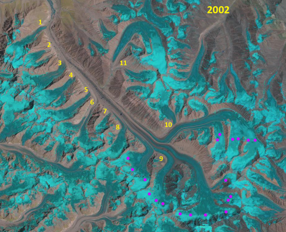
Bara Shigri Glacier in 2002 Landsat image indicating the separation of a number of tributaries. Purple dots mark the snowline 1993=5050 m and 2022=5400 m.
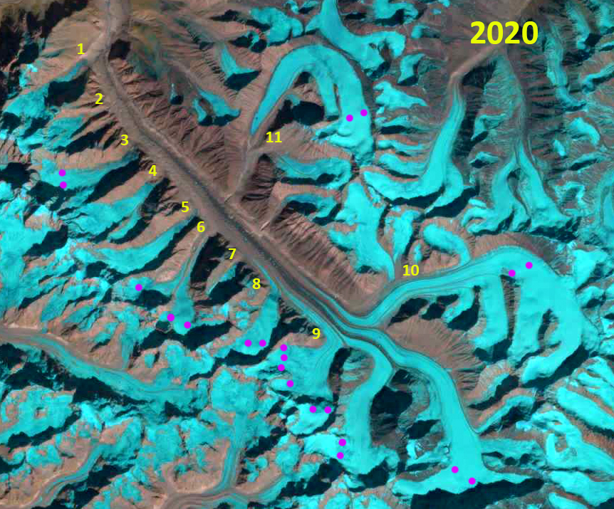
Bara Shigri Glacier in 2020 Landsat image indicating the separation of a number of tributaries. Purple dots mark the snowline 1993=5050 m and 2022=5600 m.
 Dean of Academic Affairs at Nichols College and Professor of Environmental Science at Nichols College in Massachusetts since 1989. Glaciologist directing the North Cascade Glacier Climate Project since 1984. This project monitors the mass balance and behavior of more glaciers than any other in North America.