
April 6, 2018
North Cascade Winter Snowpack Status 2018
Posted by Mauri Pelto
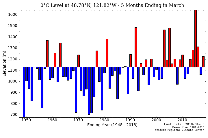
2018 Winter Freezing levels at Mount Baker (November 2017-March 2018).
The accumulation season on most Northern Hemisphere glaciers extends through April. The key benchmark for snowpack water assessment in alpine ranges is typically April 1, as that is the average maximum snowpack for an alpine range. In 2018 the North Cascade Range had freezing levels above the long term mean, but at the 21st century mean.
A result of higher freezing levels is more rain on snow events and winter melt events. This reduces the retained April 1 snowpack, which is measured as snow water equivalent (SWE). An examination of the trends in April 1 SWE at the six long term North Cascade stations, winter precipitation at the most reliable North Cascade weather stations, and the ratio between the two indicates a similar decline in snowpack and snowpack/winter precipitation ratio, while winter precipitation has increased. The ratio between SWE and precipitation, snowpack storage efficiency-on right axis, has been in decline, as noted by Mote et al (2008) and Pelto (2008). This ratio change has driven most of the SWE.
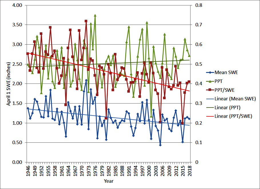
For 2018 precipitation is 2.7 m with, 1.1 m of that retained on average as April 1 SWE. The April 1 SWE is similar to the 2016 and 2017 values.
At the sites closest to the glaciers with snowpack measurements the April 1 snow depth is 4.21 m at Lyman lake and 4.24 m at Mount Baker ski area. At Stevens Pass there is a snow depth of 3.53 m, which is approximately the average, webcam image below is from 4/6/2018. As winter wraps up, snowpack is relatively normal despite a winter of wide temperature fluctuations, Feb freezing levels 400 m below the mean and December 500 m above the mean. The glaciers still have 3-6 weeks for accumulation to build up, while melt get underway lower on the mountains. We will be in the field again in 2018 to examine snow depths and melt across the North Cascade glaciers.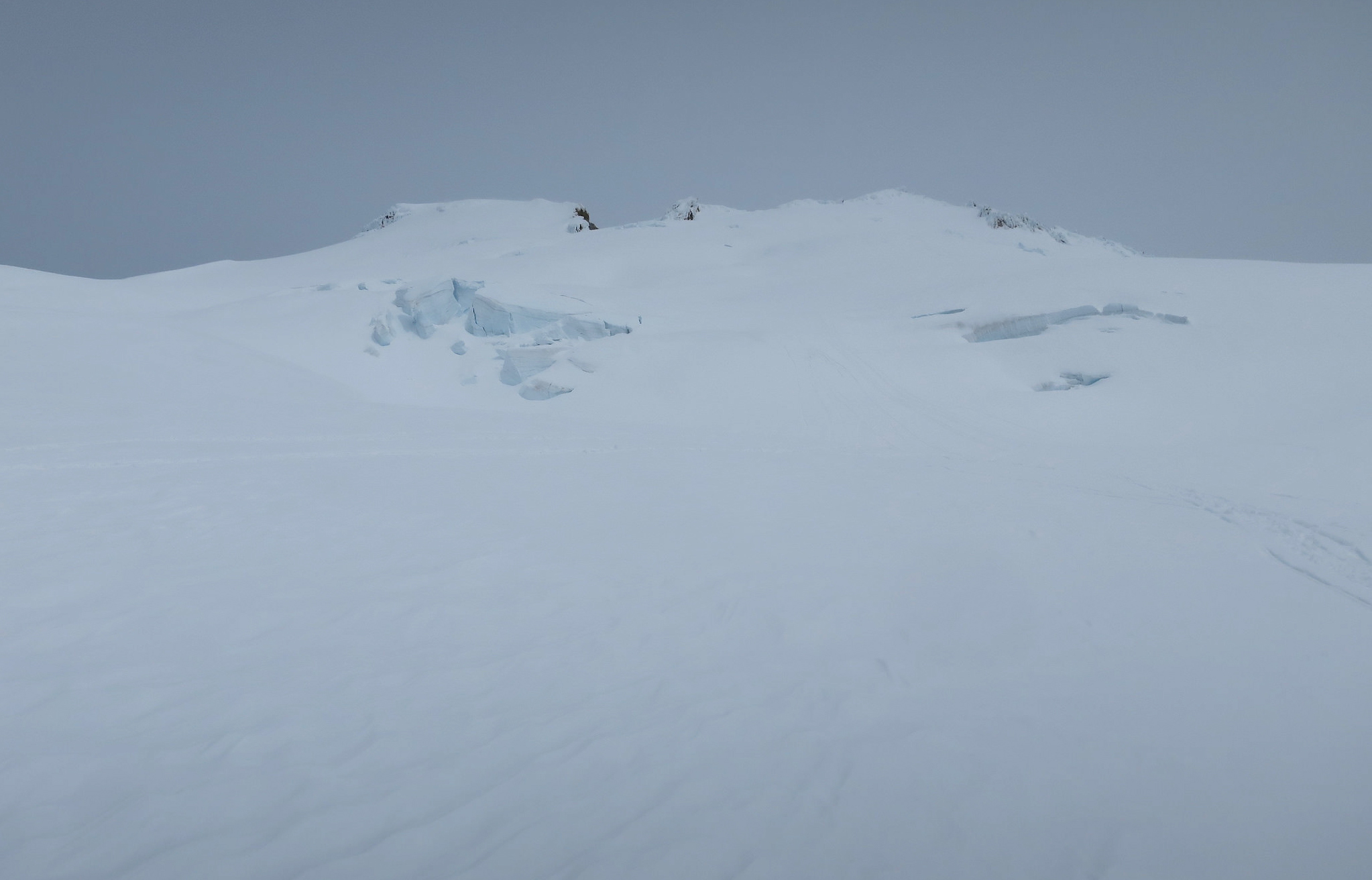
A view up toward the icefall on Easton Glacier at 2000 m.

Stevens Pass ski area from Webcam 4/6/2018
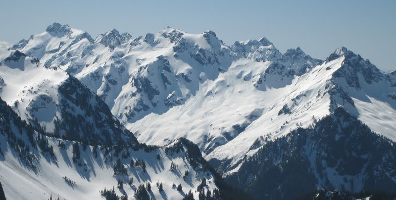
Monte Cristo Range waiting for spring to begin
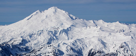
Mount Baker coated with March 2018 snowpack.
 Dean of Academic Affairs at Nichols College and Professor of Environmental Science at Nichols College in Massachusetts since 1989. Glaciologist directing the North Cascade Glacier Climate Project since 1984. This project monitors the mass balance and behavior of more glaciers than any other in North America.