
September 1, 2013
North Cascade Glacier Climate Project 2013 Field Report
Posted by Mauri Pelto
The 2013 winter season provided close to average snowpack in the North Cascades as indicated by the average SWE at SNOtel stations in the range. The summer melt season has proved to be long, warm and dry. The May-August mean temperature at the station closest to a glacier, Lyman Lake, has been tied for the 2nd warmest in the last 25 years with 2009 and only 2004 warmer. The summer has lacked record periods of warmth and has featured sustained warm temperatures and higher than average humidity, reducing the number of nights when the glacier surface has frozen. The average minimum temperatures at Lyman Lake are the highest in the last 25 years for July and August. The humidity was the strikingly high during our field season, note diagram from a Cliff Mass article on the topic. The net result will be significant negative glacier mass balances in the North Cascades. There is one month left in the melt season most glaciers are close to an equilibrium balance already.
-

- Seattle Minimum Temperatures this summer. Notice August
-

- April 1 SWE at Snotel Stations in North Cascades
-

- Graph of North Cascade glacier retreat of the 47 glaciers we assess 1967-2013.
After a month of perfect summer weather we arrived to a foggy and wet conditions on the Columbia Glacier. The Columbia Glacier terminus was exposed and has retreated 85 m since 1990. The glacier had a substantial area of blue beginning 200 m above the terminus and extending along the western side of the basin for 400 m. The area of blue ice on August 1 was 50,000 square meters, by Aug. 21 the area had expanded to 200,000 square meters, the shift of the 2013 winter snowline during this period indicates a melt of m during the three weeks.
-

- Columbia Glacier terminus west side
-

- Stewart Willis and Ben Pelto surveying Columbia Glacier terminus
-

- Jill Pelto at terminus Columbia Glacier
-

- Columbia Glacier on Aug. 20
-

- Columbia Glacier on Aug. 1
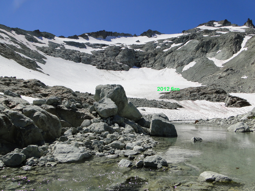
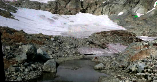
The Lower Curtis Glacier terminus was exposed early in the summer resulting in a continued retreat of 20 m since 2011, the area of thick seraced terminus lost since 1990 has been 60,000 square meters. The lateral retreat and terminus retreat since 1990 are both in the 125-150 meter range depending on location.
-

- Lower Curtis glacier lateral retreat
-

- Matt Holland and Jill Pelto at Lower Curtis Glacier terminus
-

- Lower Curtis glacier terminus retreat
We spent a week observing ablation and resulting glacier runoff on Sholes Glacier. With Oliver Grah and Jezra Beaulieu who work for the water resources section of the Nooksack Indian Tribe we emplaced a stream gage right below Sholes Glacier and one on Bagley Creek which is snowmelt dominated. With the water level gages in we all began work on a rating curve for the Sholes Glacier site directly measuring discharge on 14 occasions, kayak socks helped reduce the impact of cold water. Average ablation during the week was 8.25 cm/day of snowpack or 5 cm of water, discharge measurements identified a mean of 5.2 cm/day of from the glacier during this period. The agreement between ablation and discharge was a nice result. Discharge became notably more turbid after 1 pm, peaking in turbidity around 5 pm. Of equal interest was the change in snowcovered area. On July 19th a Landsat image indicated 100% snowcover for Sholes Glacier. On Aug. 4th our surface measurements indicates a blue ice area of 12,500 square meters, which is also evident in a Landsat image from that day. By Aug. 20th a satellite image indicates that the blue ice area had expanded to an area of square meters. This coincided with the area where snowdepth was observed to be less than 1.2 m on Aug.4. This represents a volume loss of 592,000 cubic meters of water in 16 days.
-

- landsat comparison of snowpack on Sholes Glacier. Fullly snowcovered on 7/19, 98% snowcovered on 8/4 and 60% snowcovered on 8/20.
-

- Sholes Glacier outlet
-

- Sholes glacier outlet stream gage, Jezra Beaulieu
-

- Sholes Glacier Aug. 3
-

- Sholes Glacier Aug. 5
-

- Sholes Glacier 9-1-2013 from aywolfpac-NWhikers
We measured the mass balance on Rainbow and Sholes Glacier during this period. The snowpack was poor on both, especially above 1900 meters on Rainbow Glacier. Typical depths are over 5-6 m, this year 3.75-4.5 m. The poor snow depths were also noted on the Easton Glacier above 2000 m in crevasse stratigraphy measurements. Each crevasse is approached probing to ensure it is safe and then assessed to make sure the crevasse is vertically walled, this enables a safe but also accurate measure. In some cases layers from mulitple years can be assessed. IN the Lynch Glacier crevasse the 2013 layer will be lost to melt before end of the summer.
-

- Probing before approaching crevasse on Lynch Glacier
-

- Rainbow Glacier annual layer
-

- Rainbow Glacier annual layer
-

- Rainbow Glacier annual layer
-

- Annual stratigraphy at 2100 m on Easton Glacier
-

- Easton Glacier stratigraphy at 200o m
-

- Easton Glacier annual layer
-

- Lynch Glacier annual layers
-

- Easton Glacier terminus retreat since 1990
-

- Low slope of Easton terminus
-

- Easton Glacier camp sketch-Jill Pelto
-

- Low slope of lower Easton Glacier
-

- Deming Glacier terminus-David Tucker Mount Baker Volcano Research Center
-

- Deming Glacier terminus from above, note debris cover extends across nearly whole terminus now.
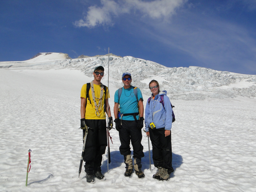
Ben in his 9th year, Jill her 5th year and Mauri 30th year of glacier work in the North Cascades
 Dean of Academic Affairs at Nichols College and Professor of Environmental Science at Nichols College in Massachusetts since 1989. Glaciologist directing the North Cascade Glacier Climate Project since 1984. This project monitors the mass balance and behavior of more glaciers than any other in North America.