27 January 2015
New satellite images of the Tsarap landslide in the Zanskar Valley
Posted by Dave Petley
Tsarap landslide images
The Tsarap landslide crisis in northern India continues, although it is good to see that there has been an appropriate level of response to the hazard from the authorities. This is an interesting contrast to the initial indifference shown by the Pakistani authorities to the Attabad landslide five years ago. Over the weekend, efforts started to airlift people trapped to the north of the landslide – in total 300 people were trapped when the Chadar Trek was suspended. The same report also notes that the expert group formed by NDMA to advise on the management of the landslide dam will visit the site this week, so it will be interesting to hear what they have to say.
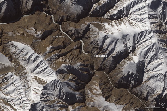
Meanwhile, also over the weekend, two sets of satellite images were published of the landslide site. The ever-wonderful NASA Earth Observatory published a beautiful Landsat 8 OLI image of the area, collected on 18th January, that very clearly shows the slide:
.
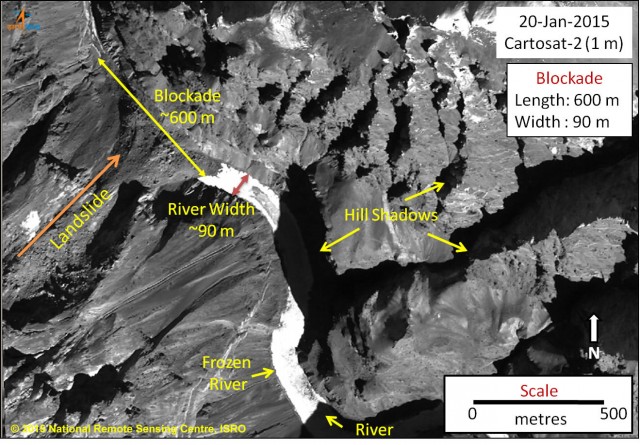
Meanwhile the National Remote Sensing Centre in India has also published a set of images, with a higher resolution:

Cartosat 2 image of the landslide from the NRSC India
.
This is without doubt the best image of the landslide so far, showing both the source area and the slide itself, together with the impounded water. I remain concerned that the material forming the dam is potentially erodible and that the dam crest is short, both of which suggest that there is the potential for a rapid breach event when the water overtops the barrier. There remains some urgency to get a monitoring system in place for this landslide, and then to start the detailed planning for what will happen when snow melt starts to fill the lake more rapidly.


 Dave Petley is the Vice-Chancellor of the University of Hull in the United Kingdom. His blog provides commentary and analysis of landslide events occurring worldwide, including the landslides themselves, latest research, and conferences and meetings.
The material blocking the flow seems to be very loose debris and has a potential threat of breaching as gradually the volume of water is building up and the length is extending upstream seen from various satellite images and with melting of snow the dam material seems unlikely to hold the water and may burst.