7 March 2012
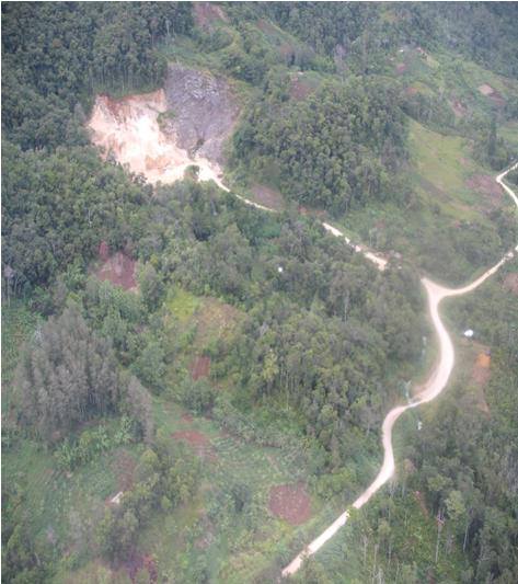
Breaking news – an image of the Tumbi Quarry site before the landslide
Posted by Dave Petley
Astute readers will have seen that Reuters yesterday ran a syndicated story about the Tumbi Quarry landslide, and the implications for Exxon-Mobil, which was picked up by many mainstream media outlets (e.g. the Guardian today). This blog is quoted in the article. With rather fortunate timing, a few days ago I have received an image of what I am reasonably sure is the site prior to the landslide (compare the features outside the landslide area with the images in this post). I will blog on this properly later today, but as a taster here is the image. I think that this image probably predates the most recent quarry expansion, and may therefore be at least a year old.
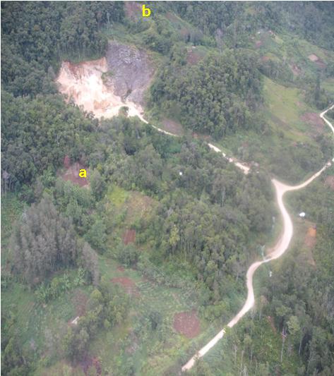
At this point I’ll draw your attention to a couple of interesting points. First, there is a number of what appears to be shallow slips – see locations a and b below:
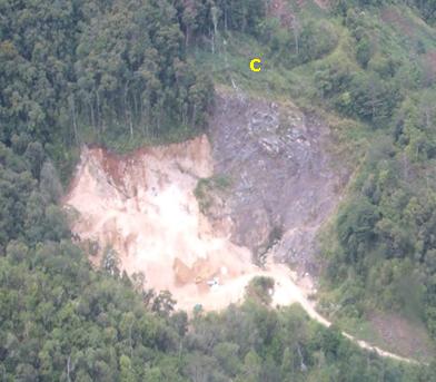
Second, in the unvegetated areas above the quarry scarp are some rather peculiar features running across the hillside (marked c below):
Note the excavator (?) at the toe of the quarry slope, which provides scale. These features on the hillslope might be footpaths, but if so they are very well-trodden.
Comments and interpretations welcome. More later!


 Dave Petley is the Vice-Chancellor of the University of Hull in the United Kingdom. His blog provides commentary and analysis of landslide events occurring worldwide, including the landslides themselves, latest research, and conferences and meetings.
Might the ferature at ‘b’ be a clearing, similar to that close to the road at the bottom of the photo? And might the peculiar features at ‘c’ be fallen tree trunks?
Looks like the features near C are planar, through-going, near vertical, and not coincident w/bedding (bedding is slope-parallel, maybe?) I vote for minor faults or major joints. Also, I don’t think the red spots have been purposefully cleared – just lots of little slope failures in weak residuum.
The look of the face and the way the seepage exits from the exposed grey weathered rock into an eroded channel directly at the toe (which crosses under the quarry access road) suggests the that exposed rock could be the result of a previous slide rather than mining. Looking for downslope debris to confirm that is tricky with the vegetation. Following the drainage down to the road crossing there is an obvious chute where the road indents, so possibly previous debris traveled far down this chute and didn’t accumulate on slopes in the photo.
Pardon the interruption, so the clearing at the top of that area where the supposed footpath is the result of that previous slide, or other erosive events post slide. The ‘footpath’ looks to extend into a faulted area to the top right of the weathered rock so could be a tension crack.
If C was indeed a tension crack there would be significant ramifications for the quarry operators. Well there would be if the site were not in PNG.