19 January 2012
The 1929 Murchison Earthquake in New Zealand
Posted by Dave Petley
The recent earthquake sequence in Christchurch has of course heightened awareness of seismic hazard in New Zealand. One the way across South Island last weekend I stopped in the town of Murchison, after which the 1929 earthquake is named. The was a large event – the estimated magnitude is Ms=7.8, such that shaking was felt across much of New Zealand. Fortunately, at the time this central region of the South Island was very sparsely populated, so the number of casualties was limited to just 17 people.
From my perspective the interesting aspect of this is that it triggered many landslides. The distribution of these landslides is currently being analysed by a team of people from GNS Science and Durham, and in particular by my PhD student Rob Parker. These slides are interesting for a number of reasons, not least is that they were responsible for much of the loss from the event. Indeed, 14 of the 17 deaths occurred as a direct result of landslides. Furthermore, it is thought that 38 valley blocking landslides occurred, and 21 of these still retain lakes.
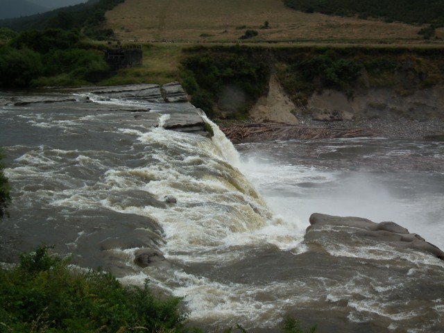
The legacy of the earthquake is still clearly evident in the landscape. Perhaps most obvious is this waterfall on the Maruia River, a tributary of the Buller River. There is a viewpoint to allow the passer-by to stop – it is a really impressive feature:
Whilst it has been widely reported that this is the fault scarp, in reality is through to be a legacy of a landslide that diverted the river across an old river channel.
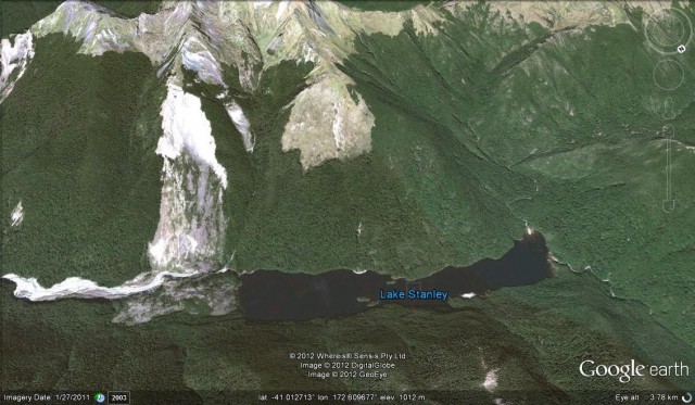
All across the area the hillsides are mantled with landforms that look like large landslides, presumably triggered by this earthquake or some previous event. These were not easy to photograph in the dreadful weather, but many are really very clear on Google Earth. This perspective view shows the landslide that created Lake Stanley. Even more than 80 years on the landslide scar and valley-blocking deposit are clearly visible:
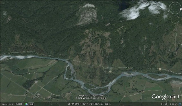
One large landslide occurred at Mātakitaki. The landslide is still very clear on the ground today (see the Google Earth image below), having clearly diverted the river away from the foot of the ridge. The characteristically uneven topography of the deposit has not been cultivated. This landslide blocked the valley, creating a lake that extended 5 km up the valley. Charles Morel, the local land owner, was killed by the landslide.
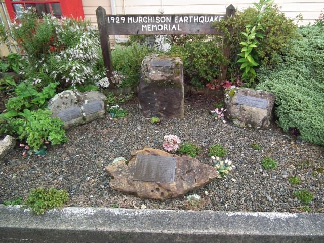
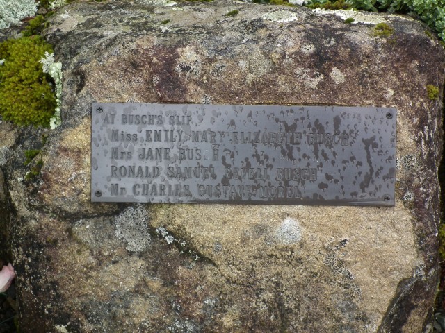
In the town of Murchison, the volunteer-led museum has an excellent collection of newspaper reports from 1929 describing the event, and some great archive photographs. There is also a small memorial to the victims of the earthquake:
This memorial even records the landslides that were responsible for many of the deaths:
Of course the importance of this is that it highlights the role that landslides are likely to play in intensifying the impacts of a future earthquake in the mountains of New Zealand, and in hindering the response to the event. Worldwide the importance of landslides during earthquakes is under-estimated – indeed a search on the Global Earthquake Model website yields not a single hit for the word “landslide”. This would seem to be a surprising omission.


 Dave Petley is the Vice-Chancellor of the University of Hull in the United Kingdom. His blog provides commentary and analysis of landslide events occurring worldwide, including the landslides themselves, latest research, and conferences and meetings.
[…] has a nice post on landslides triggered by the 1929 Murchison earthquake in New Zealand. Suvrat at Rapid Uplift […]
Can you give me the list of the people who died as a result of the landslide in or around Murchison. My mother told me that some of her relatives died because of that landslide and were buried alive. Her family were the Barclays from Lyell and the Fairhalls from Greymouth.
[The list is here:
https://www.sooty.nz/murchison.html
There are no Barclays or Fairhalls listed. D.]
Thanks for the information and discussion points here. I suppose it wouldn’t be wise building a homestead at or near the base of a mountain range even if covered in historic bush….in murchison? Never considered quake initiated landslides. Was about to pull the trigger on a property but will reconsider now.