6 October 2011
A first look at NASA satellite imagery of the landslides from the Sikkim earthquake
Posted by Dave Petley
Summary: This post presents for the first time NASA satellite images of the earthquake-affected area around Gangtok in Sikkim. Thanks again to Jesse Allan and all at the Earth Observatory at NASA for their help with this.
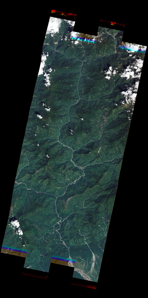
NASA have manage to collect a satellite image of the earthquake-affected area around Sikkim in northern India, recently affected by the M-6.9 earthquake. This is quite a feat given that we are in the tail end of the monsoon season, when clouds are abundant in this area. The news reports and photos from the site have suggested multiple landslide occurrence in the earthquake, so of course an image is a good way to look at this. The image is a 10 m spatial resolution ALI image, which produces a product that looks like an aerial photograph, and thus is easy to interpret.
This is the image, compressed from the original 55 MB file. Gangtok is on the right side of the image, about 2/3rds of the way up, but hidden in cloud.
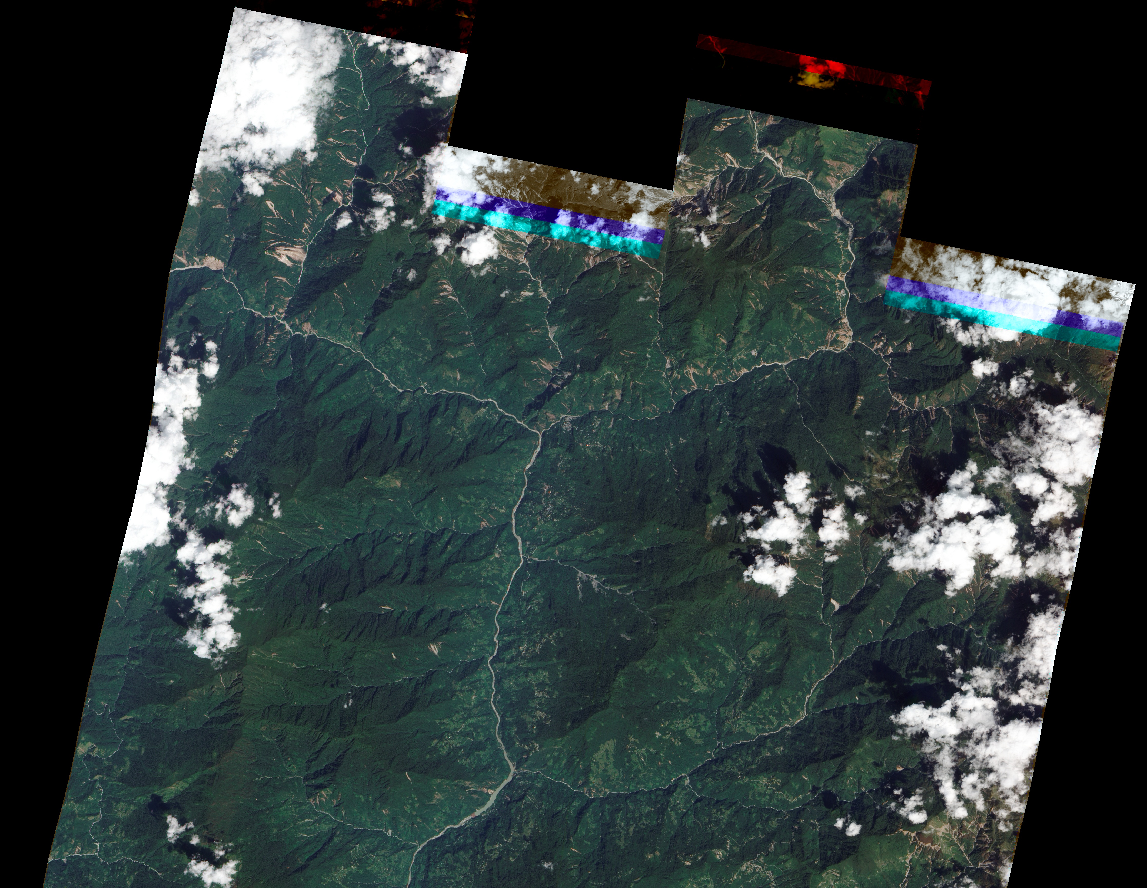
Most of the image does not show a substantive amount of landslide activity, but up at the north end of the image things start to get interesting. Up here, as shown in the image below, there is a quite high incidence of slides in the valleys:
So lets take a look at one of these areas. First, one’s eye is certainly drawn to the landslides in the northwest corner:
There are many landslides! A few things to note – first, most of the slides appear to the on the slopes that face towards the east and the south, there are few on the slopes that face to the west. The epicentre was about 45 km to the northwest of this location, so this directionality is of real interest, and personally I am slightly surprised by the fact that the slopes that failed were those orientated way from the epicentre, not towards it. Second, most of the slides appear to be shallow rockslides that have connected to the gully systems; many of them have initiated high on the hillside. There are also some large slides nearer to the main channels.
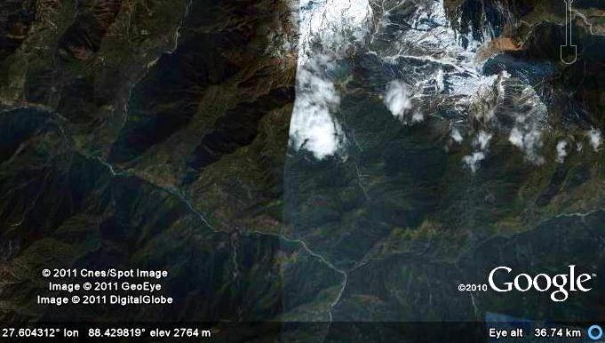
Of course, a question that must always be asked is whether these landslides were triggered by the earthquake. There is a Google Earth image of this area from 2007, shown below. It is not great quality, but good enough to see that these landslides were not present at that time. It is likely, given the directionality of the landslides, and the fact that they are clearly very fresh, that the majority were triggered by the earthquake. However, it is also possible that some were triggered by a monsoon rainfall event ahead of the earthquake.
I will try to post again on the area of the image to the east of the above, which also has many landslides. It will be fascinating to take a look at the area off this image to the northwest – i.e. around the epicentre in the really high mountains. This is where any really large landslides are likely to be located.


 Dave Petley is the Vice-Chancellor of the University of Hull in the United Kingdom. His blog provides commentary and analysis of landslide events occurring worldwide, including the landslides themselves, latest research, and conferences and meetings.
I would think that the majority of landslides being on east facing slopes is probably more related to local structural geology than the orientation of the epicentre. It could be that a weak geological structure (schistosity?) is dipping east, thus making those slopes less stable compared to the other flank…
The Indian National Remote Sensing Centre has mapped the landslides based on satellite imagery made on the 29th and 30th September. The area covered is on a similar orientation to that of the NASA image. The URL for the report is http://www.nrsc.gov.in/tmp-images/sikkim_earthquake.pdf (5.25 mb)
thank AAM very interesting
[…] “The Landslide Blog”, probably the best in the world! Copyright Dave Petley and “The Landslide Blog“ j = jQuery.noConflict(); var addedComment = function(response) { […]
Thank you for the insight…..really very interesting.Do you have any pics of the Darjeeling and Kalimpong region too as we too have been affected by the recent Sikkim earthquake…. surprisingly, also the South East slope is the weakest link here too…..
Interview with Mahendra P. Lama, Vice-Chancellor, Sikkim University on disaster management deficiencies in the Indian Himalaya:
The Hindu, Chennai, 13 October 2011, http://www.thehindu.com/todays-paper/tp-opinion/article2532769.ece
Eight page report from the Geological Survey of India on landslides induced by the 18th September Nepal /Sikkim earthquake http://www.portal.gsi.gov.in/gsiDoc/pub/report_portal_final_20102011.pdf
Thank you Dave for these images. Two hypotheses: could human impact be different on East and South slopes vs. West slopes? Rice vs. tea vs grazing? Secondly, soil moisture content is surely different ?
[…] motion in these steep rocky mountain faces.” This directionality effect is similar to my observation based on satellite imagery a month or so ago. As the report notes, it would be really interesting to map properly the landslide distribution […]