4 August 2011
Images of landslides from the Christchurch earthquakes part 3: topographic amplification at the cliff tops
Posted by Dave Petley
This is part 3 of this series. The other posts in this series are as follows:
Part one: boulder damage to a house
Part three: topographic amplification at the cliff tops
Part four: large-scale cliff collapses
Part five: landslides that involve sliding
One of the key aspects of landslide and rockfall triggering in earthquakes is the process that we term topographic amplification. The idea is simple, which is that the topography causes enhanced shaking at key locations. We believe that this is particularly significant at ridge tops and breaks of slope (locations in which the slope gradient changes). In effect it is a resonance effect that causes the ground to shake much more violently in those locations. We think that this is a key process in the triggering of landslides and rockfalls in earthquakes.
Of course it is also potentially bad news for any structures located at the top of slopes too, so I was interested to see how the houses that had occupied those beautiful cliff top locations in the hills to the east of Christchurch had performed. as the pictures below show, the answer is that they did not do well. It is important to stress that these images show shaking damage, not landslide problems (though there is some of that on the ridge tops too – see the post tomorrow…).
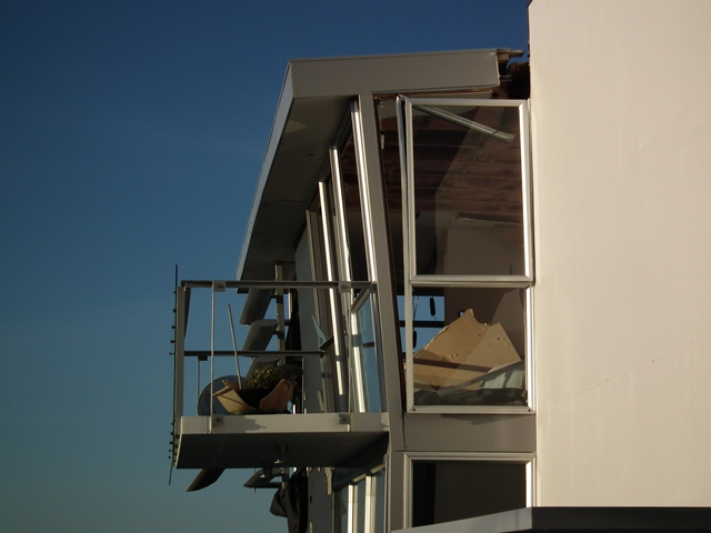
The best illustration of the magnitude of the shaking on the ridge tops was found on this balcony:
If you look carefully you can see that the plant plot has been smashed. It has clearly been lifted vertically and then dropped, which suggests vertical accelerations considerably in excess of 1 g:
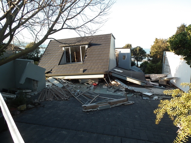
There was huge disruption to even sturdy structures in this area, but similar houses set back from the cliff remained intact. The tile roof of this houses suggests high levels of acceleration:
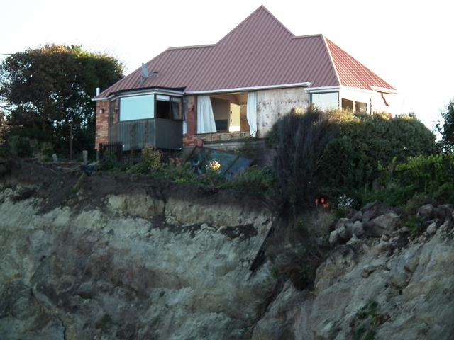
Note the cliff collapses. One or two houses collapsed completely:
Whilst others suffered very signficant levels of damage:
The next post will look at what this meant for the cliffs below. The other posts in this series are as follows:
Part one: boulder damage to a house
Part three: topographic amplification at the cliff tops
Part four: large-scale cliff collapses
Part five: landslides that involve sliding


 Dave Petley is the Vice-Chancellor of the University of Hull in the United Kingdom. His blog provides commentary and analysis of landslide events occurring worldwide, including the landslides themselves, latest research, and conferences and meetings.
[…] Images of landslides from the Christchurch earthquakes part 3: topographic amplification at the clif… […]
[…] Part three: topographic amplification at the cliff tops […]
[…] Part three: topographic amplification at the cliff tops […]
Yes, a girlfriend’s house was on an east facing slope, just below the top of the slope, and the Los Angeles 1994 Northridge earthquake was 12 miles west of her location. I suspected that as she was on the ‘dead-end away side’ of the hill to the arriving tremor waves, that she got hit harder than other houses. The house above hers at the very top of the slope had even more damage than hers.
Out in The Valley, in North Hollywood where my house is, I got lucky, basically zero damage, and I was about equidistant from the epicenter ! But 2 miles south of me houses with chimneys, they all had severe damage to the chimneys.
I was suspecting that there were actually 2 epicenters, and an ‘interference pattern’ developed, with null zones (my house), and additive zones (where the chimneys were damaged, and the parking structure in Sherman Oaks that collapsed). This would explain the checkerboard of heavy damage and no damage.
Anyway, your article supports my theory of why her house got shaken so violently, it was on the ‘dead end’ of the hill ! And like the end of a wet towel that is quickly ‘waved’ the end ‘snaps’ ! and to a tune much more violent than the middle of the towel that propagates the wave down its length.
[…] Part three: topographic amplification at the cliff tops […]
[…] Part three: topographic amplification at the cliff tops […]
[…] The aftermath of these cliff collapses can be seen in my earlier posts here and here. […]
[…] earthquake induced landslides tend to extend to the ridge crests because of the process known as topographic amplification – basically the seismic shaking is more intense at high elevations. On the other hand, […]