
March 29, 2013
Rongbuk Glacier Supraglacial Lake Expansion, China
Posted by Mauri Pelto
The Rongbuk Glacier is famous as the climbing gateway to the north side of Mount Everest (Qomolangma). In recent years the great climber and mountain photographer David Breashears has highlighted the change of this glacier over a the 1921-2007 period using repeat images of the glacier. Here we examine a change on the surface of the main Rongbuk glacier over the last 15 years, the development of a substantial supraglacial lake. Ren et al (2006) noted the retreat of glaciers on the north side of Qomolangma as 5-10 meters/year. Ye et al (2009) noted a loss in glacier of 15 square kilometers for the glacier draining the north side of Qomolangma, and further noted the rapid expansion of the supraglacial lake from 0.05 in 1974 to 0.71 square kilometers in 2008. ye et al (2015) observe a mean annual mass balance loss in the Rongbuk watershed of -0.43 m/year from 1974 to 2006, which is approximately the same as the global average. There is also thinning high on the glacier at Nup La, where the glacier connects to the Ngozumpa Glacier at the China-Nepal border. 
Rongbuk and West Rongbuk Glacier in Google Earth Image
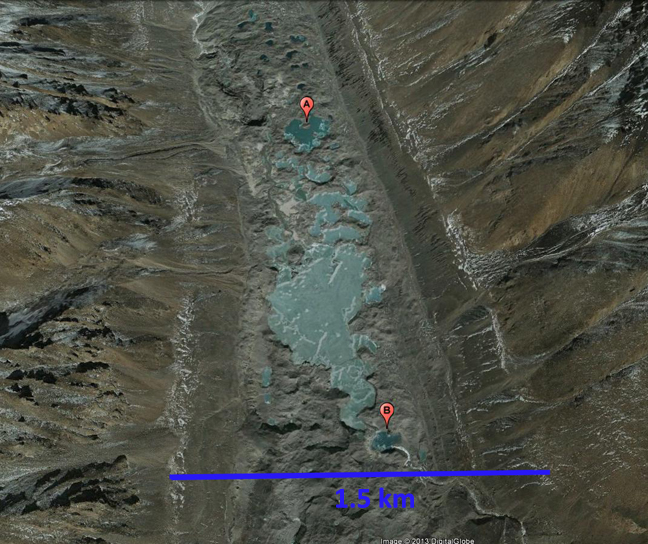
The red arrows in the Landsat images from 1992, 2001, 2012 and 2016 indicate the extent of the supraglacial lake in 2012 , first four images below. In the two Google Earth images from 2003 and 2011, last two images in sequence, the lake extent is marked with point A and B. In 1992 the lower section of the Rongbuk Glacier was heavily debris covered with a isolated melt ponds amidst the rugged debris covered surface. By 2001 some of the melt ponds have coalesced, but a well defined lake is not present. The key to lake expansion is the downwasting of the higher mounds of debris covered ice on the ice tongue. A second key is that the stream exiting the East Rongbuk Glacier now in part feeds this lake system, this could not happen until the glacier surface was low enough for this stream to be able to access the surface. By 2012 the lake has expanded to a length of 1.9 kilometers, and is still expanding in area. By 2016 the lake had expanded more in width than length since 2012. A higher resolution view using Google Earth images indicates that most of the lake formation occurred between 2003 and 2011. The terminus is so covered by debris that examining retreat of the front of this glacier is not as important as the thinning of the ice in the lower 8 km of the glacier, which is downwasting rapidly and will melt away. Notice the meltwater stream entering the lake system from the lower right in the 2011 image.
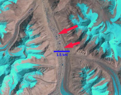
1992 Landsat image-red arrow indicate area of 2012 glacial lake.
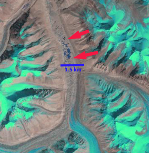
2001 Landsat image
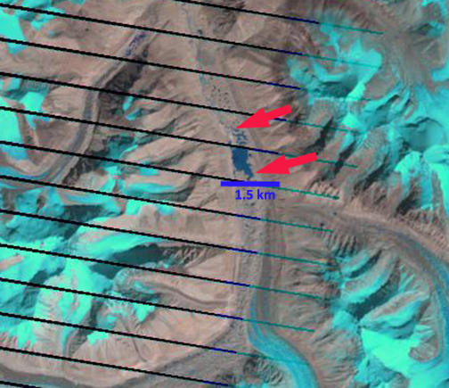
2012 Landsat image
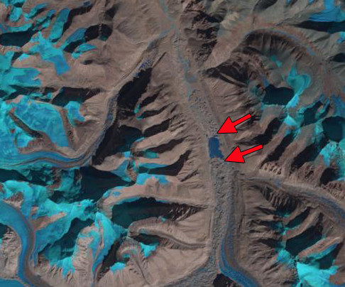
2016 Landsat image
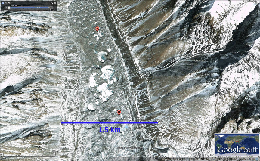
Above a 2003 Google Earth image and below same are in 2011
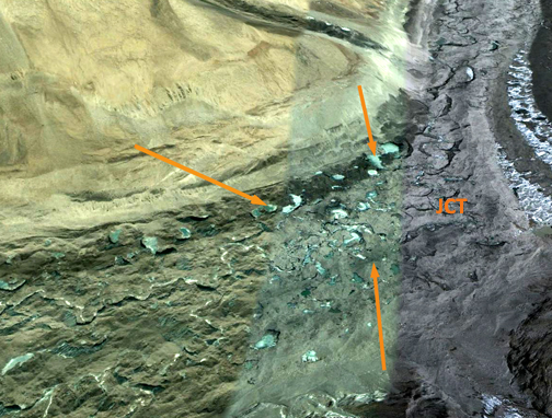
Upglacier of the this lake at the main junction of the Rongbuk Glacier and West Ronguk Glacier is another area of lakes that could coalesce into the same type of feature. This indicates that this glacier will have to retreat a long ways to reestablish equilibrium. The glaciers behavior reflects the same trends though the specific symptom, surface lake formation is different, as Lumding Glacier, Ngozumpa Glacier and Imja Glacier.
 Dean of Academic Affairs at Nichols College and Professor of Environmental Science at Nichols College in Massachusetts since 1989. Glaciologist directing the North Cascade Glacier Climate Project since 1984. This project monitors the mass balance and behavior of more glaciers than any other in North America.
I am trying to find the name of the Author who had two images of Rongbuk Glacier; one in 1968 and the other in 2007 showing the loss of ice. I am using this image and want to give credit. Do you have a name? Was that David Breashears?
Thank you very much,
I have seen many comparisons of the 2007 image from David Breashears with the 1921 images from the Mallory expedition. Not familiar with the 1967 comparison.