
4 May 2010
Flood Waters and Ash From Space
Posted by Dan Satterfield

The Iceland Volcano ash cloud is clearly visible in this image taken from space today. Image from NASA Aqua satellite in true colour. click image for much bigger version.
The ash is back.
Ireland has just announced airspace closings for tomorrow and there is now concern that the ash may start to seriously effect flights in the UK. If Gatwick and Heathrow in London shut down the impact will be felt worldwide.
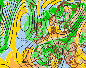
Winds at 10,000 feet for tomorrow night. Wind will flow paralell to the black lines. Model data ctsy. Penn State.
Looking at the model data tonight, the greatest threat seems to be Ireland but there may be a narrow window late tomorrow when the ash will be funneled by the upper level winds toward the UK. Late in the week a high will build south of Iceland and this should keep the ash away from Europe for a few days.
One bit of good news. The ash is mainly below 20,000 feet. This means a transatlantic flright from Amsterdam or Paris will be able to fly well above it.
The airspace shut down a couple of weeks ago was much more severe because the ash was up to 34,000 feet. (I know I usually do all metric on this blog but air traffic around the world still uses flight levels in feet)
Now another image from the same satellite.
In the previous post I showed the image from the Aqua satellite pass over Nashville today.
I went back and grabbed a shot taken just about a year ago of the same area. The before and after images show very well the magnitude of the floods.
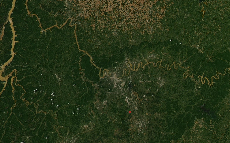
Here is the image from May 21 2009.
AQUA image of Nashville and Middle TN. on 21 May 2009. Nashville is dead center in the image. The Cumberland River is visible but not easily. Click for full res. Ctsy. NASA.
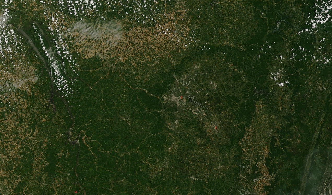
Now here is the image from my previous post showing the same area today at 1850 GMT (1:50 pm local Nashville time).
The image taken today shows the magnitude of the severe flood.
Could this flood be related to climate change? Possibly. I wrote a post on that a few days ago.
More soon,
Dan
 Dan Satterfield has worked as an on air meteorologist for 32 years in Oklahoma, Florida and Alabama. Forecasting weather is Dan's job, but all of Earth Science is his passion. This journal is where Dan writes about things he has too little time for on air. Dan blogs about peer-reviewed Earth science for Junior High level audiences and up.