
4 May 2010
Oil and Water From Space
Posted by Dan Satterfield
NASA’s AQUA satellite made a pass over Nashville and the Gulf at 1850GMT today. (1:50pm Central U.S. summer time).
The flooded rivers around Nashville are clearly evident in the image (see below). Nashville is at the center of the image. Accurate rain gauges from Central Tennessee show a rain event of incredible proportions. Areas around Nashville had over 17 inches of rain in 24 hours. This is more than one third the annual rain for Nashville in one day!

Image of flooded rivers around Nashville (dead center of image). The Grand Ole Opry has water up to the stage. NASA AQUA MODIS image.
A few minutes later the satellite passed over the Gulf and spotted the thickest part of the oil slick. The slick is much bigger than it looks in this image. You are seeing only the thickest part.
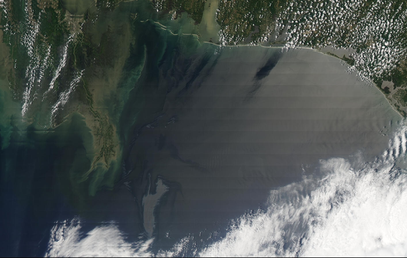
Oil slick is visible just SE of the mouth of the Miss. River. (Bottom left of image) From NASA AQUA Satellite at 1850 GMT. Click image for full size.
Ocean currents are driven in a large part by winds and the winds will be picking back up again in 48 hours.
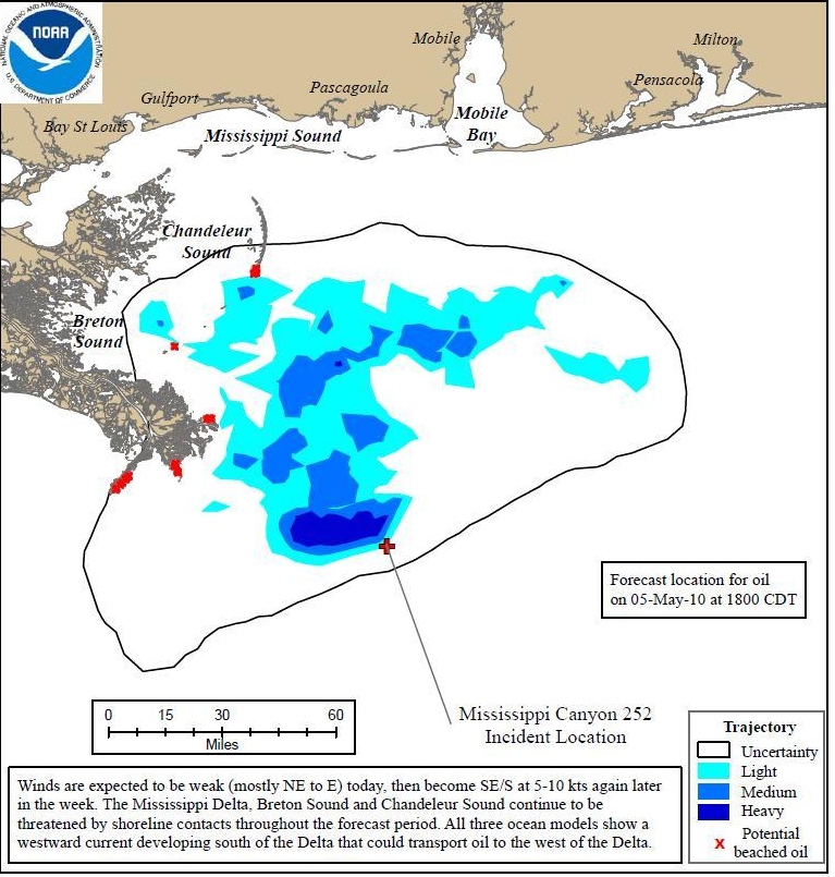
Oil slick forecast from NOAA for 23GMT Wednesday 5 May. (6 pm US Central Summer Time)
Some oil is now likely to be pushed to the WEST of the Mississippi Delta. The forecast of the oil slick for tomorrow at 6 pm CDT shows the oil may very well have arrived at shore along the Delta in Louisiana.
This data is based on ocean models being run by NOAA. These models also take into account the wind.
If the oil continues to leak into the Gulf over a long period, the currents will spread it eastward toward Florida. The gulf loop current will eventually pick it up and take it around Florida and out into the Gulf Stream.
How far it goes depends on how much is leaking and how long it leaks…
Both of those estimates remain very fuzzy.
Dan
PS More info coming soon on the ash from Iceland’s volcano…
 Dan Satterfield has worked as an on air meteorologist for 32 years in Oklahoma, Florida and Alabama. Forecasting weather is Dan's job, but all of Earth Science is his passion. This journal is where Dan writes about things he has too little time for on air. Dan blogs about peer-reviewed Earth science for Junior High level audiences and up.