
2 September 2011
Tropical Storm Lee May Swamp Louisiana- and Maybe MS. & Alabama
Posted by Dan Satterfield
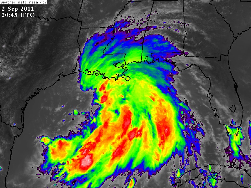
GOES images show TS Lee is a VERY wet tropical system. The slow movement increases the potential for over a foot of rain in parts of the Southeast U.S.
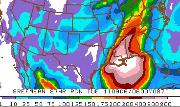
Rainfall forecast from an average of several runs of the WRF model.
The NWP guidance continues to indicate very heavy rains over the Gulf Coast and some models are squeezing out over 15 inches of rainfall in spots. It seems likely that this system will move very slowly and still be dumping heavy rains over Alabama on Tuesday. If the past is a guide ( and it is), then we could see flooding well inland from Lee. As it was with Katrina, forget about the winds, because even if Lee makes it to minimal hurricane strength, it’s the water that will be the story.
The huge amount of convection in the Gulf, all the way down to the Yucatan Peninsula is very worrying. There is a significant threat that the U.S. may suffer two weather catastrophes within two weeks of each other. Don’t forget about the Texas drought either, 80% of the state is now in exceptional (read that as incredible) drought.
 Dan Satterfield has worked as an on air meteorologist for 32 years in Oklahoma, Florida and Alabama. Forecasting weather is Dan's job, but all of Earth Science is his passion. This journal is where Dan writes about things he has too little time for on air. Dan blogs about peer-reviewed Earth science for Junior High level audiences and up.