
28 December 2017
Using GOES-16 to Detect and Forecast Cold Temperatures
Posted by Dan Satterfield
Just where was the coldest spot in New York state this morning? With weather stations, you could get close, but with the new GOES-16 satellite, you can find the exact spot. Just southeast of Philadelphia NY.

The bright green in northern New York is a ground temp. of 234K which is around -39 C. Philadelphia NY, in that area had a low of -39.5C. There are some spots nearby showing -40C (F) even!
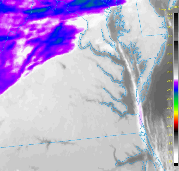
Now, look at the “Bay Effect” snow band that developed as winds coming down the Chesapeake Bay (at just the right angle) picked up moisture from the 6° C water and brought a few light snow showers into Norfolk. Another band is visible just north, coming into Accomack County, Virginia. We expected it to form, and I mentioned a few flurries were possible there on air last night.
Lastly, the urban heat island effect around Toronto just before sunrise Thursday morning (circled in yellow). It was around 3-5C warmer in the city than surrounding areas!

The ground is so cold across the northeast U.S. that the satellite is showing colours that we usually see for high cirrus clouds. We can tell the difference because clouds move and the ground (well most of the time) does not! The high resolution thermal infrared data from the GOES-16 is making it possible to give more precise and accurate temperature forecasts. And not just for cities, but for different portions of one individual city or county!
 Dan Satterfield has worked as an on air meteorologist for 32 years in Oklahoma, Florida and Alabama. Forecasting weather is Dan's job, but all of Earth Science is his passion. This journal is where Dan writes about things he has too little time for on air. Dan blogs about peer-reviewed Earth science for Junior High level audiences and up.