
2 August 2016
The Data is In from Ellicott City’s Flood Saturday Night. It’s Incredible.
Posted by Dan Satterfield
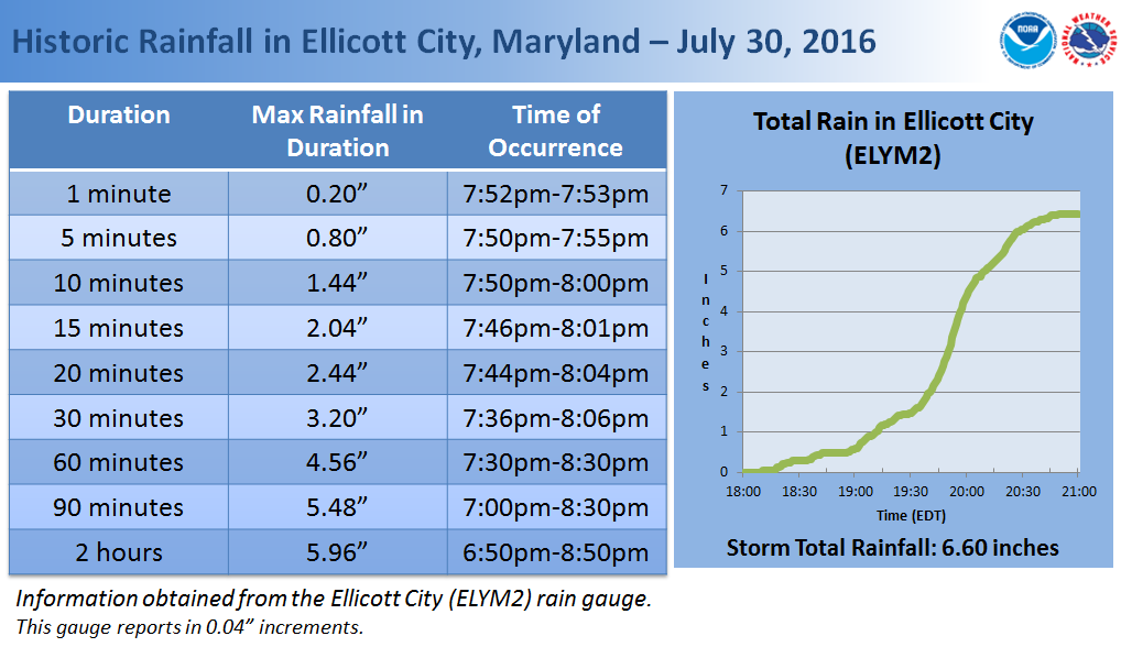
From NWS Baltimore -Washington.
The NWS in Baltimore-Washington posted an excellent summary of the data from the historic (and deadly) flood in Ellicott City, MD. on Saturday evening. I wrote about this flood yesterday but there is even more data now from flood gauges on area streams and more precise rainfall data. Go here: http://www.weather.gov/lwx//EllicottCityFlood2016 .
The stream gauge data shows just how quickly the local streams can rise in an event like this. There has been a lot of talk about how to get the public to understand the often heard message: Turn around don’t drown! Flash flooding is one of the biggest weather killers, but we are now used to seeing videos of people driving into rapidly rising waters. Hopefully the videos will start to have an impact. Social scientists and meteorologists are talking about how to get this message across (There was talk about it at a recent conference I attended in Austin TX). The scary (viral) video from Saturday night shows clearly that we have a long way to go.
Look at the flood gauge below, and you can see how fast the water can rise…
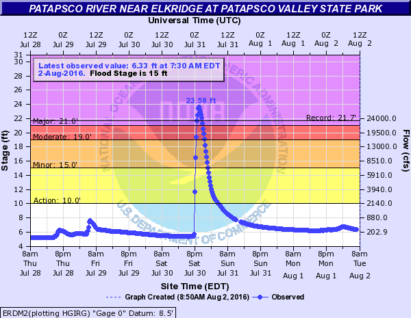
From USGS
 Dan Satterfield has worked as an on air meteorologist for 32 years in Oklahoma, Florida and Alabama. Forecasting weather is Dan's job, but all of Earth Science is his passion. This journal is where Dan writes about things he has too little time for on air. Dan blogs about peer-reviewed Earth science for Junior High level audiences and up.