6 December 2012
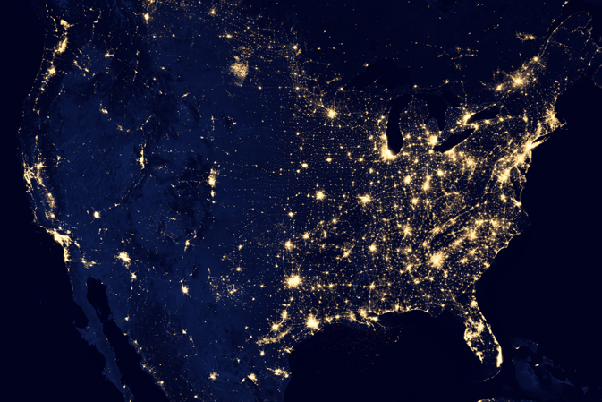
NASA Releases New “Lights at Night” Image In High Resolution.
Posted by Dan Satterfield

This view of the Earth at Night is a composite image from the Suomi Satellite. Click on the image for a 7 megabyte very high res. image.
This image is possible thanks to the VIIRS sensor on the new Suomi satellite. The day night band imagery has already produced some spectacular nighttime shots of clouds and storm systems. You can read more about Suomi here.
You can overlay these on Google Earth by getting this KML File.
There is a 55 MB Quick Time movie of the Earth at night from NASA here.


 Dan Satterfield has worked as an on air meteorologist for 32 years in Oklahoma, Florida and Alabama. Forecasting weather is Dan's job, but all of Earth Science is his passion. This journal is where Dan writes about things he has too little time for on air. Dan blogs about peer-reviewed Earth science for Junior High level audiences and up.
Some of those small dots at the top of the picture (north) are only accessible by winter road, by plane, or in a couple of case, by boat/canoe. There is no year-round road to them. I’ve been to some of them for work. In ten years or so, there will be at least one full season road into the area so it would be interesting (and maybe depressing) to see how a picture 20 years from now would differ.