
3 February 2011
Arctic Ice Update-Another Record Low in January
Posted by Dan Satterfield
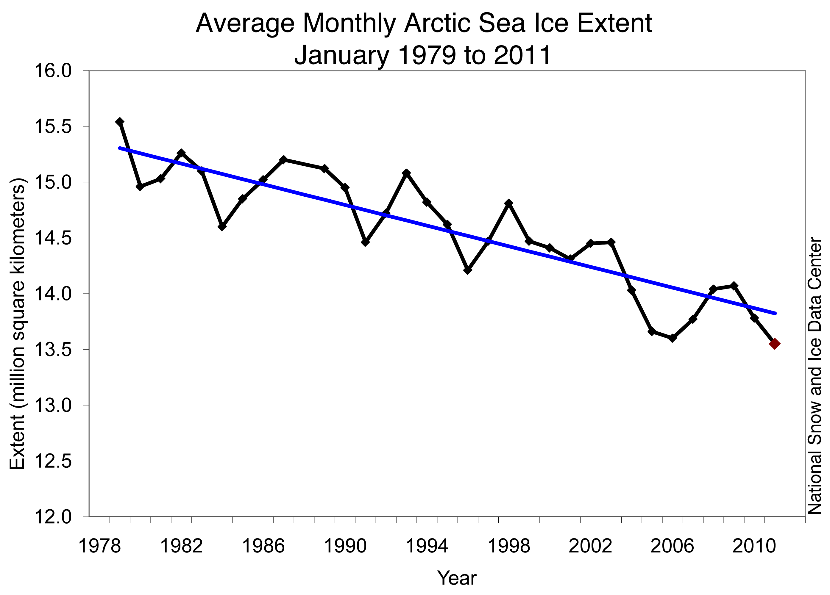
The long term trend continues down. From NSIDC (NOAA).
Here is the release from the National Snow and Ice Data Center:
Arctic sea ice extent averaged over January 2011 was 13.55 million square kilometers (5.23 million square miles). This was the lowest January ice extent recorded since satellite records began in 1979. It was 50,000 square kilometers (19,300 square miles) below the record low of 13.60 million square kilometers (5.25 million square miles), set in 2006, and 1.27 million square kilometers (490,000 square miles) below the 1979 to 2000 average.
Ice extent in January 2011 remained unusually low in Hudson Bay, Hudson Strait (between southern Baffin Island and Labrador), and Davis Strait (between Baffin Island and Greenland). Normally, these areas freeze over by late November, but this year Hudson Bay did not completely freeze over until mid-January. The Labrador Sea remains largely ice-free.
Many climate models, used by the IPCC and other researchers, are continuing to underestimate the loss of sea ice. The big questions remain over whether the loss of ice is related to the snowy winter over the USA and Europe. I covered this in a previouspost here.
As you can see below, the track of the sea ice cover continues to run near the all time record low in 2006-2007.
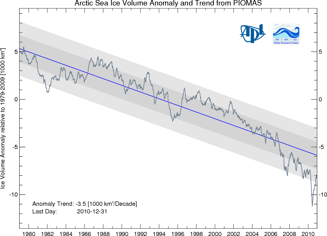
 The Polar Science Center, at the University of Washington, has a model that estimates the volume (compared to the surface coverage) of Arctic ice. This is critical information and needed to forecast the trends into the future.
Their latest estimate is below.
 We will have the January temperature data from NASA and NCDC in a couple of weeks…
 Dan Satterfield has worked as an on air meteorologist for 32 years in Oklahoma, Florida and Alabama. Forecasting weather is Dan's job, but all of Earth Science is his passion. This journal is where Dan writes about things he has too little time for on air. Dan blogs about peer-reviewed Earth science for Junior High level audiences and up.
[…] This post was mentioned on Twitter by Andrei Evbuoma, Dan Satterfield. Dan Satterfield said: Update on Arctic Sea ice today from NOAA- record low in January: http://bit.ly/ePjRLG #AGW #Climatechange […]