
4 March 2011
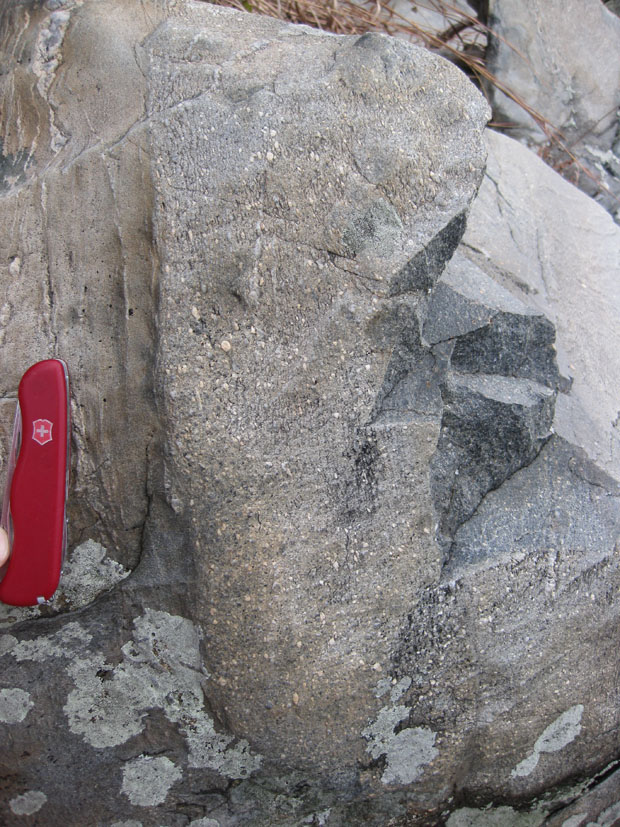
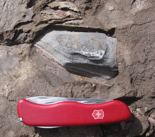
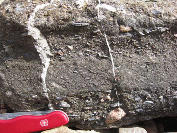
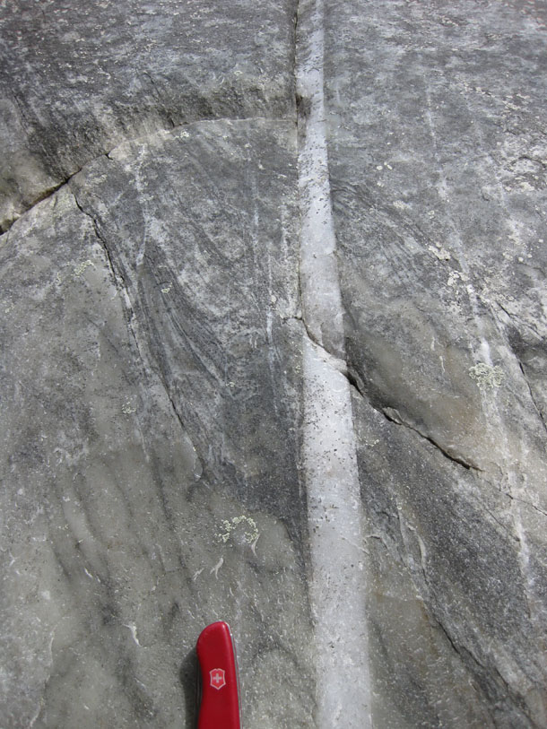
Friday fold: Buckled vein in the Catoctin
Another fold seen in the Catoctin Formation, where last week we encountered a very different style of folding — chevrons overprinting Catoctin foliation. Here, we instead have a light colored vein that appears to have been buckled into a semi-ptygmatic form. The trace of the foliation in the Catoctin is discernible, too.
Enjoy your Friday!
1 March 2011
News from the Billy Goat Trail (3): grab bag
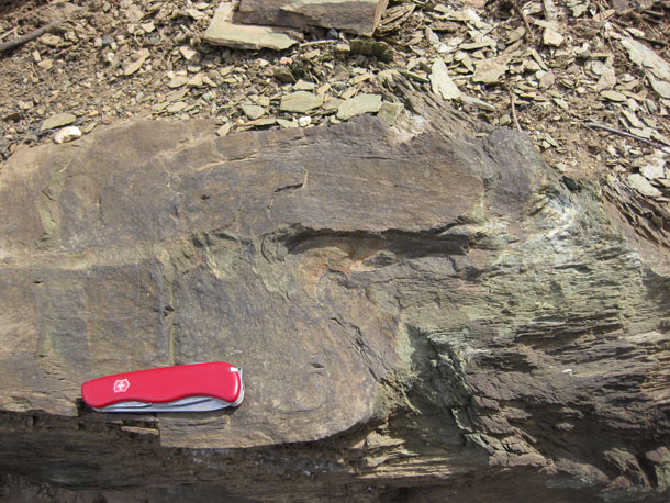
Okay, a final post (for now, anyhow) sharing some images from last Friday’s field trip to the Billy Goat Trail, in Potomac, Maryland.
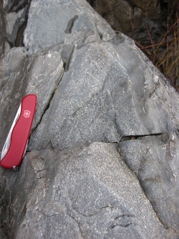
Yesterday we looked at lamprophyre dikes, but there are other dikes on the Billy Goat Trail, too. Like this granite pegmatite:
What’s interesting to me about this is that the joint set seems to have contradictory cross-cutting relations with the dike. Did the joints come first? Or the crystallization of the magma? If the latter, are the joints not really joints, but small faults? Blerg.
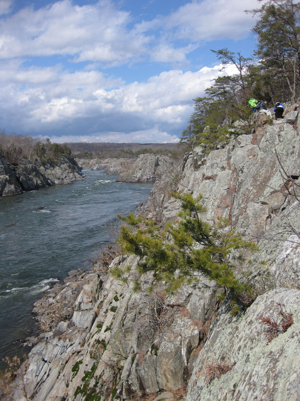
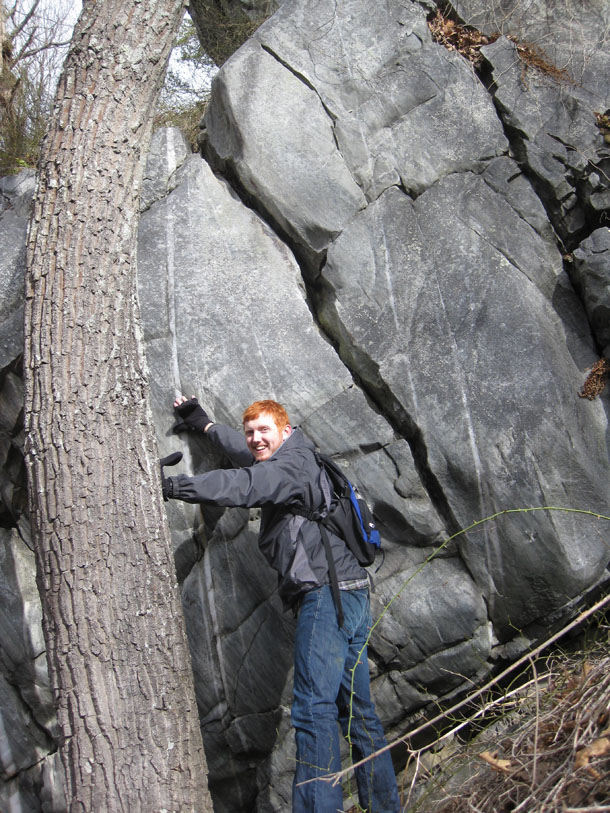
A look upstream at Mather Gorge, with the Rocky Islands in the distance. Students working at upper right:
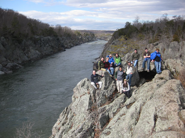
A class portrait adjacent to Mather Gorge, looking upstream, from the “Pothole Alley” stretch of trail:
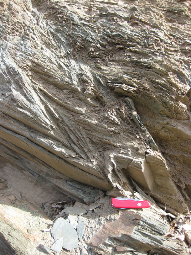
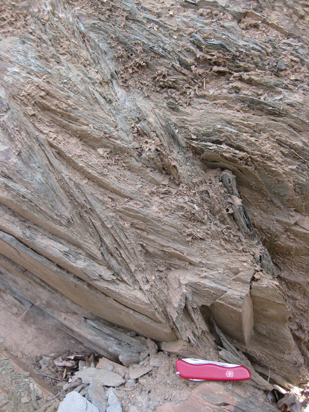
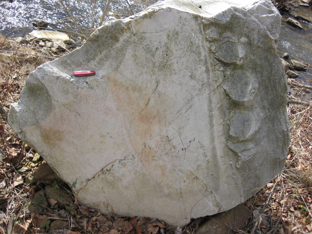
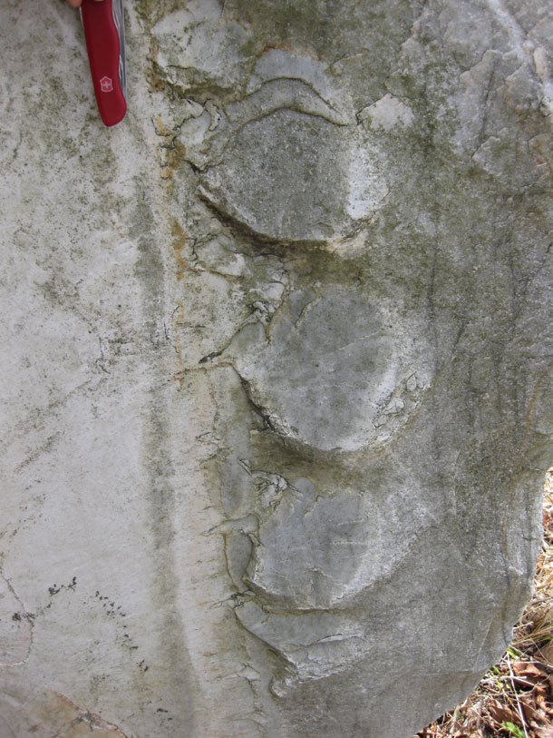
Okay, what are these?
I have some ideas, but before I pollute your mind with them, let’s hear what you have to say…
28 February 2011
Graphic analysis: “Climate data challenges”

![]() This image, in the February 11 issue of Science, accompanies an article by Overpeck, et al., in which they talk about climate data challenges. I would argue that this graphic offers some challenges of its own. Though the data are sound and the paper addresses a critical issue in a sober and thoughtful way, I think the design of this graphic could use some work.
This image, in the February 11 issue of Science, accompanies an article by Overpeck, et al., in which they talk about climate data challenges. I would argue that this graphic offers some challenges of its own. Though the data are sound and the paper addresses a critical issue in a sober and thoughtful way, I think the design of this graphic could use some work.
My chief critique is that this graphic tries to do too much. It simultaneously attempts to:
- list sources of information which lead to climate predictions,
- list natural and human realms that will be affected by climate change,
- show the past temperature changes (as anomalies),
- show predictions for future temperature changes (as anomalies),
- show the global distribution of past temperature changes (as anomalies), and
- show predictions for the global distribution of future temperature changes (as anomalies).
My critiques are:
- The color scheme for the past versus the color scheme for the future is odd: the indigo and white of the “past” evokes cold without being quantitative about it — a psychological association which is nonscientific. The background color scheme for the future has less of a color gradient (medium blue to lighter blue), and does not bring any clear psychological associations up. It is less clearly “evocative” of any particular temperature mindset, and so it meets more with my approval than the left side of the background color. However, it is inconsistent to color the graphic in this fashion — why not just a uniform color scheme?
- Observed “temperature” change (and future “temperature” change) would be a more accurate descriptor of the data being plotted. Climate change includes temperature change, but it also includes variables such as precipitation change, albedo change, storm intensity change, and others. The only variable shown in this image is temperature anomaly, so let’s call a spade a spade.
- From +2.5°C to +8.0°C, the color changes in “redness” are too subtle to be immediately discernible (and therefore meaningful).
- The contrast of the red on the scale bar at left with the background is different from the contrast of the red on the globe at right with the (different) background — this makes it more difficult to read the graphic.
- The arrow with its cavalcade of associated words is clunky and bizarre. It feels very Pravda to me, though I doubtless have Edward Tufte to thank for that association. Is the arrow simply leading from the current state of the Earth to the predicted (high end) future state of the Earth? If so, why is the arrow inclined in slope? Perhaps it has something to do with the fact that …
- … the position of the “global” maps are located at different vertical positions on either side of the past/future divide. The bottom of each globe icon sits at the temperature anomaly for the present (+1°C) and the future (year 2100, high-end prediction, +4.2°C), This strikes me as gimmicky at best, redundant certainly (since the graph at bottom already conveys the same average global temperature anomaly information), and deliberately provocative at worst. I think this is the fatal flaw of this graphic — in spite of representing valid and important scientific information, this shifting upward of the future globe by the same vertical distance as 3.2 degrees of temperature anomaly magnitude is hokey and propangandist, and undermines the credibility of the work.
What are your thoughts?
I’m grateful to Lee Allison for posting a note about this study (and including the graphic) on his blog.
____________________________________________
Overpeck, J., Meehl, G., Bony, S., & Easterling, D. (2011). Climate Data Challenges in the 21st Century Science, 331 (6018), 700-702 DOI: 10.1126/science.1197869
News from the Billy Goat Trail (2): lamprophyre dikes
So I mentioned yesterday that last Friday saw my structural geology class out collecting data on Maryland’s Billy Goat Trail, while I explored a few new areas. Let’s continue the story today, and shift from the graded beds to looking at a series of interesting lamprophyre dikes.
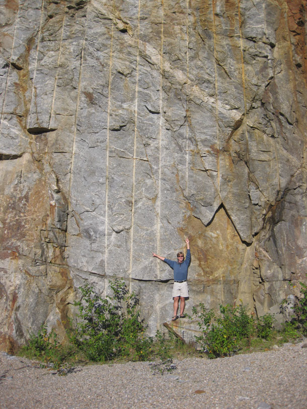
Here’s a view looking from the Maryland shoreline across the Potomac River at Virginia. There, in Great Falls Park, you can see a series of four subparallel mafic igneous dikes, steeply dipping upstream, and weathering away faster than the meta-graywacke that they cut across.
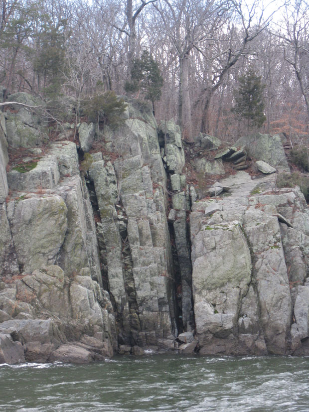
The metagraywacke has a metamorphic age of ~460 Ma, and so the dikes must have been intruded more recently than that. (Another line of evidence in support of this interpretation is that they are not ductilely deformed like other pre-460-Ma units in the area.) K/Ar dating of biotite in the lamprophyre dikes gives a crystallization age of ~360 Ma.
These dikes are actually the source inspiration for our project. The thing about them is that they don’t line up along strike from the Virginia to the Maryland side of the river. There is a distinctive right-lateral offset of 30 feet or so. Why is this?
One possibility is that the dikes were themselves cross-cut by a right-lateral fault. Another possibility is that there is no fault, but instead the lamprophyre magma was intruded into jagged fractures, which “jog” to the right underneath the river. Here’s a cartoon illustrating the two possibilities:

The 2000 USGS map of the area by Scott Southworth and colleagues shows that they choose the fault hypothesis as the preferred explanation. One of the main lines of evidence in support of this interpretation is the extremely straight (low sinuosity) trend of Mather Gorge. The idea is that the fault crushed up the rock along its surface, and when the Potomac River incised, it exploited this planar zone of pulverized rock as the easiest area in which to cut down.
A challenge to the fault hypothesis may be found in the details of the dikes’ outcrop patterns. If you examine them closely, you will find that they are actually quite “branchy” and “splitty,” with offshoots galore, and thus are not perfectly planar. The dikes, in other words, are at least a little bit jagged. But this observation doesn’t prove a big jog beneath the river, nor does it disprove the presence of a fault. Another observation that visitors to the area may make is that there are a great many planar features in the area, including metamorphic foliation and 4 or 5 joint sets. Perhaps one of these features is parallel to the trend of Mather Gorge, and can itself explain the oddly-straight section of river? If so, we might be able to use Occam’s Razor to carve away the (unnecessary) fault hypothesis.
So that’s why I had the students out there measuring strikes and dips all day — they were seeing if Mather Gorge’s trend might correlate with a joint set or the dominant strike of foliation.
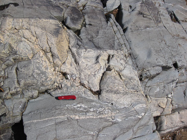
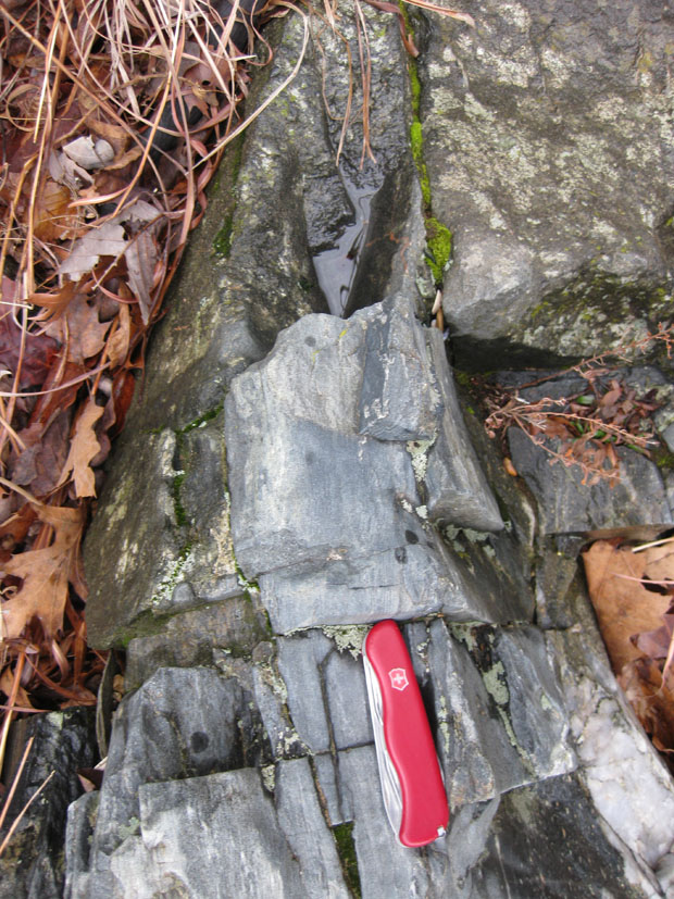
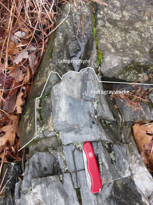
Meanwhile, it gave me an opportunity to clamber down on the Maryland side of the river to the water, examining the dikes along the way. Check out some of these images of the contact. Here’s one with a lamprophyre dike in the center, and walls of more resistant metagraywacke on either side:
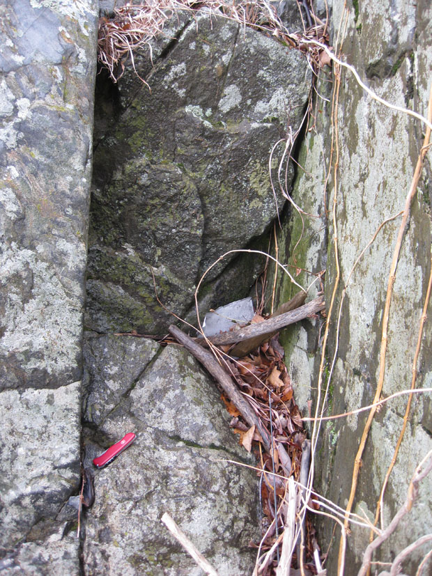
You’ve gotta love the east coast slime-layer that coats these rocks, eh? Makes it tougher to figure out what the heck is going on when everything is coated with lichens, algae, and moss.
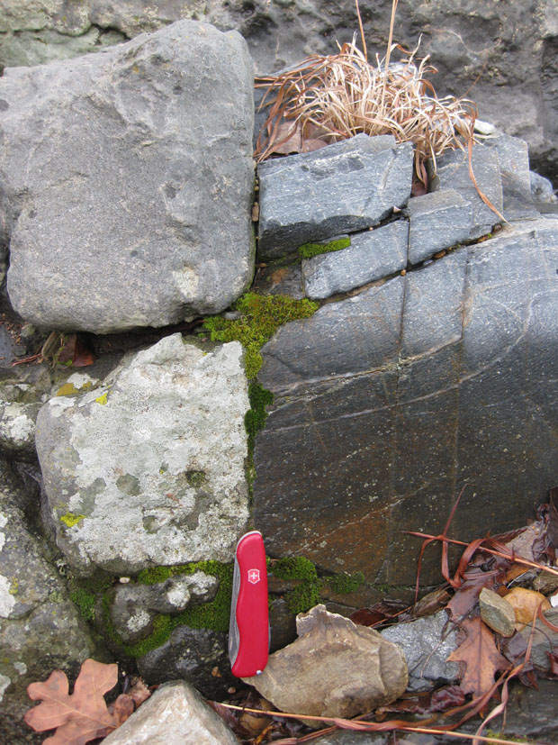
Lamprophyre at left (notice the greater degree of weathering and vegetation growth) and metagraywacke at right:
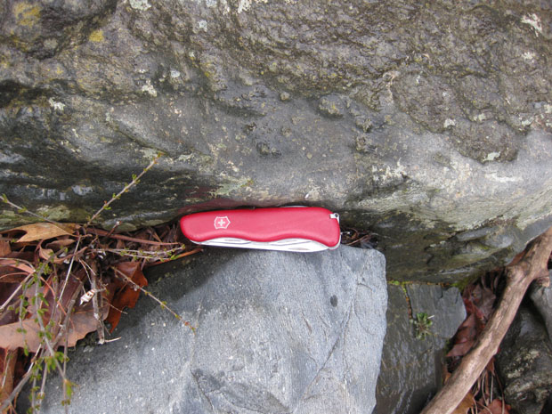
Knife sits astride the contact, as it does in this photo, too (lamprophyre at top, metagraywacke at bottom):
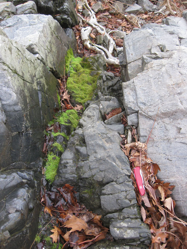
Looking down one dike towards the river (and the roots of a sycamore tree):
Complicated nature of the contact in one area:
Annotated version of this last photo:
There are some really nice exposures of the dikes on the Virginia side. Someday I should go over there with a camera and document them all for you.
27 February 2011
News from the Billy Goat Trail (1): Graded beds
I took my structural geology students out the Billy Goat Trail (upstream half of the “A” loop, near Potomac, Maryland) last Friday, and had them gather data for a project to assess whether or not Mather Gorge is controlled by a fault. I got this idea from Aaron Martin, the structural geologist at the University of Maryland, and I think it’s a nice project for structure students early on in the semester, as it gives them practice collecting a lot of data, and plotting that data on a stereonet.
Long-time readers will know that the Billy Goat Trail is one of my favorite areas to hike and geologize (and subsequently blog about). It’s chock full of geologic wonders, little hidden gems scattered across a dramatic landscape.
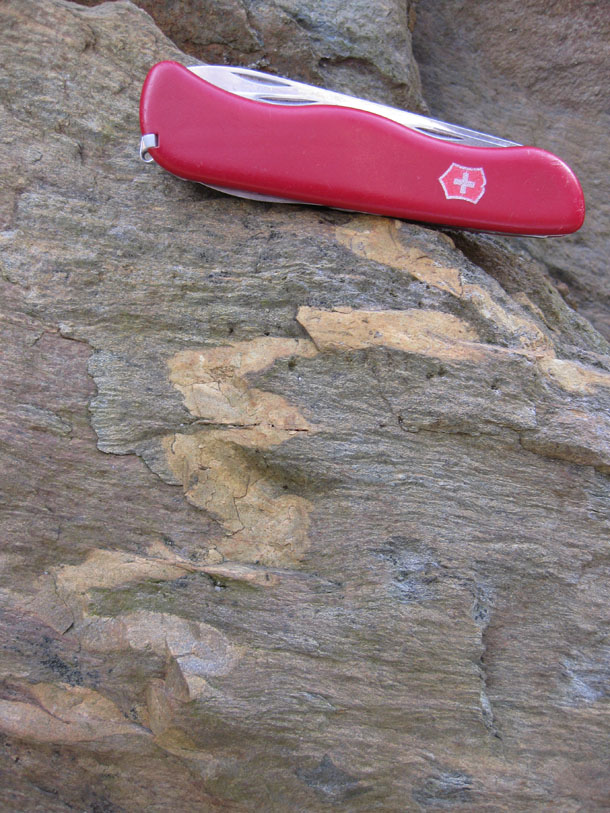
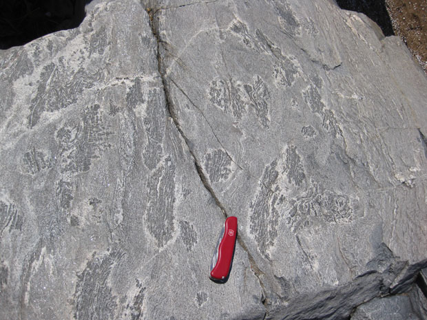
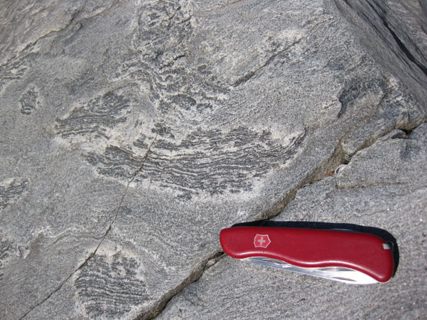
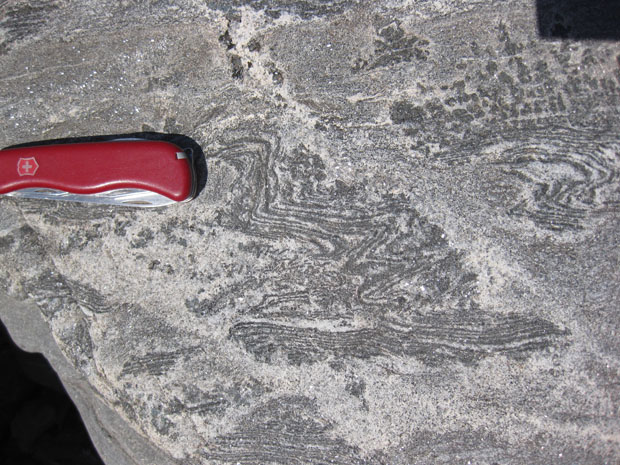
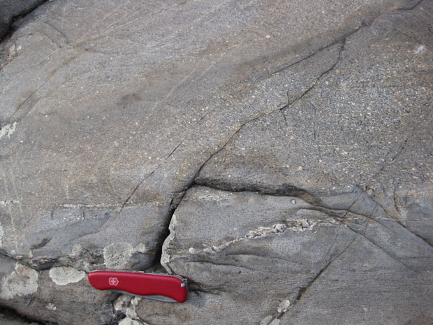
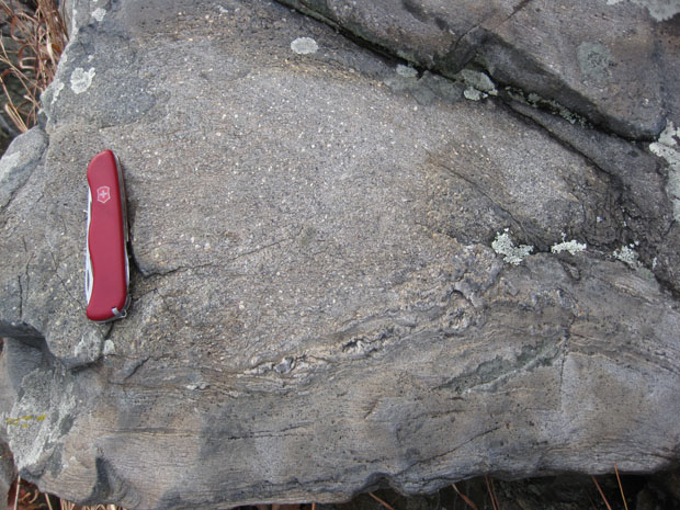
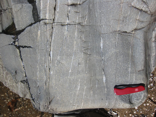
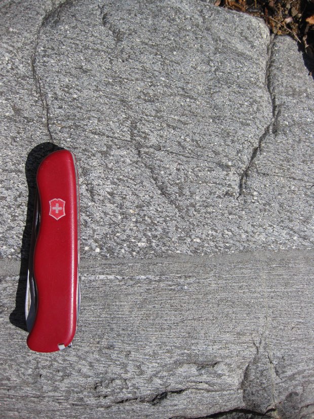
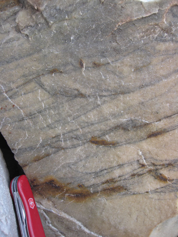
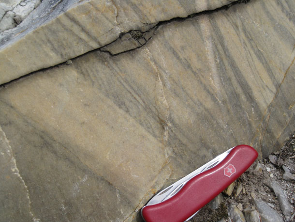
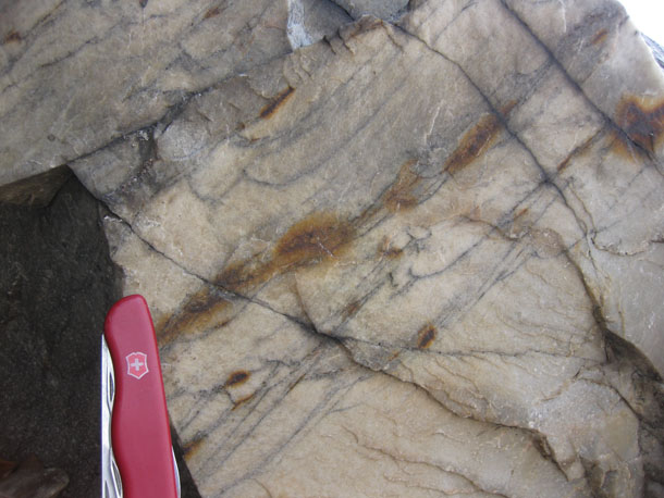
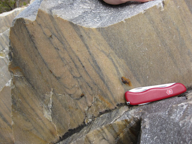
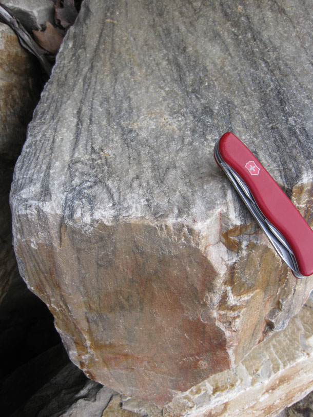
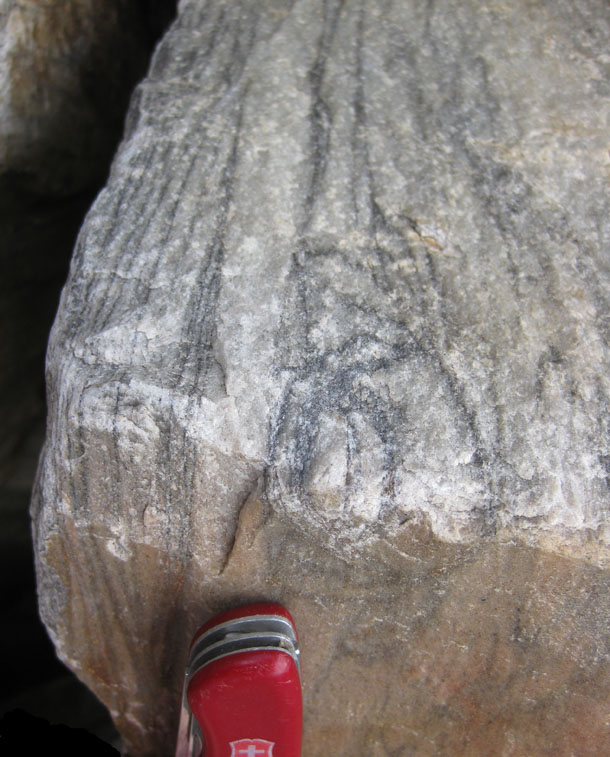
While the students were busy collecting strikes and dips of foliation planes and joint surfaces, I wandered around in a few new areas and noticed things. One thing I noticed were a bunch of new examples of graded bedding. Most of the rocks along the Billy Goat Trail started off as deep sea turbidites, and they bear the distinctive graded bedding that results from that depositional setting.
Here are a few examples. Remember that Abrupt transitions from fine-grained sediments to coarse-grained sediments mark the base of each graded bed, and then the grain size gradually (and gradationally) changes to fine grained as you head “up” (paleo-up) from the base of the bed.
Let’s start out with two shots where photo-up is the same as paleo-up:
Here’s a nice look at the base of the bed (abrupt fine to coarse contact) here; younging direction is to the right:
Here’s an upside-down graded bed (tectonically inverted) that has been folded into an antiform:
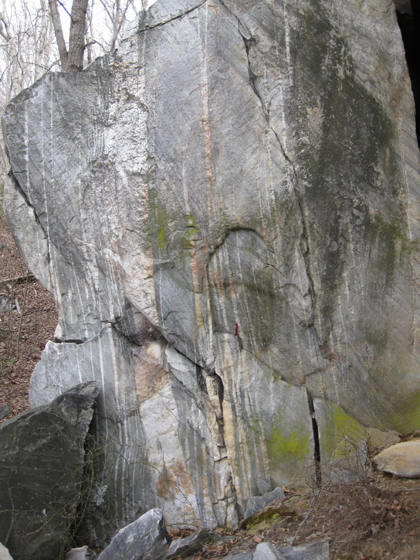
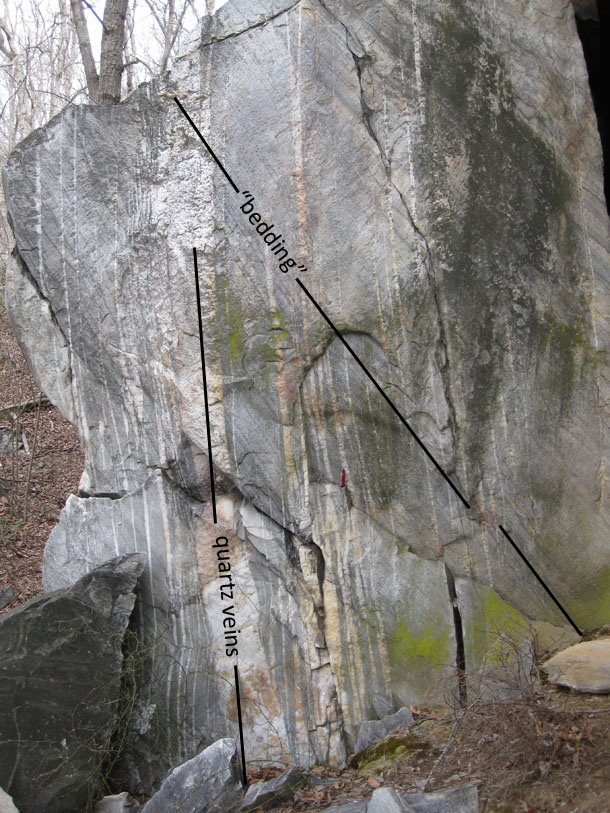
Two complete graded beds overprinted by quartz veins; younging direction or paleo-“up” is to the right:
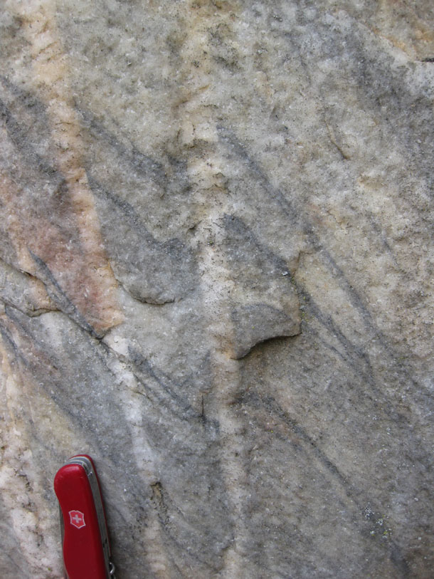
One more, close-up, just to round out the post:
26 February 2011
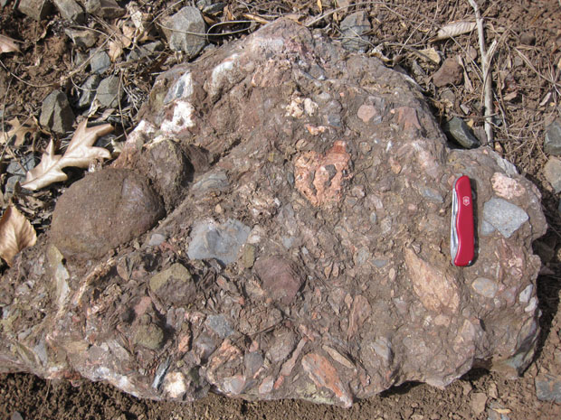
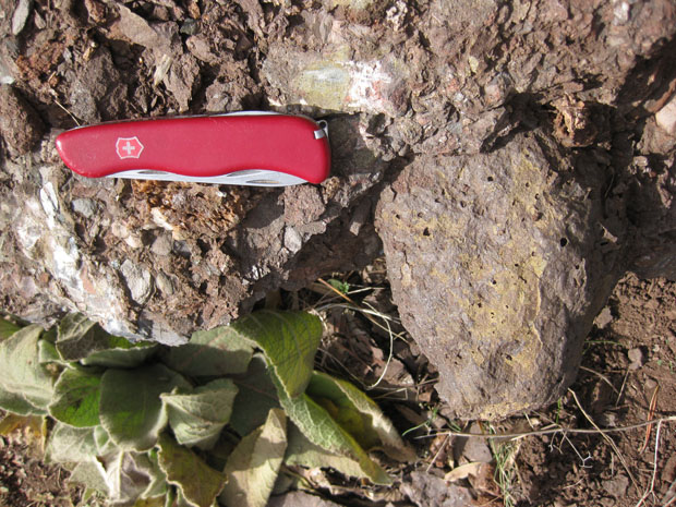
Waterfall Formation outcrops
I first mentioned the Waterfall Formation on this blog in May of 2008, but this was my first time visiting it in situ. Previously, including the May 2008 visit, was memorable time with charismatic boulders of float.
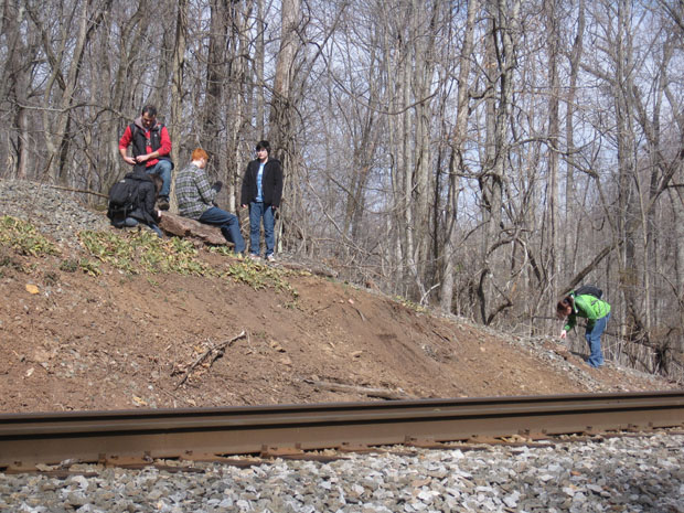
The occasion to see this geologic unit in outcrop was the field trip 6 days ago with the George Mason University GeoClub, when we took a hike to Thoroughfare Gap. After looking at the rift-related volcanism of the Neoproterozoic (breakup of Rodinia –> Catoctin Formation), and the subsequent metamorphosed quartz sandstone of the Weverton Formation (including some lovely fracture morphology), we hiked east, into a Triassic rift basin that accompanying another supercontinent breakup (breakup of Pangea –> Culpeper Basin).
We were checking out a border “fanglomerate” called the Waterfall Formation, which was deposited at the edge of the basin. It’s pretty cool to hike from severely metamorphosed and deformed rocks of the Blue Ridge province, and head a quarter mile east, and what do you find but… unmetamorphosed immature sediments!
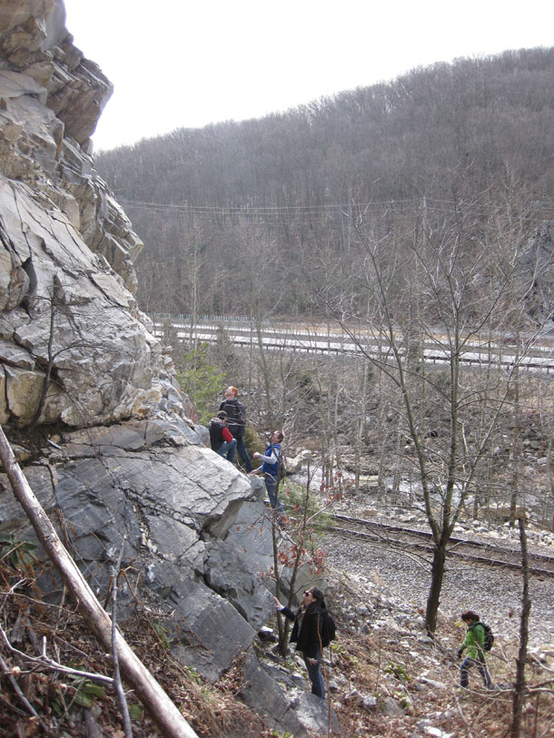
The group checks out a few outcrops along the railroad tracks:
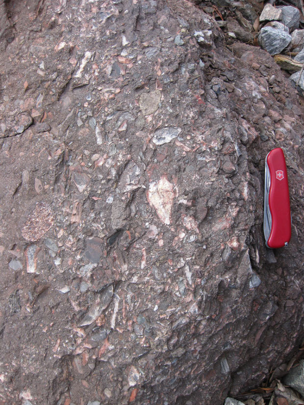
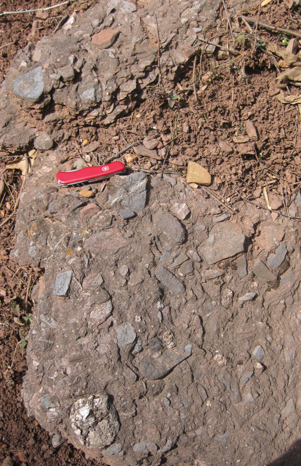
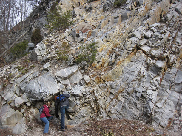
Here’s a hodgepodge of images from the area, some outcrop and some float, some zoomed out to show texture, some zoomed in to show individual clasts, kind of like I did last week with another conglomerate of another age, in another part of North America.
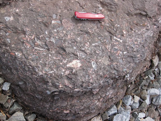
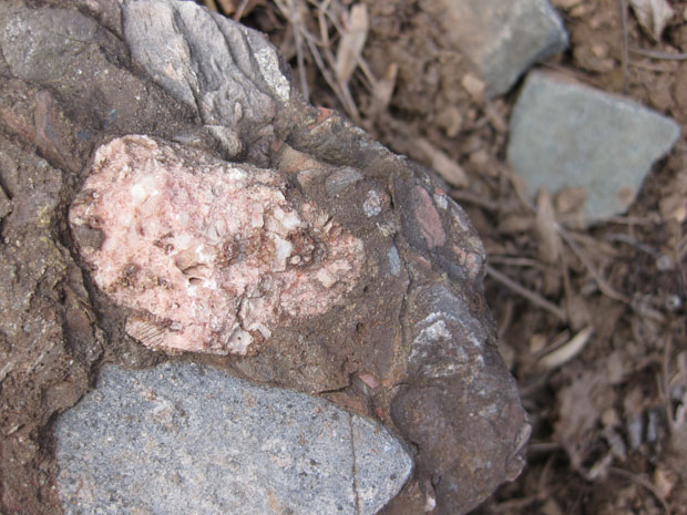
Some of these clasts are limestones, and some are basalts, including vesicular basalts like the really big clast in the previous image. Here’s a close-up of one of the limestone clasts, weathering away faster than the matrix:
Zooming in on two clasts just to the right of the knife in the previous photo:
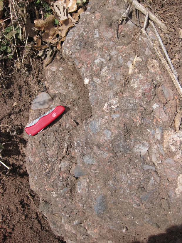
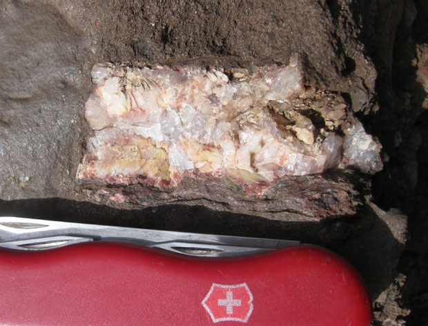
Pegmatite clast:
Vesicular basalt clast:
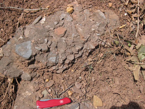
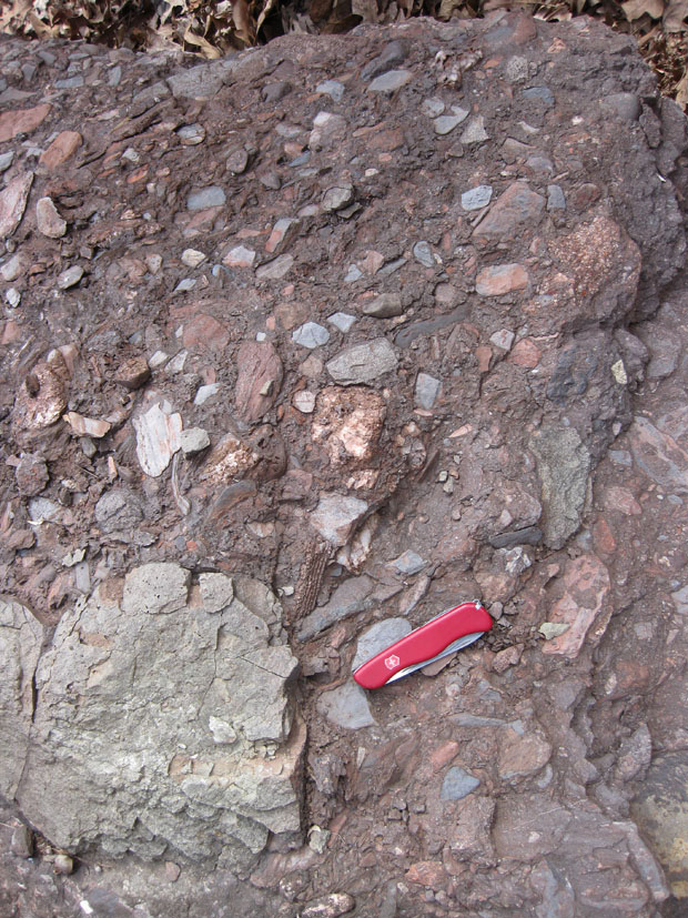
Some inverted graded bedding and calcite veins in this one:
(Note how the veins cut directly across the clasts.)
It was a great day out in the sunshine and mountains and among a diverse suite of rocks. Thanks again to our trip leaders, Aaron and Alan for inviting me to come along.
25 February 2011
Friday fold: Kinktactin
Last Sunday morning, two of my former GMU students, Aaron and Alan, led a hike for the GMU Geo-Club to Thoroughfare Gap, a water gap in the Bull Run Mountains of Virginia’s eastern Blue Ridge province. I’ve mentioned the Weverton Formation structures we saw there, and a nice example of a hackle fringe in previous posts.
We hiked west down the railroad tracks, and crossed the contact from the Weverton into the underlying Catoctin Formation greenstone (meta-basalt), which was dominantly non-photogenic. However, one thing that caught my eye was this chevron fold in a foliated section of the Catoctin.
Here, the Catoctin Formation is a chlorite phyllite (in places schisty). These rocks began as giant oozing basaltic lava flows, extruded onto the mid-Atlantic margin of North America long before the Atlantic itself. In fact, these lava flows are thought to have accompanied the breakup of an early supercontinent called Rodinia, and the opening of the Iapetus Ocean basin. Later, when the Iapetus closed, Africa rammed into North America and metamorphosed the basalt into greenstone. It was at this time that the Appalachian mountains were “made” and Pangea was sutured together. It was also, of course, at this time that they were likely to have been folded.
Check out a side view of the folds, with and without highlighting sunlight:
The style of folding here is very distinctive: straight limbs of constant thickness and crisp “hinge” areas. They are called chevron folds for this reason, and as Alan pointed out, you could put three of them on your shirtsleeve to pass for a sergeant of structural geology.
Most of the Catoctin that we observed here did not exhibit any obvious folding. We only noticed the greenschist foliation being bent up in this one place.
Happy Friday — hope you can get out for a hike of discovery this weekend too.
24 February 2011
Paddle hackle
Another serendipitous sighting on last weekend’s field trip to Thoroughfare Gap was this boulder of Weverton Formation, lying in the no-man’s-land between the railroad tracks and Broad Run:
As you look at this boulder, I hope you will notice what caught my eye and prompted me to take the photo. There’s a big flat surface (white) at left, but at right, in the gray portion of the rock, you can see a series of sub-parallel joint surfaces, dipping steeply towards the camera. They look like Ping-Pong paddles! Here’s a closer look at them, with my Swiss Army knife for scale:
I think what we might be looking at here is a single big joint face, that started in the bottom and then propagated to the top. It met slightly tougher gray quartzite at right, and at that mechanical discontinuity, the joint surface broke up and flared into an array of twist hackles. Typically, these features are relatively small (in my experience), so this seemed like a nice large example. Each of the hackle faces bears its own petite plumose structure.
Some other links to elucidate what the hell I’m talking about here:
http://www.nvcc.edu/home/cbentley/geoblog/2009/02/more-photos-of-plumose-structure.html
http://www.nvcc.edu/home/cbentley/geoblog/2009/04/making-joints-in-structural-geology.html
I didn’t notice it when I took the photo, but the arc-shaped feature (highlighted by oxide/mud staining) at the bottom of the main joint face may be a concentric rib. Thoughts?
22 February 2011
Beds and veins in the Weverton
Sunday morning, I was pleased to join a group of George Mason University “GeoClub” students on a field trip to Thoroughfare Gap, just west of Haymarket, Virginia. It’s a distinctive landmark where westbound travelers on I-66 leave the Culpeper Basin (Triassic to Jurassic rift valley associated with the breakup of Pangea) and enter the Blue Ridge province (Mesoproterozoic basement complex topped with sediments, flood basalts, and a transgressive sedimentary sequence, all metamorphosed and arched upwards and thrust to the west during the Alleghanian Orogeny). One NOVA student, who’s doing an Honors project on this area, joined us as well:
Here’s a view to the south, looking into the water gap:
On your left in the above picture, you see cliffs of resistant quartzite. This is the Weverton Formation, a Cambrian-aged quartz sandstone deposit (base of the transgressive Chilhowee Group) which was subsequently metamorphosed during Appalachian mountain-building. Across the gap, you can see the ridge on the other side. This northeast-trending ridgeline is known in Virginia as Bull Run Mountain. It is the eastern limb of a vast anticlinorium (upwarped fold) which is exposed as the Blue Ridge geologic province. The water gap itself was carved by Broad Run (not Bull Run), and you can see the stream itself is not the only linear feature which crosses Bull Run Mountain at this latitude. You can also see the train tracks, Interstate 66 (both east and west-bound lanes) and in the far distance, Route 55.
We came here to check out the rocks. Students Aaron and Alan had scouted it out several weeks previously, and found enough cool stuff that they felt it would make a good site for the GeoClub to check out. They were our trip leaders. Aaron hustled over to the first good outcrop, joined by Tiffany:
Looking in closer at what they are closely looking at:
And the annotated version:
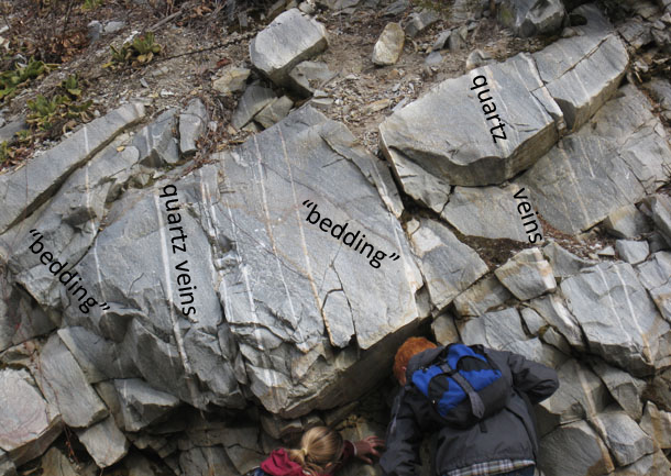
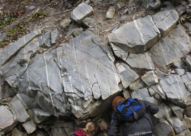
The quartzite here has dark layers in it that we interpreted as bedding. Because of some weird features in it (which I will show you later in this post), I’m not 100% confident in my “bedding” interpretation, but let’s go with it for the moment, and just put “bedding” in quotes to indicate our lack of certainty. (Deal?) If I’m right about it being bedding, then clay flakes originally deposited as layers within the sandy facies of the Iapetan shore were locked in place during lithification and ensuing metamorphic fusing of the quartz grains around it. Later, this bedding was tilted to its current orientation, dipping moderately to the east. At some other post-depositional point (but not necessarily before or after), the quartzite fractured, and hot water sealed shut the fractures with a series of white-colored veins of milky quartz. These quartz veins are subparallel to one another, and dip steeply to the east.
Where we observe the cross-cutting relationship between the quartz veins and the “bedding” planes on certain outcrop surfaces, we can detect offsets in the bedding, like the prominent black layers in this photo:
You can see the apparent offset here is “left lateral,” …
… but when you actually orient this photograph on the outcrop, the west side of the quartz vein is dropping down relative to the east side — a “normal” offset (in the faulting sense of the word).
Aaron found an exposure further up the hill where a creep-tilted tree was parallel to the quartz veins. Coincidence?
(Yes, it’s coincidence.)
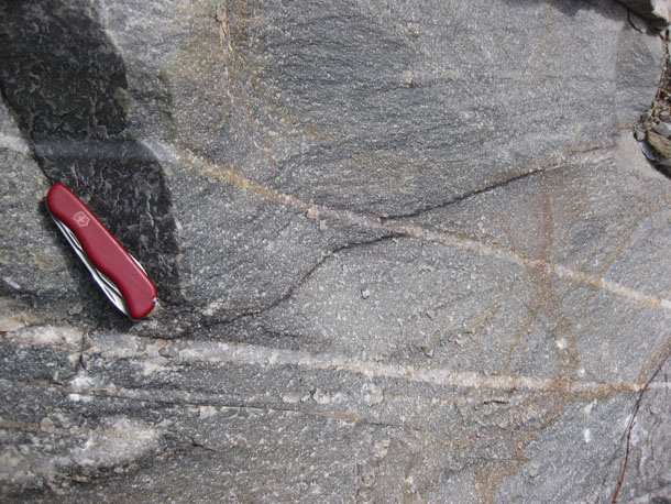
Another exposure showing the relationship between the veins and the “beds:”
Perspective is towards the north. My trusty Swiss Army knife (at center) provides a sense of scale. Here’s an annotated version of the same photo:
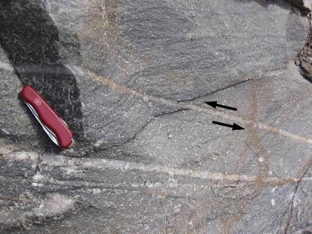
If you zoom in to the exposures at the far right of this outcrop, you’ll see this:
The “bedding” here is deflected along the quartz vein in what appears to be a drag fold. Again, the sense of kinematics is west-side-down, and east-side-up. Here’s another:
Okay, had enough milky quartz veins? Let’s go back to the question of whether these black layers are really bedding, and associated primary sedimentary structures.
Here’s a scene that looked to me like lovely, classic cross-bedding, concave-up indicating paleo-up (which is also current “up”):
But here’s another spot, not too far away, where the truncated side of the “cross beds” faces the other direction! They are concave-down, which indicates the younging direction (paleo-“up”) is in the direction that in the modern day we would call “down”:
… Okay… so maybe it’s not just a giant slab of sandstone fused into quartzite and preserving all its internal structures intact, like a mammoth frozen in tundra. Perhaps there is some internal folding which has flipped the bedding around in some kind of isoclinal fold (the black layers are parallel regardless which way these “crossbeds” indicate is “up”).
But what do I make of this…?
Okay… that looks something like cross-bedding, but it’s pretty crisp and steep there on the edges. If these black layers are clay highlighting scours into earlier-deposited sand, then how come they curl over on themselves? Were the originally deposited at the angle of repose and then later deformed? What’s driving me nuts about interpreting these structures is that they can’t be undeformed cross beds, as those have an angle (with respect to the main bed) of 30° or so. These suckers instead curl up past 90°, and even tilt back on themselves!
And what about this…?
What is that? Are these deformed crossbeds? (i.e., the top of the cross beds have been sheared in the same direction the current was flowing) Or is this the lining of some burrow? Is this a trace fossil?
Really, this pattern reminds me of “ladder dikes,” and those are primary magmatic structures, not the sorts of things you would expect in a batch of Cambrian beach sand… Maybe some sort of dewatering or gas escape structure? Your hypotheses (and justifications) are welcome! (That’s what the comments are for.)
One more… A different section through what might be the same thing as the previous image:
Right there on the corner — a series of nested and partially overlapping (cross-cutting) circles:
Again, I find myself thinking of “snail structures,” magmatic primary structures which are thought to reflect flow through a tube-like “pipe” going up through the crystal mush of a magma chamber, though sectioned “horizontally” rather than the vertical section which we call a “ladder dike.” Clearly, this isn’t an intrusive igneous rock, but there was potentially something dynamically similar at work on these rocks.
Thoughts as to what these patterns are, or how they formed? I’m grateful for your feedback.
I’ll continue with describing what we saw on this field trip in a future post. That’s enough for today.
21 February 2011
Mount Washington 1
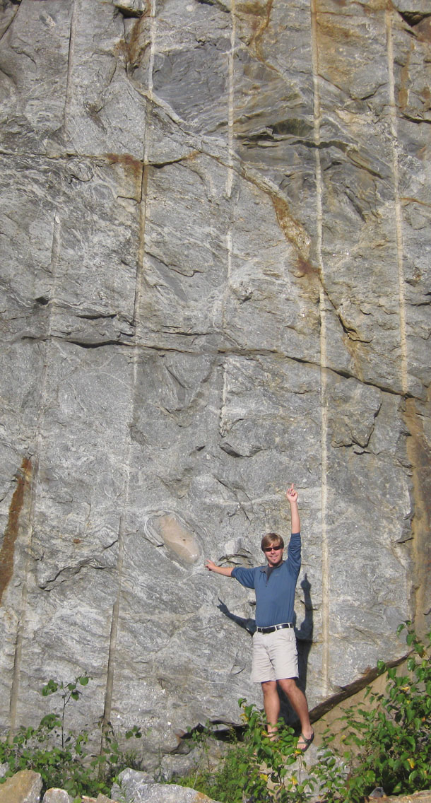
I’d like to start a series on the geology I encountered last summer at Mount Washington, in New Hampshire. It’s not only the site of the “World’s Worst Weather,” but it’s got some cool rocks and some cool geomorphology too. I hiked it last August with my fiancee Lily, and my cousin Brad. Lily and I got to the mountain first, and to kill some time while we waited for Brad to drive up, we checked out a prominent outcrop on the west side (east facing, hence the fine morning lighting) of the road up to Pinkham Notch.
According to the superb map accompanying Dykstra Eusden’s book The Presidential Range: Its Geologic History and Plate Tectonics, the outcrop we were checking out is the Crawford Member of the Rangely Formation, a gray migmatitic orthogneiss.
A quick taste of what we saw there:
Here’s a pegmatite dike dipping at (apparently) 45° to the north (right) and a big, gray, angular inclusion:
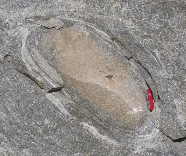
A closer look at a similar exposure, a bit further down the outcrop:
Again, you can see a big angular gray inclusion (this time above me), and also an elliptical inclusion (“concentrically mineralogically zoned calc-silicate granofels”) that’s tan in color. Let’s zoom in on that second one:
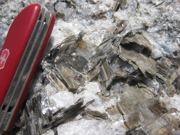
Nearby were some ground-level exposures of the pegmatite. For instance, consider this veritable “library” of muscovite books:
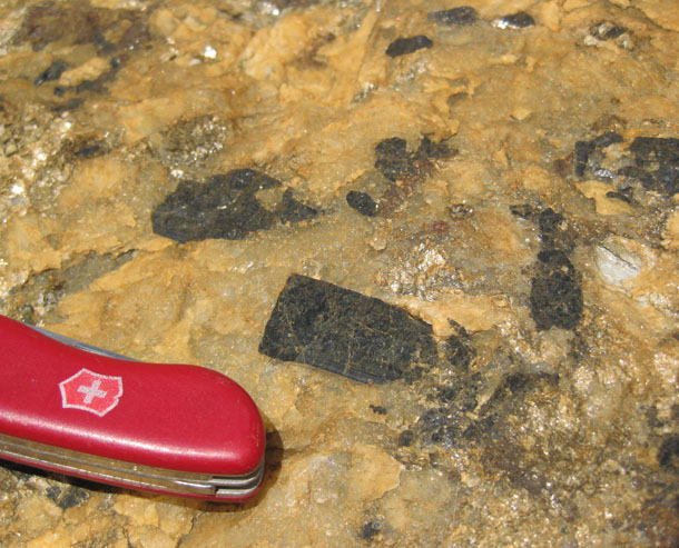
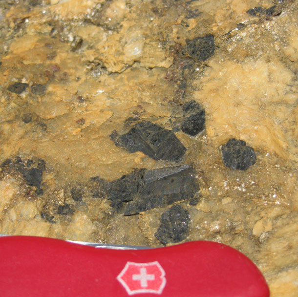
And here we go with a rust-stained exposure of pegmatite, bearing large black crystals of tourmaline (?):
More later, from the trail…
 Callan Bentley is Associate Professor of Geology at Piedmont Virginia Community College in Charlottesville, Virginia. He is a Fellow of the Geological Society of America. For his work on this blog, the National Association of Geoscience Teachers recognized him with the James Shea Award. He has also won the Outstanding Faculty Award from the State Council on Higher Education in Virginia, and the Biggs Award for Excellence in Geoscience Teaching from the Geoscience Education Division of the Geological Society of America. In previous years, Callan served as a contributing editor at EARTH magazine, President of the Geological Society of Washington and President the Geo2YC division of NAGT.