28 February 2011
News from the Billy Goat Trail (2): lamprophyre dikes
Posted by Callan Bentley
So I mentioned yesterday that last Friday saw my structural geology class out collecting data on Maryland’s Billy Goat Trail, while I explored a few new areas. Let’s continue the story today, and shift from the graded beds to looking at a series of interesting lamprophyre dikes.
Here’s a view looking from the Maryland shoreline across the Potomac River at Virginia. There, in Great Falls Park, you can see a series of four subparallel mafic igneous dikes, steeply dipping upstream, and weathering away faster than the meta-graywacke that they cut across.
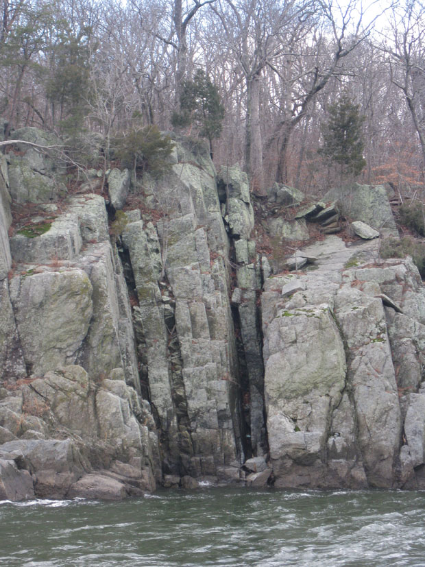
The metagraywacke has a metamorphic age of ~460 Ma, and so the dikes must have been intruded more recently than that. (Another line of evidence in support of this interpretation is that they are not ductilely deformed like other pre-460-Ma units in the area.) K/Ar dating of biotite in the lamprophyre dikes gives a crystallization age of ~360 Ma.
These dikes are actually the source inspiration for our project. The thing about them is that they don’t line up along strike from the Virginia to the Maryland side of the river. There is a distinctive right-lateral offset of 30 feet or so. Why is this?
One possibility is that the dikes were themselves cross-cut by a right-lateral fault. Another possibility is that there is no fault, but instead the lamprophyre magma was intruded into jagged fractures, which “jog” to the right underneath the river. Here’s a cartoon illustrating the two possibilities:

The 2000 USGS map of the area by Scott Southworth and colleagues shows that they choose the fault hypothesis as the preferred explanation. One of the main lines of evidence in support of this interpretation is the extremely straight (low sinuosity) trend of Mather Gorge. The idea is that the fault crushed up the rock along its surface, and when the Potomac River incised, it exploited this planar zone of pulverized rock as the easiest area in which to cut down.
A challenge to the fault hypothesis may be found in the details of the dikes’ outcrop patterns. If you examine them closely, you will find that they are actually quite “branchy” and “splitty,” with offshoots galore, and thus are not perfectly planar. The dikes, in other words, are at least a little bit jagged. But this observation doesn’t prove a big jog beneath the river, nor does it disprove the presence of a fault. Another observation that visitors to the area may make is that there are a great many planar features in the area, including metamorphic foliation and 4 or 5 joint sets. Perhaps one of these features is parallel to the trend of Mather Gorge, and can itself explain the oddly-straight section of river? If so, we might be able to use Occam’s Razor to carve away the (unnecessary) fault hypothesis.
So that’s why I had the students out there measuring strikes and dips all day — they were seeing if Mather Gorge’s trend might correlate with a joint set or the dominant strike of foliation.
Meanwhile, it gave me an opportunity to clamber down on the Maryland side of the river to the water, examining the dikes along the way. Check out some of these images of the contact. Here’s one with a lamprophyre dike in the center, and walls of more resistant metagraywacke on either side:
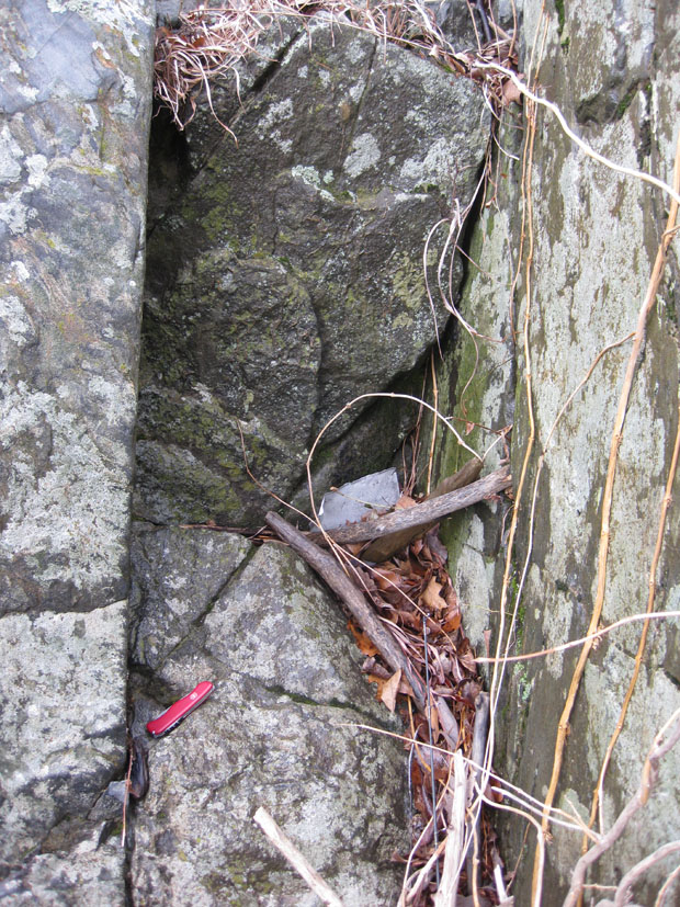
You’ve gotta love the east coast slime-layer that coats these rocks, eh? Makes it tougher to figure out what the heck is going on when everything is coated with lichens, algae, and moss.
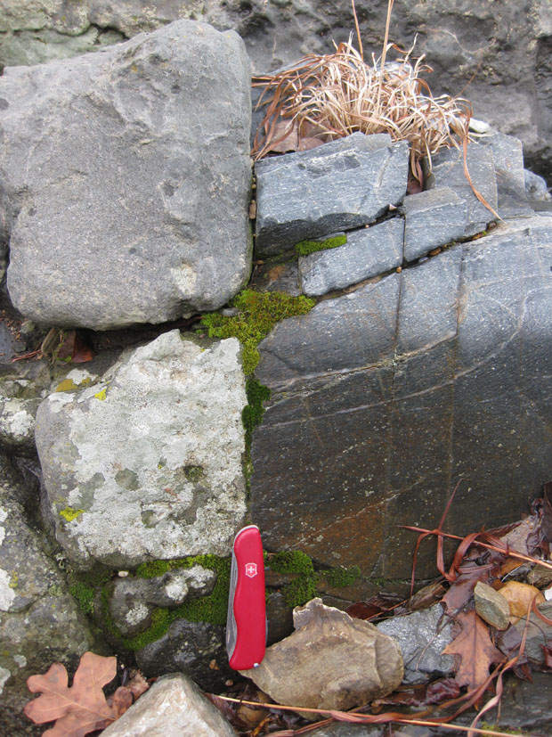
Lamprophyre at left (notice the greater degree of weathering and vegetation growth) and metagraywacke at right:
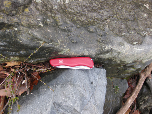
Knife sits astride the contact, as it does in this photo, too (lamprophyre at top, metagraywacke at bottom):
Looking down one dike towards the river (and the roots of a sycamore tree):
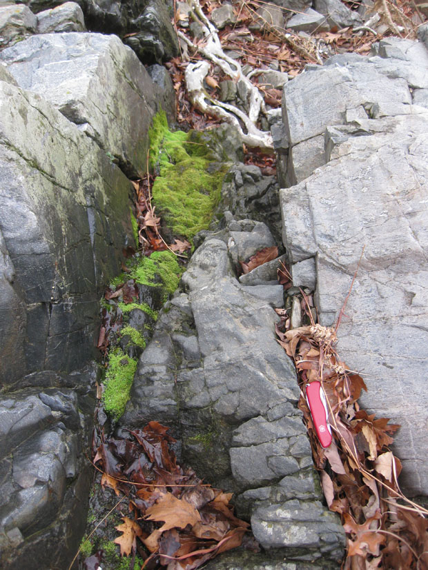
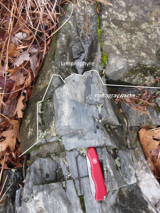
Complicated nature of the contact in one area:
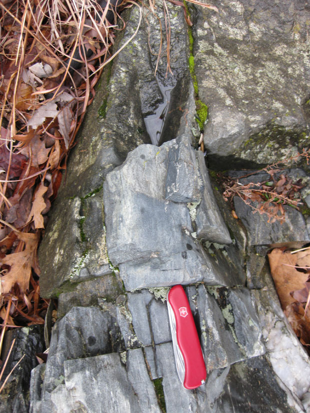
Annotated version of this last photo:
There are some really nice exposures of the dikes on the Virginia side. Someday I should go over there with a camera and document them all for you.


 Callan Bentley is Associate Professor of Geology at Piedmont Virginia Community College in Charlottesville, Virginia. He is a Fellow of the Geological Society of America. For his work on this blog, the National Association of Geoscience Teachers recognized him with the James Shea Award. He has also won the Outstanding Faculty Award from the State Council on Higher Education in Virginia, and the Biggs Award for Excellence in Geoscience Teaching from the Geoscience Education Division of the Geological Society of America. In previous years, Callan served as a contributing editor at EARTH magazine, President of the Geological Society of Washington and President the Geo2YC division of NAGT.
[…] we looked at lamprophyre dikes, but there are other dikes on the Billy Goat Trail, too. Like this granite […]