
18 October 2019
Friday folds from the Foreknobs Formation
Posted by Callan Bentley
TGIF!
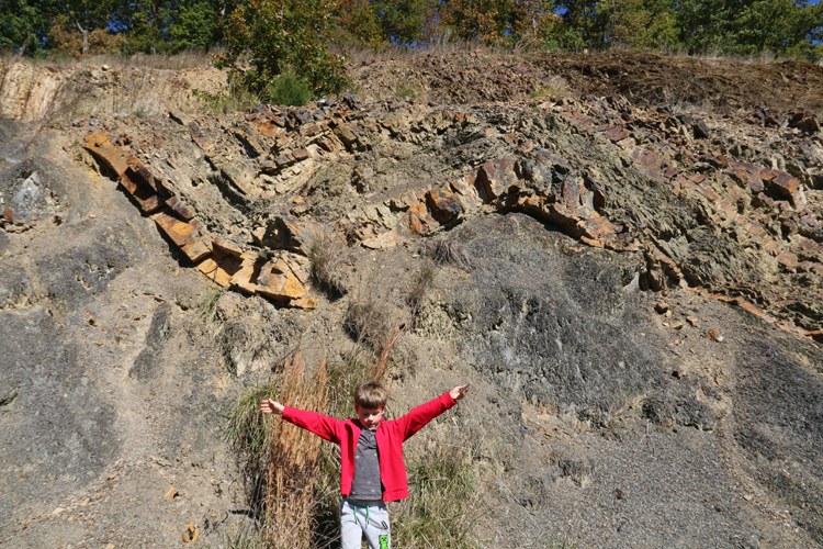
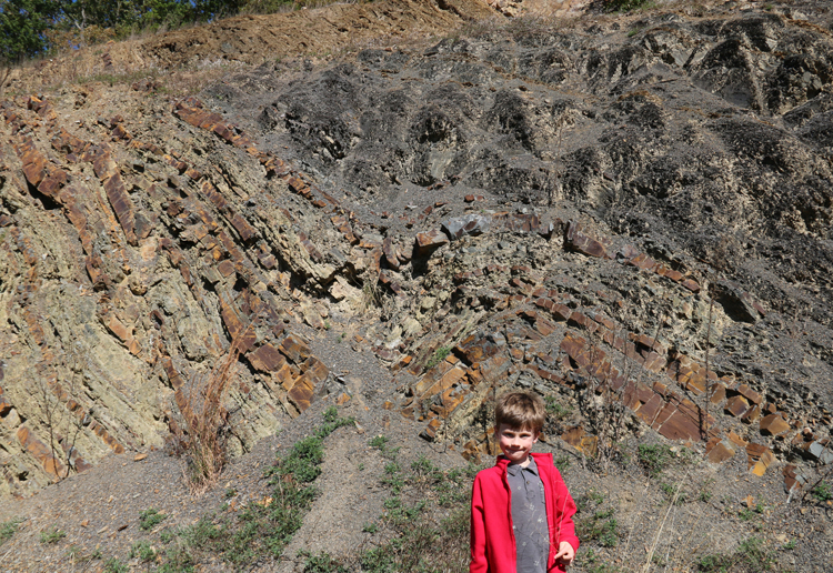
That’s my seven year old field assistant showing off the shape of a syncline in shale, siltstone, and fine sandstone of the Foreknobs Formation, a Devonian nearshore package of clastic sediment in the Valley & Ridge Province of eastern West Virginia.
Want to see something freaky for Halloween? Photoshop can make it happen:
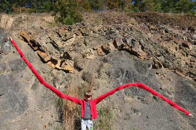
Ewwww. Creepy!
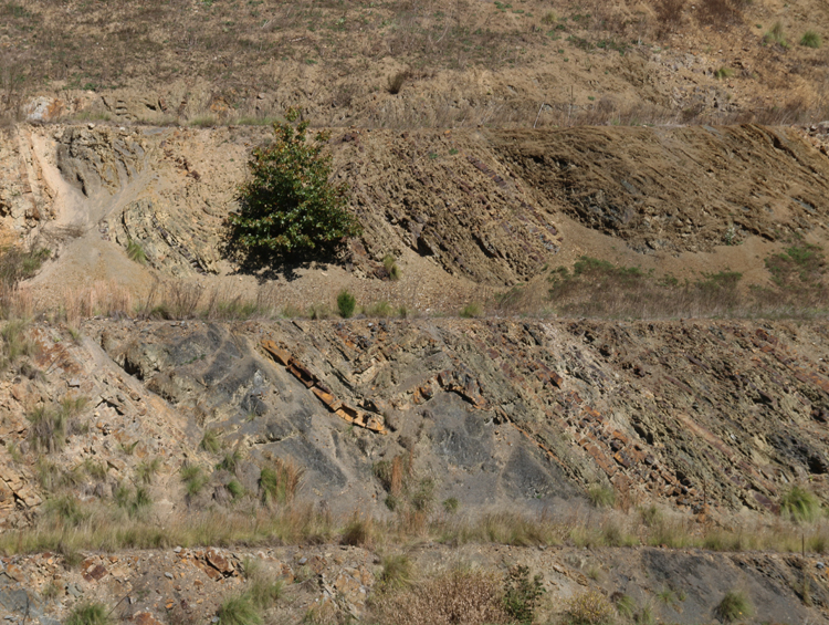
Another shot of the same fold, with a thick massive sand above a thicker black shale, from across the road (and no tentacle-armed boy for scale in this one):
My son and I took a field trip on Monday out to Corridor H, in Grant and Hardy Counties, West Virginia. There, a new highway has cut into folded and faulted strata of the Paleozoic section. Today’s Friday fold ensemble comes from an outcrop of Foreknobs that I’d never previously bothered to stop at. It was a delightful reminder that, despite dozens of trips to Corridor H over the years, there are still surprises lurking in these road cuts…
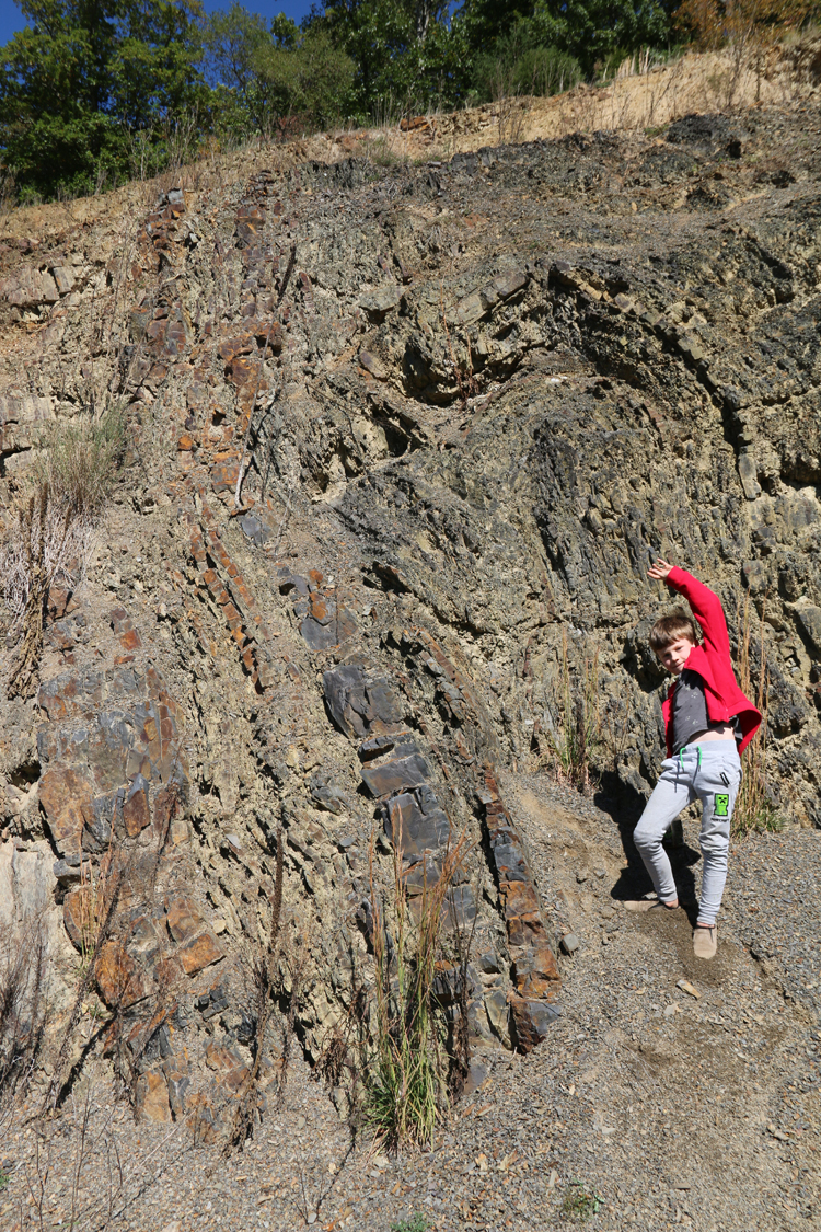
Here are some more folds we saw:
All these photos are taken of south-facing outcrops (note how well lit they are in the low October noon light), so our perspective is looking to the north. So west is to the left, and east is to the right. Once that orientation is mentally established, we note that the west-dipping limbs are much shorter than the east-dipping limbs. This asymmetry is found throughout the Valley & Ridge province: the folds are said to have a westward vergence. This indicates the tectonic transport direction: during deformation, these sedimentary layers were shoved from the east toward the west.
Here, my field assistant slugs some iced tea:
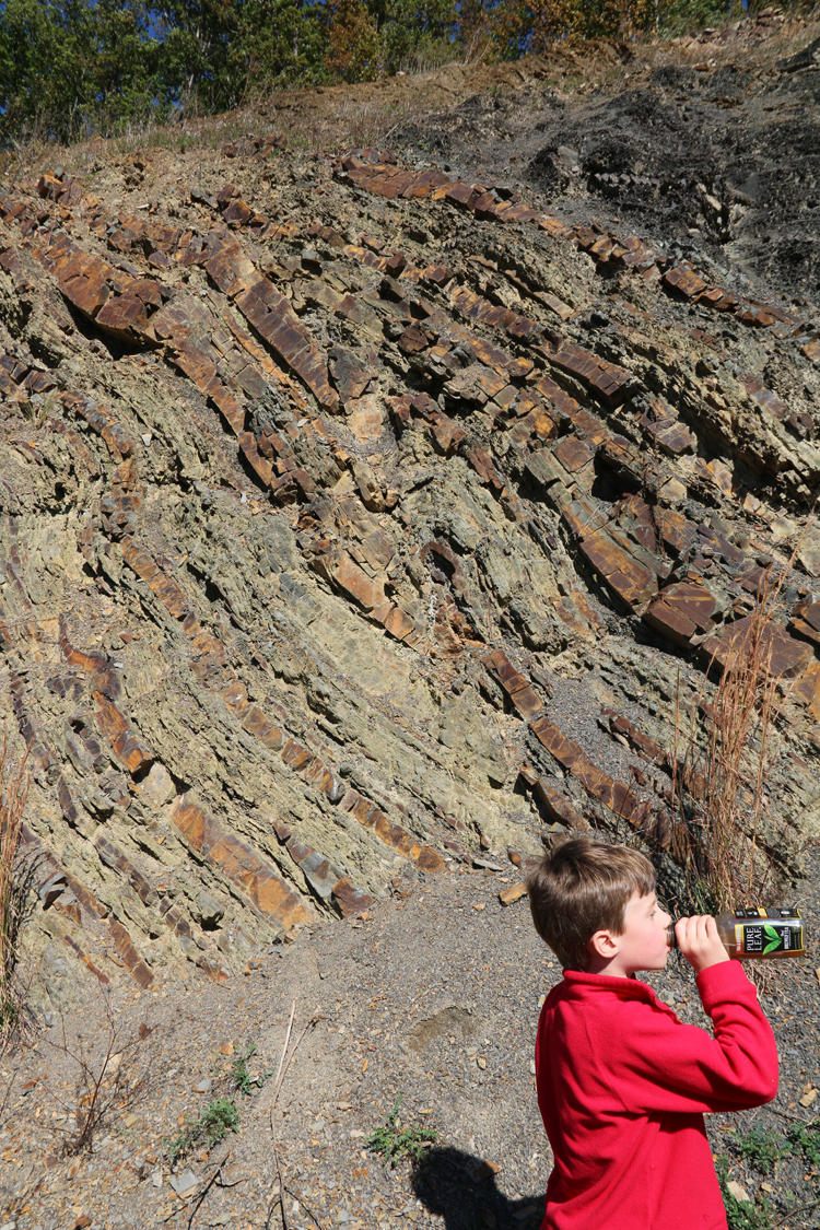
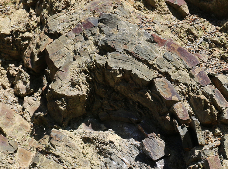
…but behind him is a small overturned, breached anticline, a little fault propagation fold:
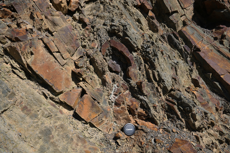
A similar overturned fault propagation fold, with the bonus of a decent little cleavage fan developed on the axis of the fold, on the lower part of the most prominent resistant layer:
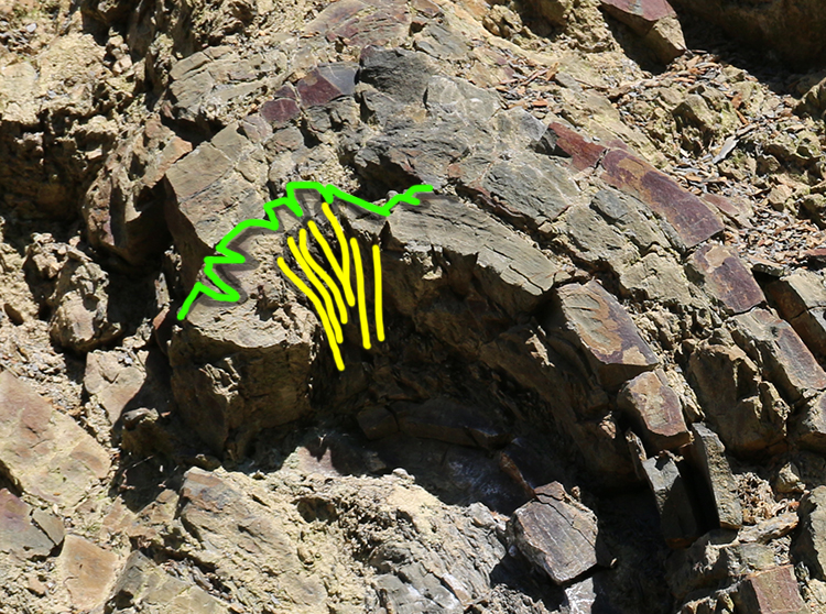
Let’s take a closer look:
Annotations here, with yellow showing cleavage in the shale/slate on the bottom of the siltstone layer, and the green on the upper surface of the siltstone, showing outer arc extension on the siltstone’s extended upper edge.
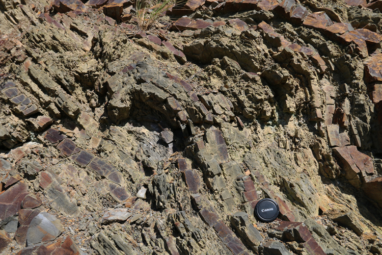
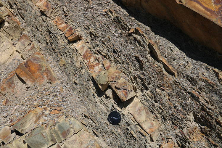
Here’s a small thrust fault doubling a siltstone bed for a few inches of overlap:
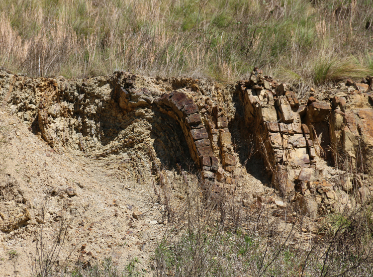
And I’ll conclude with a shot that lacks a proper sense of scale, as I shot it full zoom across the highway of the higher berm of the roadcut, on the other side of the road:
It’s a delight to go out in the field with my son. He really engages with the exploration now, finding rocks he thinks are cool (“This one is a perfect triangle!”) as well as helping me search for key features. We’ve been doing this a while now, and I look forward to future field work with him.
Happy Friday to you and your family field assistant!
 Callan Bentley is Associate Professor of Geology at Piedmont Virginia Community College in Charlottesville, Virginia. He is a Fellow of the Geological Society of America. For his work on this blog, the National Association of Geoscience Teachers recognized him with the James Shea Award. He has also won the Outstanding Faculty Award from the State Council on Higher Education in Virginia, and the Biggs Award for Excellence in Geoscience Teaching from the Geoscience Education Division of the Geological Society of America. In previous years, Callan served as a contributing editor at EARTH magazine, President of the Geological Society of Washington and President the Geo2YC division of NAGT.