9 May 2012
Overturned bedding in the Weverton (?) Formation
Posted by Callan Bentley
On Monday, I was out in the field at the Blue Ridge / Valley & Ridge transition (“boundary”?) in the Elkton East quadrangle, where Chuck Bailey and students (from the College of William & Mary) were leading a field review of their new geologic map. A field review is a form of field-based peer review, wherein the authors of a new geologic map take peers and interested others out into the field to showcase the key outcrops which led to the decisions that they made as to map interpretations. One of the outcrops we visited was in the Chilhowee Group, a late Neoproterozoic-Cambrian transgressive sequence of sedimentary strata that were subsequently deformed during Alleghanian mountain-building. There’s a classic Chilhowee sequence (river gravel + beach sand, lagoonal mud, barrier island sand), but one thing I’ve come to appreciate over the past six or seven years is that there is a significant amount of lateral variation in the type of sediment deposited. Consequently, it’s often a tough call to decide which of the three formations (Weverton, Harpers, or Antietam) you’re in. It’s sandy, sure: but really that is not diagnostic. Chuck and colleagues decided this one was Weverton, but they admit that’s a best guess given the circumstances.
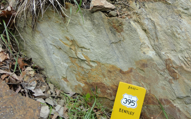
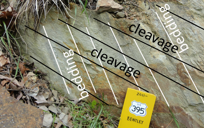
I was struck by the bedding / cleavage relationships in this outcrop – both dip to the southeast, but bedding dips more steeply than cleavage. The view in this photo is looking along strike to the northeast:


You know what that means: These beds must be overturned!
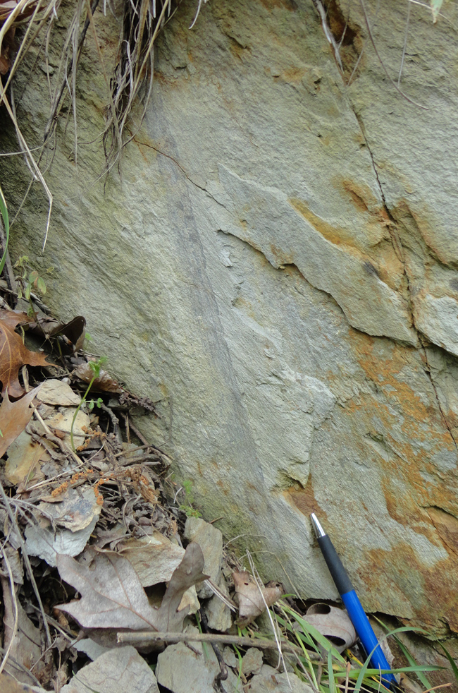
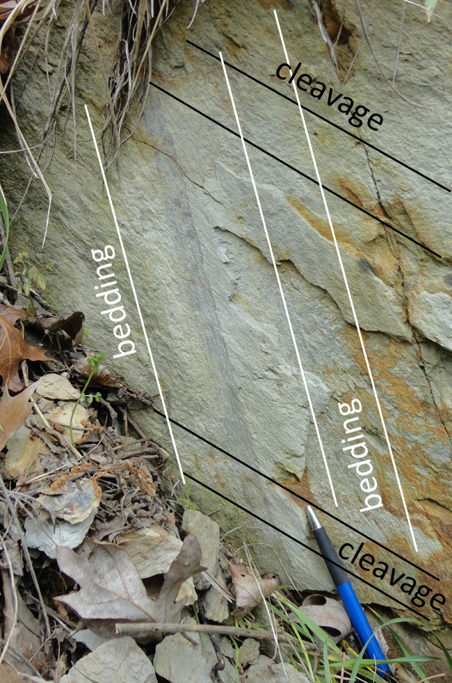
Here’s a close-up of the leftmost (northwesternmost) of the beds:


…Sweet: A small-scale structure that reveals a regional-scale situation (e.g., the overturned northwestern limb of the Blue Ridge Anticlinorium)!
I’ll have some other images from this trip to share in the next few days.


 Callan Bentley is Associate Professor of Geology at Piedmont Virginia Community College in Charlottesville, Virginia. He is a Fellow of the Geological Society of America. For his work on this blog, the National Association of Geoscience Teachers recognized him with the James Shea Award. He has also won the Outstanding Faculty Award from the State Council on Higher Education in Virginia, and the Biggs Award for Excellence in Geoscience Teaching from the Geoscience Education Division of the Geological Society of America. In previous years, Callan served as a contributing editor at EARTH magazine, President of the Geological Society of Washington and President the Geo2YC division of NAGT.
[…] As I mentioned, Monday had me out in the field, looking at the western Blue Ridge and eastern Valley & Ridge provinces in Virginia. This was a field review for the new geologic map of the Elkton East quadrangle by Chelsea Jenkins, Chuck Bailey, Mary Cox, and Grace Dawson. […]
[…] I’ve written a lot here about the geology of Massanutten, having lived in the depths of its differentially-eroded doubly-plunging synclinorium for 8 years. But this was the first time I’d seen this image. I like how it puts emphasis on the lower elevation of the Page Valley (right/east) relative to the Shenandoah Valley (left/west). I also note the overturned strata in the furthest east (right) position, something I’ve also documented on this blog. […]