
6 April 2014
Edinburgh: Arthur’s Seat, Salisbury Crags and Hutton’s Section
Posted by Jessica Ball
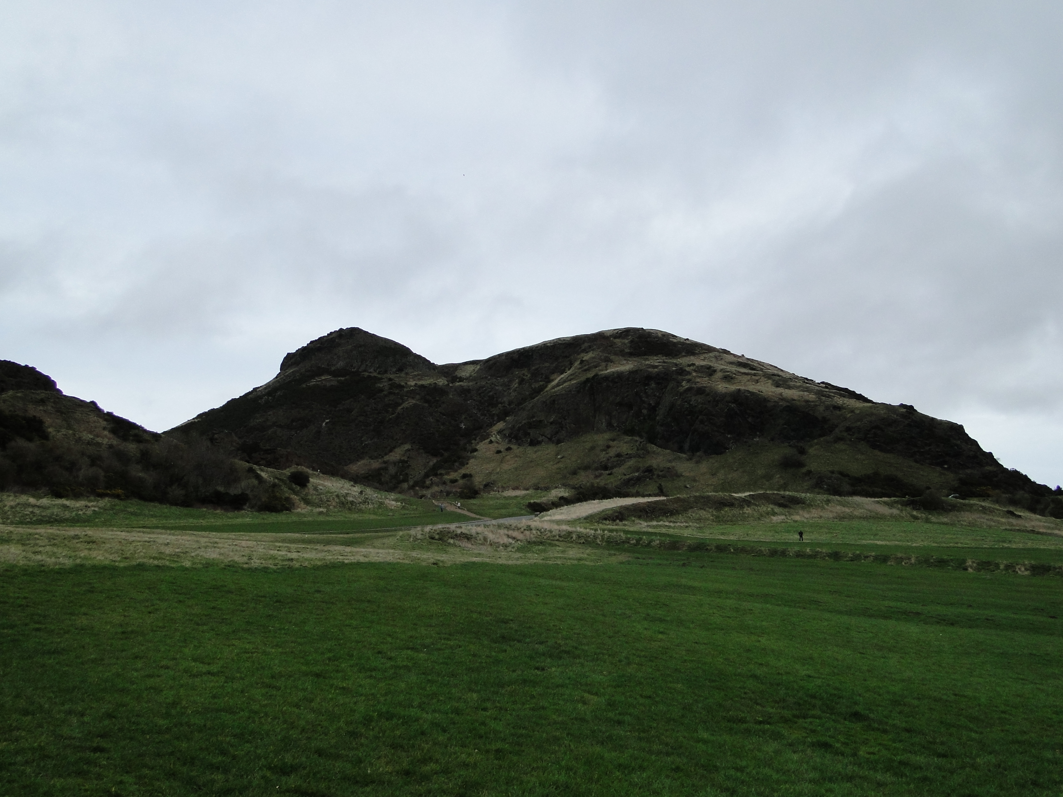
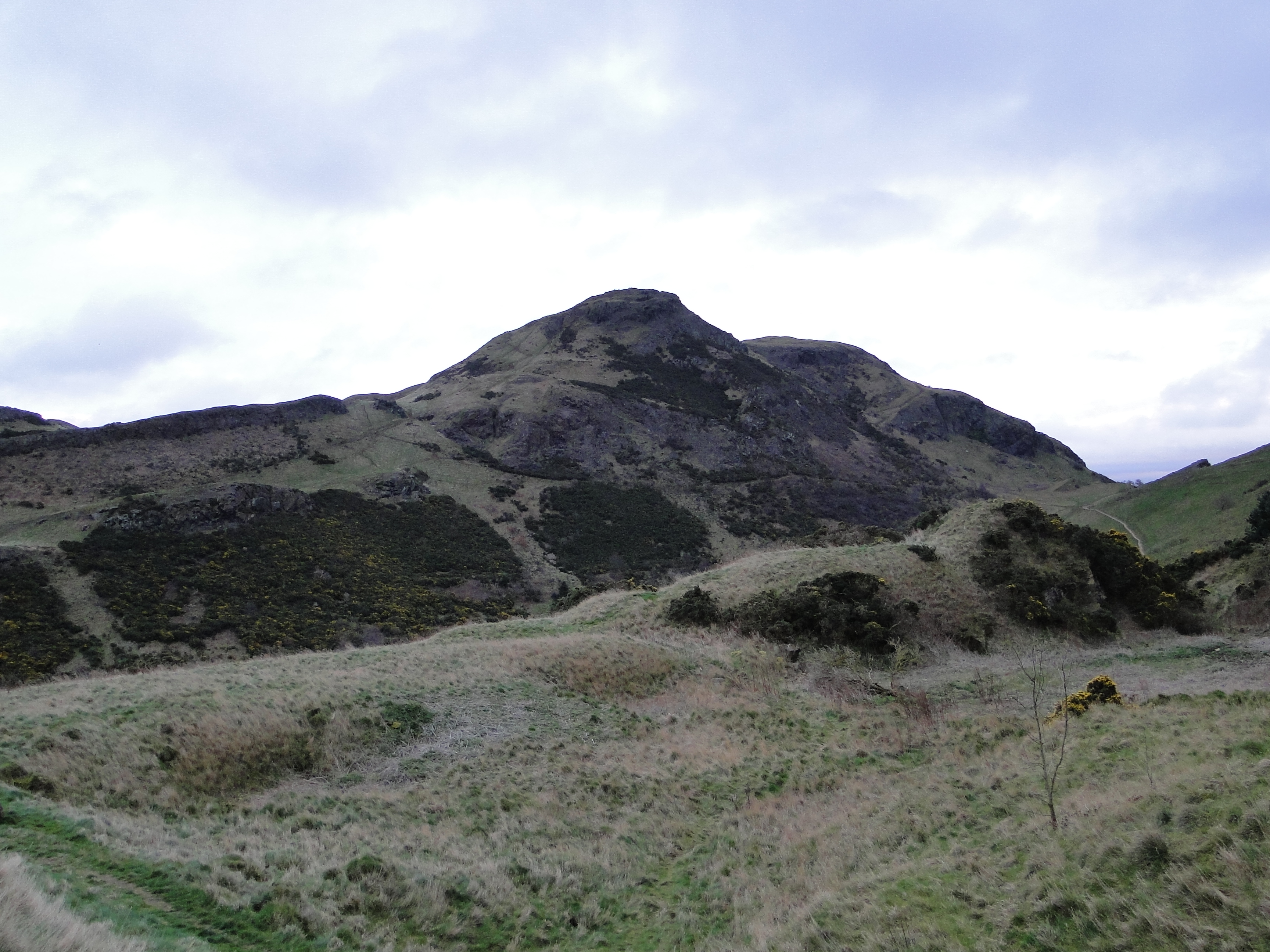
The Arthur’s Seat volcano in Holyrood Park
On the last day of my visit to Scotland, my advisor and her husband (both former UB volcanology folks) took me on a hike to Holyrood Park to visit Arthur’s Seat, Edinburgh’s volcano. The volcano we see now is tilted about 25 degrees to the east, but originally formed in a tensional stress regime on a continental margin about 350 million years ago. What’s left of the volcano is about 13 different lava flows, agglomerates from the crater, some intrusive sills and dikes of basalt.
But there’s more in the park than just the volcano. As I mentioned in the previous post, there’s a locality that’s truly worthy of a geologic pilgrimage: Hutton’s Section.
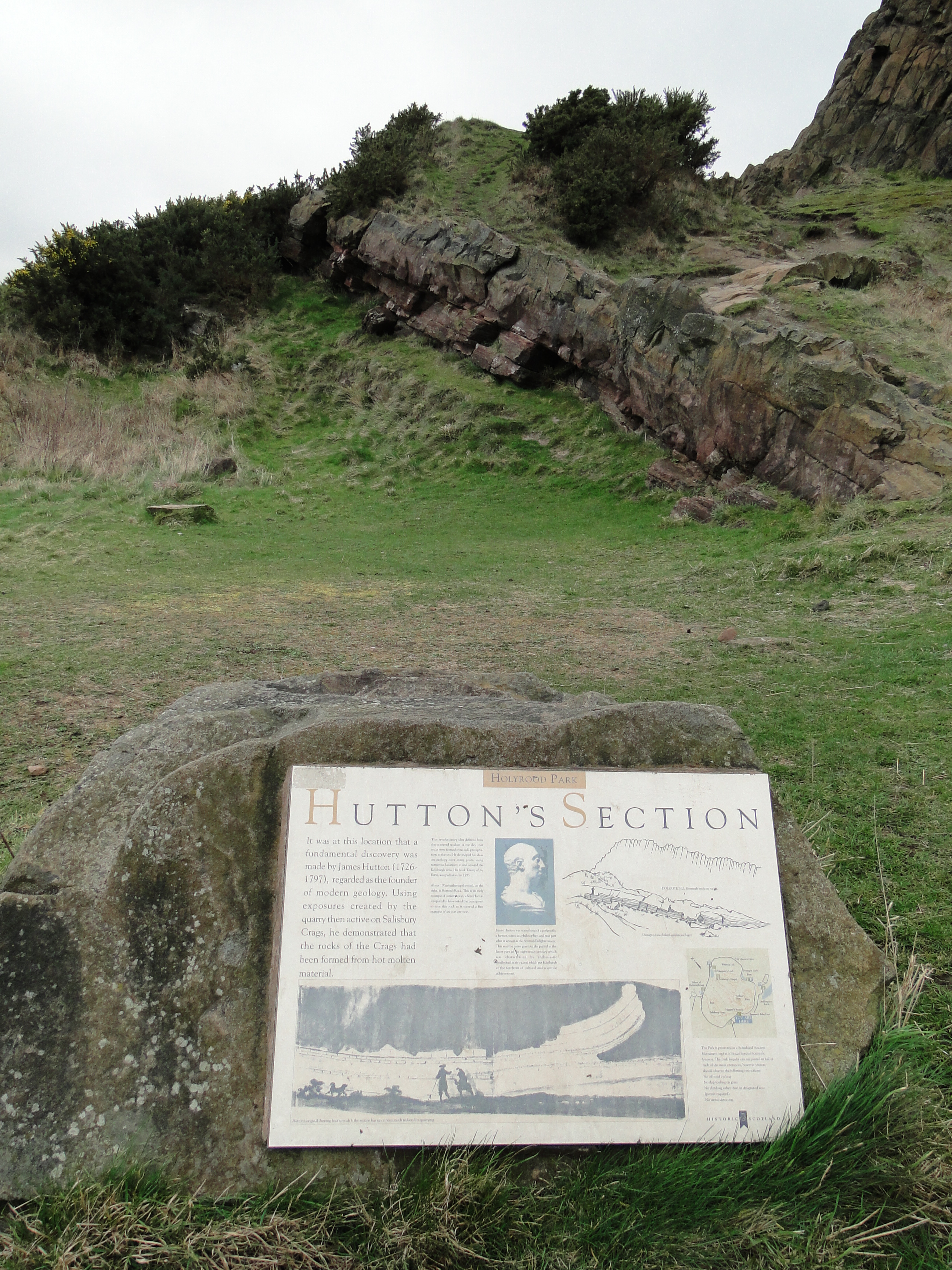
Hutton’s drawing on this informational plaque is just a LITTLE off scale…
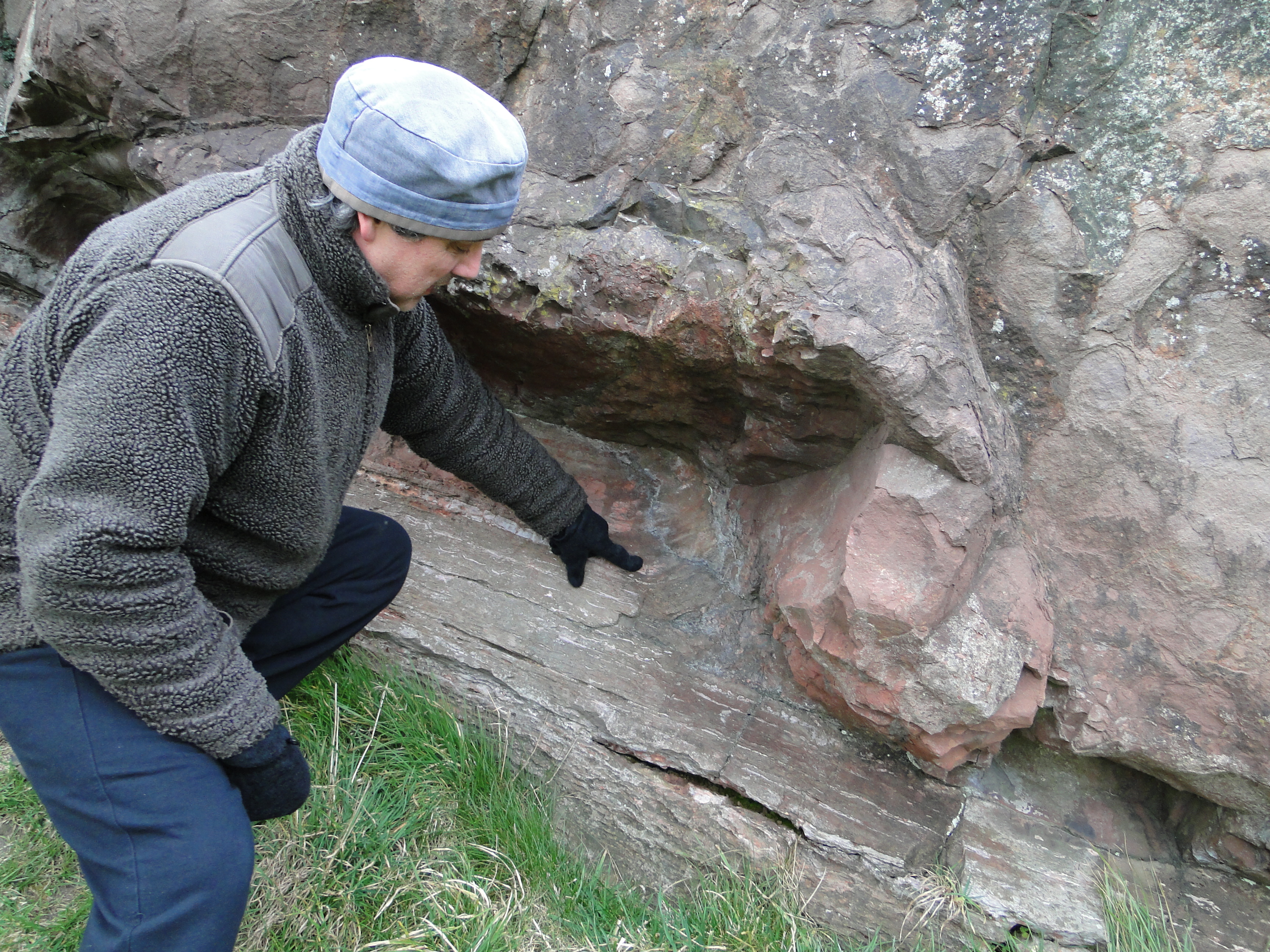
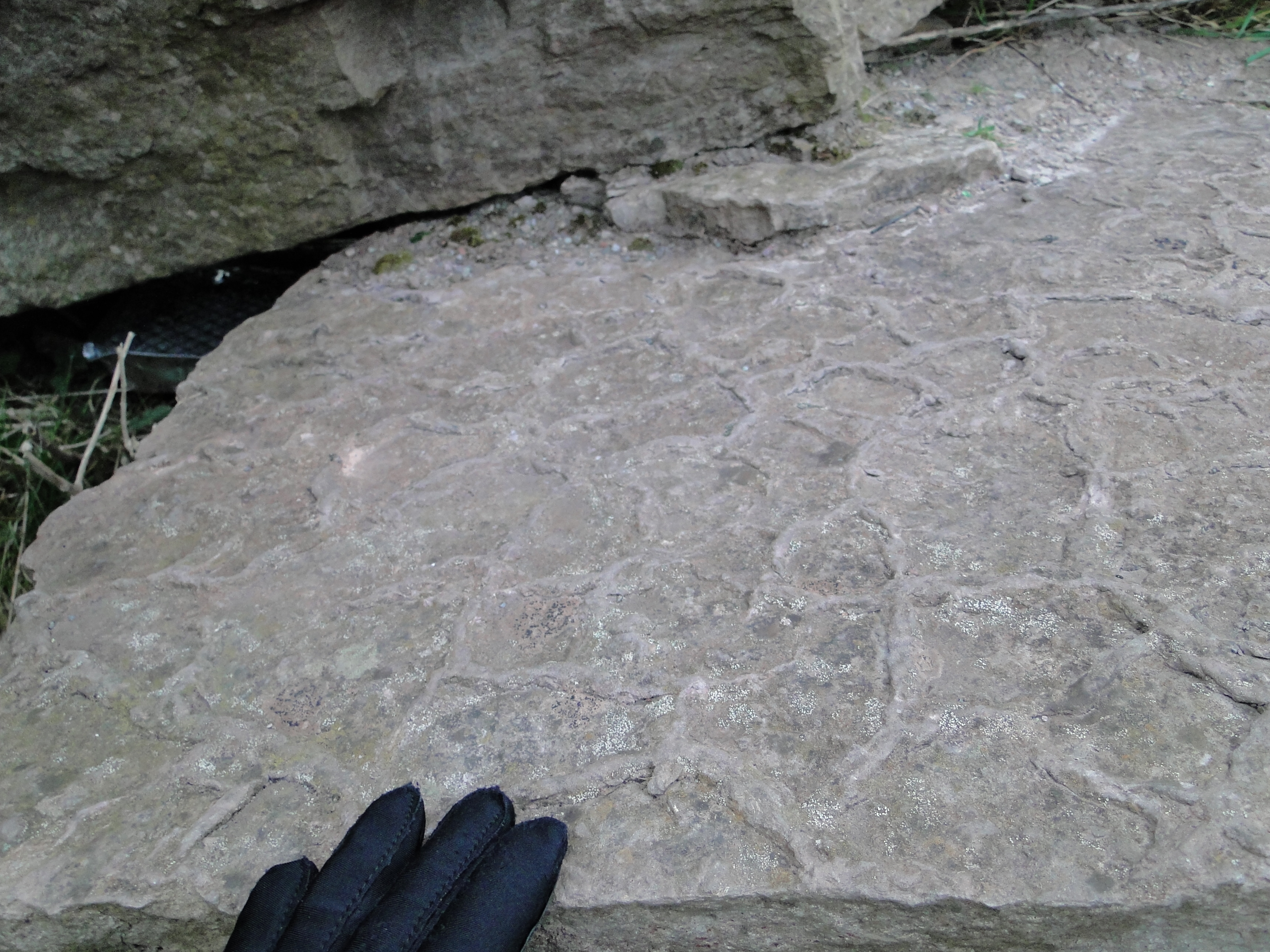
In 1788, James Hutton, an Edinburgh scientist and philosopher, published his Theory of the Earth, which suggests that present-day geologic processes operated the same way in the past and can be used to interpret what we see in the rock record. He based this and his other conclusions partly on observations he made at the small quarry above, located at the base of the Salisbury Crags (a dolerite sill). The sill that forms the crags intruded about 25 million years after the Arthur’s Seat volcano ceased erupting, disrupting the sandstone layers that underlie the area. At Hutton’s section, you can not only see where the sandstone layers were ripped up by the intrusion, you can also see some contact metamorphism where they were ‘baked’ by the hot basalt.
In discussing this section, Hutton said that
“We know that the land is raised by a power which has for its principle subterraneous heat, but how that land is preserved in its elevated station, is a subject which we have not even the means to form a conjecture.”
He suggested that molten rock under pressure could intrude across or between sedimentary layers and sometimes reach the surface as lava flows, a conjecture that’s played out in both the Salisbury Crags and in the Arthur’s Seat volcano, whose feeder dikes intrude the same sandstones.
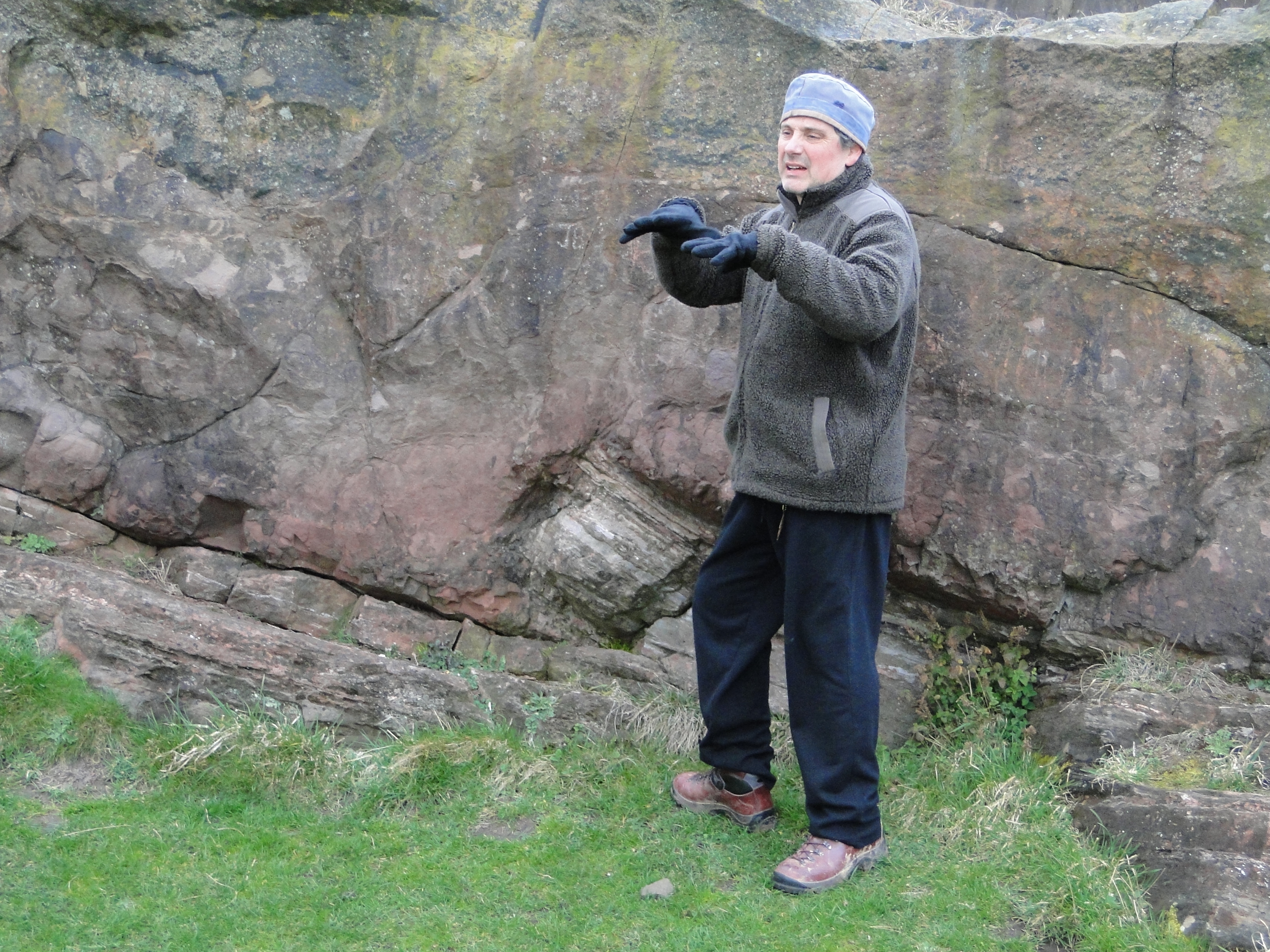
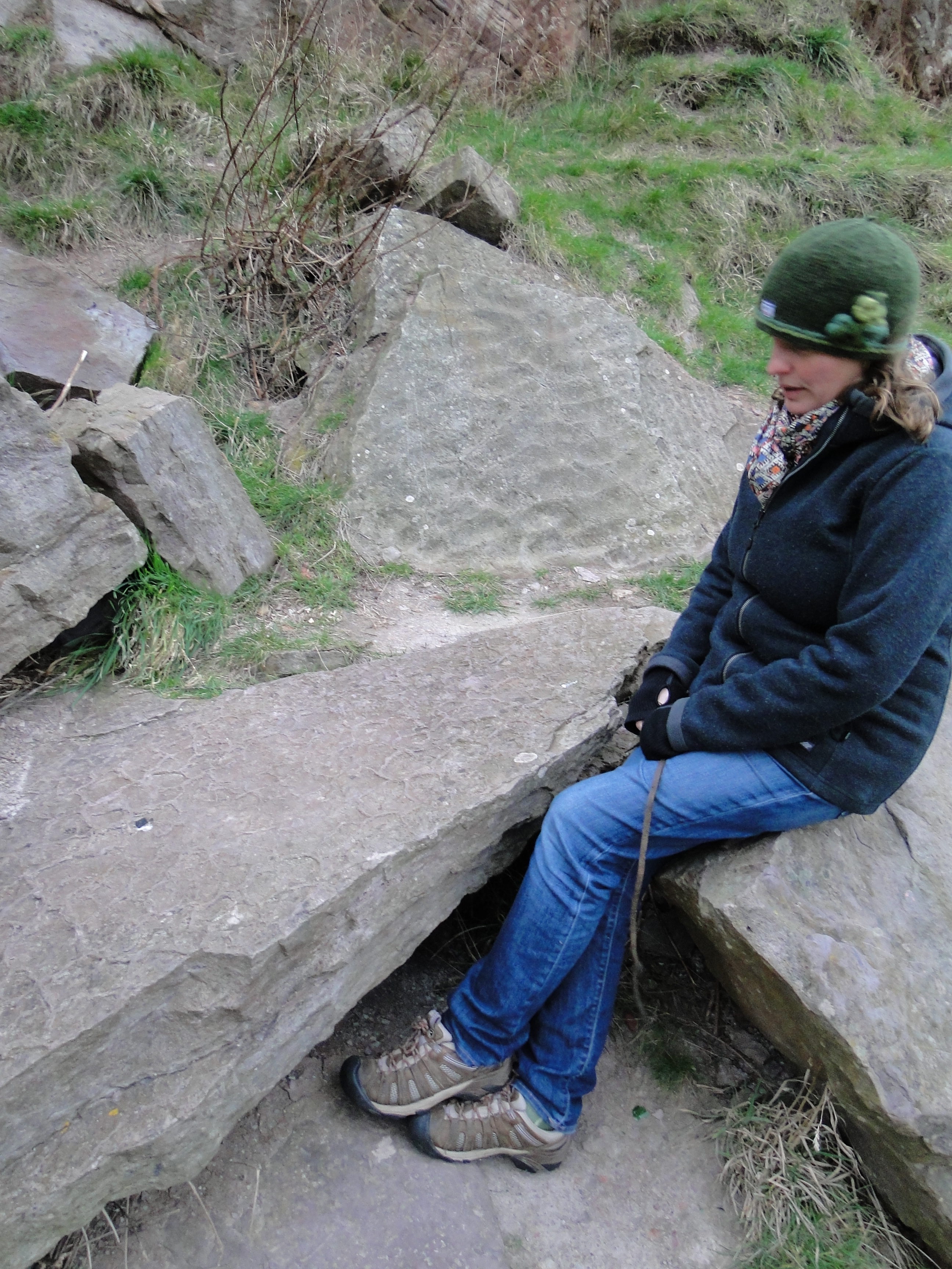
Dr. Caco explaining Hutton’s reasoning
The ripped-up bit is very dramatic for a geologist, although considerably smaller in scale than the illustration found on the informational plaque, which is an etching by John Clerk of Eldin for the book:
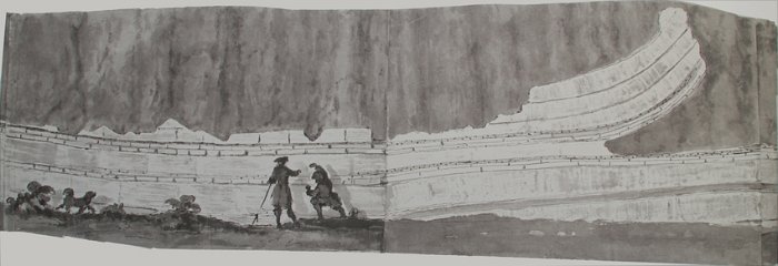
Scale is very important! Don’t let your professors catch you messing up a sketch like this.
And the real-life version:
The bent-up sandstone in question
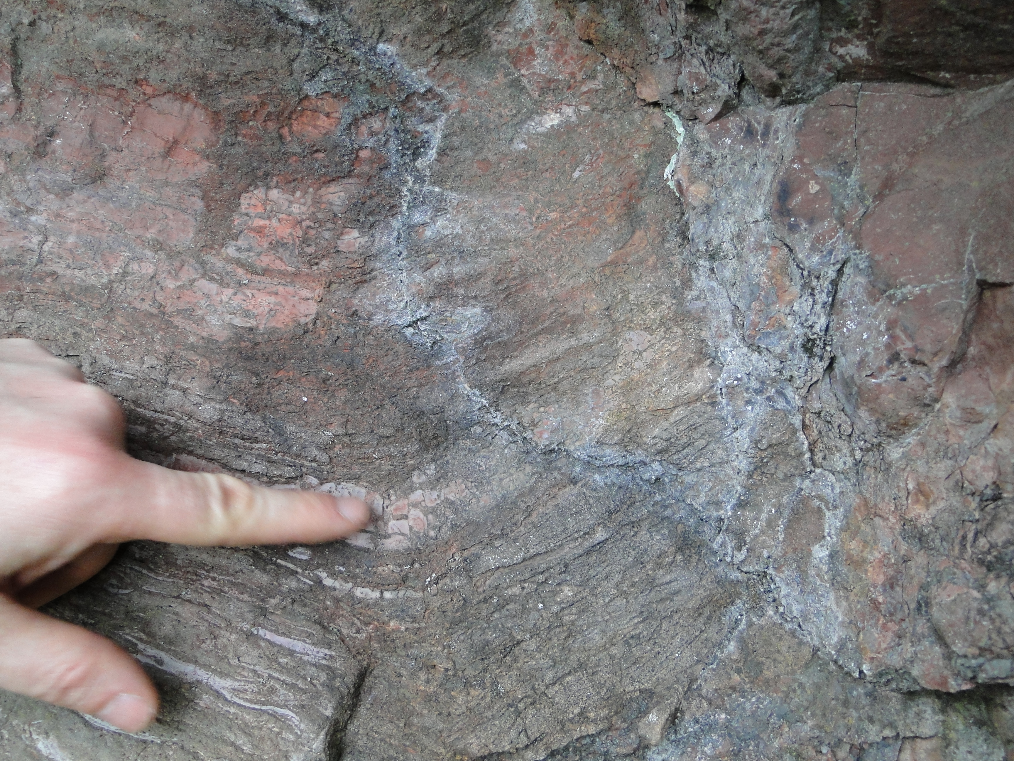
The contact between the dolerite and the sandstone
In addition to the amazing geology, the park is a wonderful place for views of Edinburgh and the surrounding area. One of the tourist guides bills it as a ‘little slice of the Highlands’, although I was assured I hadn’t had the true Highland experience until I’d been out hiking in the wind and rain. It was just windy that day, so I suppose I’ll have to go back to Scotland and get properly rained on.
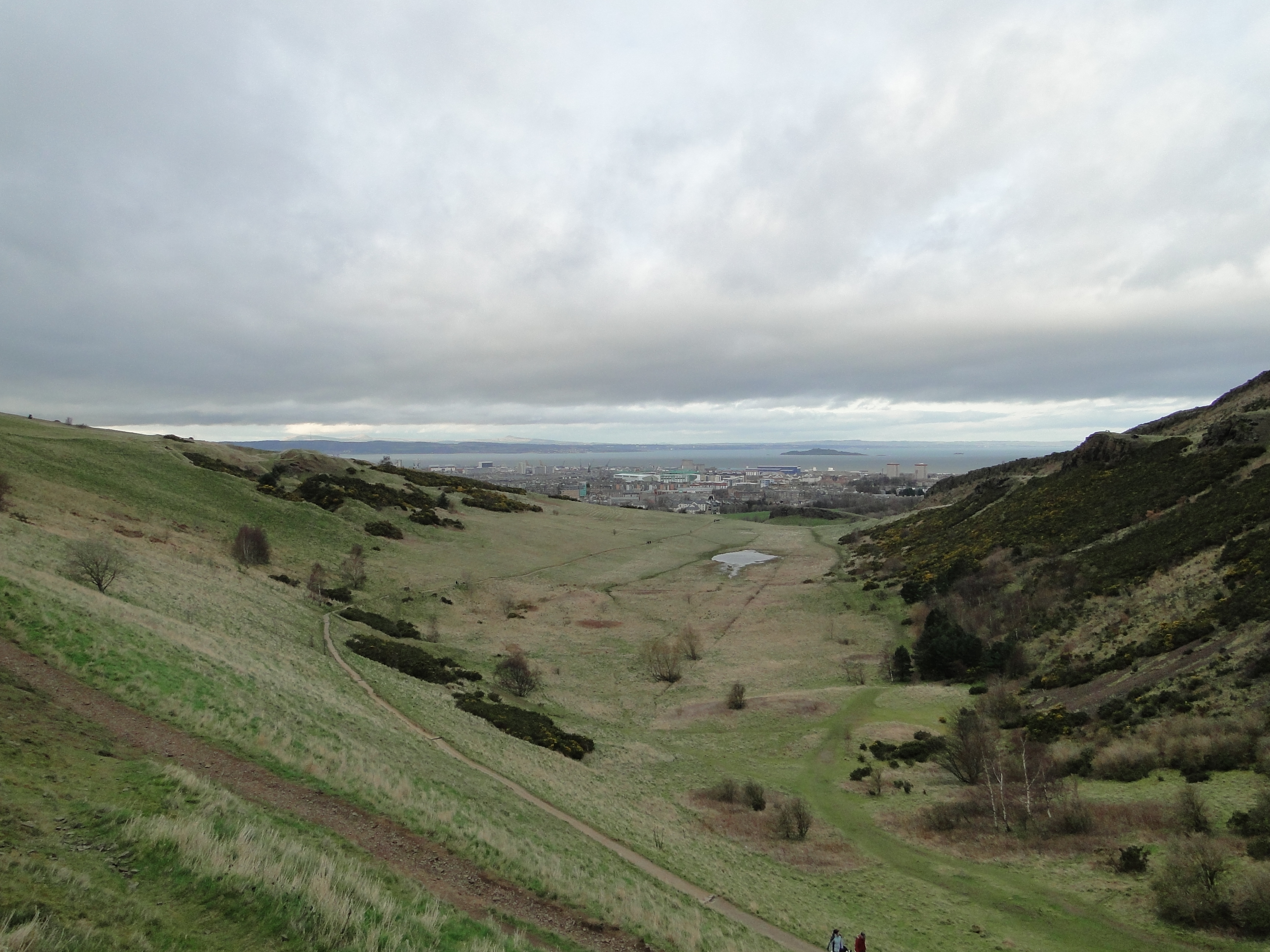
Looking north down the Hunter’s Bog at the Firth of Forth
The Salisbury Crags themselves are very impressive, although not the best choice for hiking when it’s especially windy.
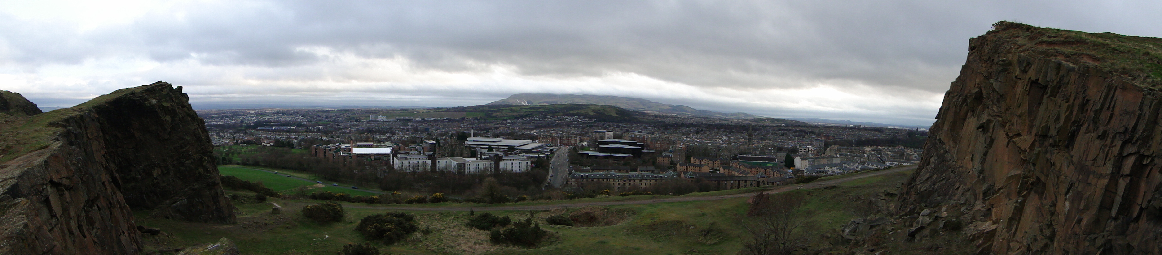
From the top of the Salisbury Crags overlooking a quarry (a panorama, so while there’s a bit of an alcove here, it’s a lot straighter than it appears.
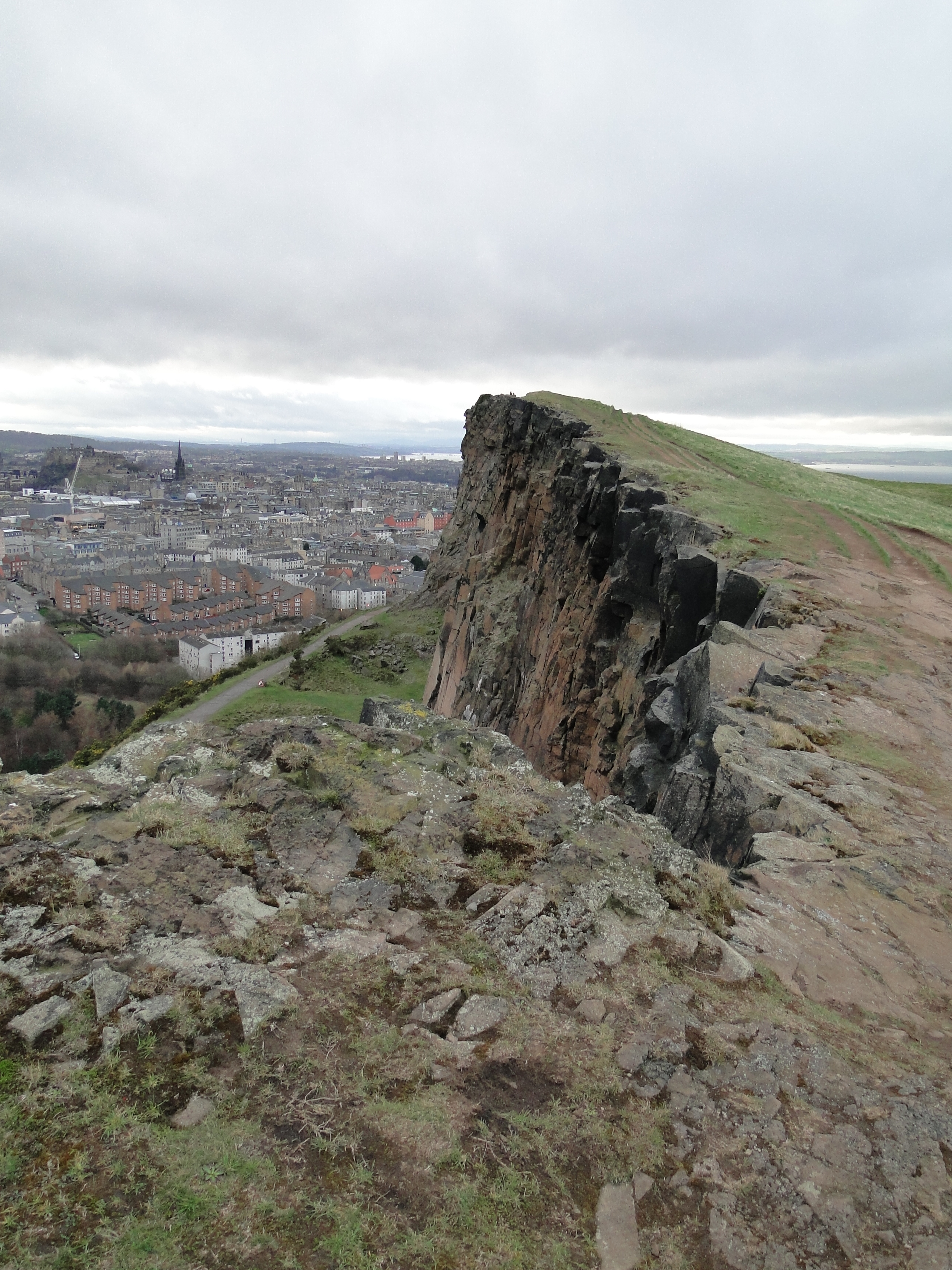
The edge of the crags
Despite being covered in vegetation (including gorse, a deceptively evil bush that you should never, ever try to walk through), Arthur’s Seat has a lot of features that are easy to pick out from a distance. The lava flows that would have made up the early flanks of the eroded volcanic edifice are very clear, for example.
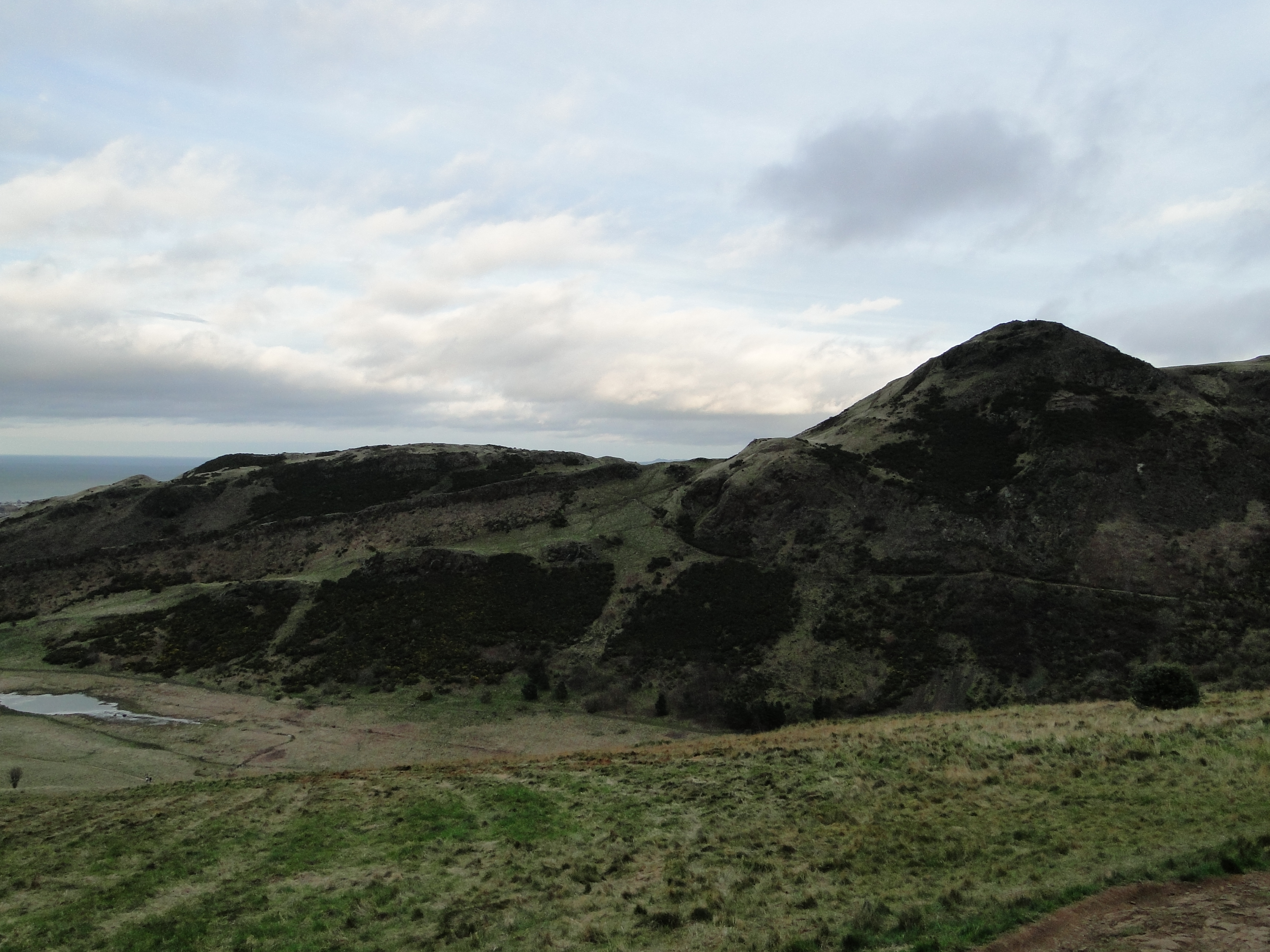
Tilted lava flows on the north flank of the volcano
The Edinburgh Geological Society has a great brochure with geologic and schematic maps of the area, which I’ve used to annotate this panorama and point out some of the lava flows and intrusions. (The British Geological Survey also has a 3D cut-out model of the volcano . I think I need this among the ‘deskcrops’ in my office, it’s so cute.)
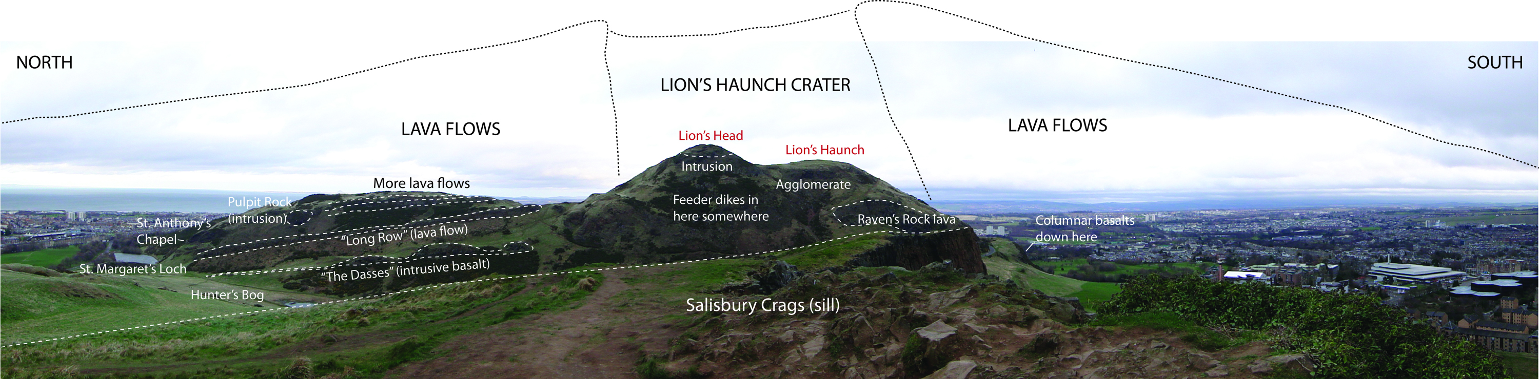
Here’s what the volcano might have looked like (with a few features labeled, courtesy of the Edinburgh Geological Society’s “Discovering Edinburgh’s Volcano” brochure (link). Click to make everything readable!
It’s not a geologic field trip if you don’t stop in places with impressive views to do some arm-waving! My advisor and her husband have some plans in the works to take advantage of the fact that there’s a volcano practically in their backyard that hasn’t had a great deal of physical volcanology study done on it.
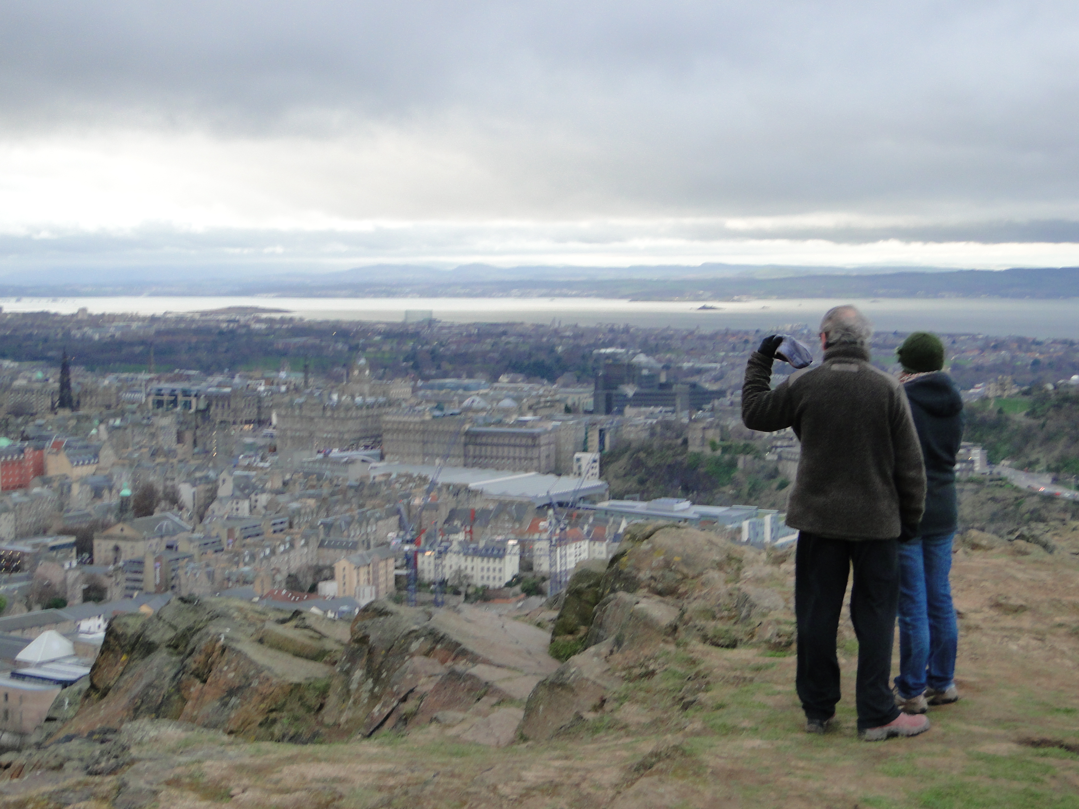
Looking out over Edinburgh (with appropriate weather)
And being that Edinburgh is the home of many of geology’s pioneers, it kind of makes a nice circle that I had a chance to visit them there.
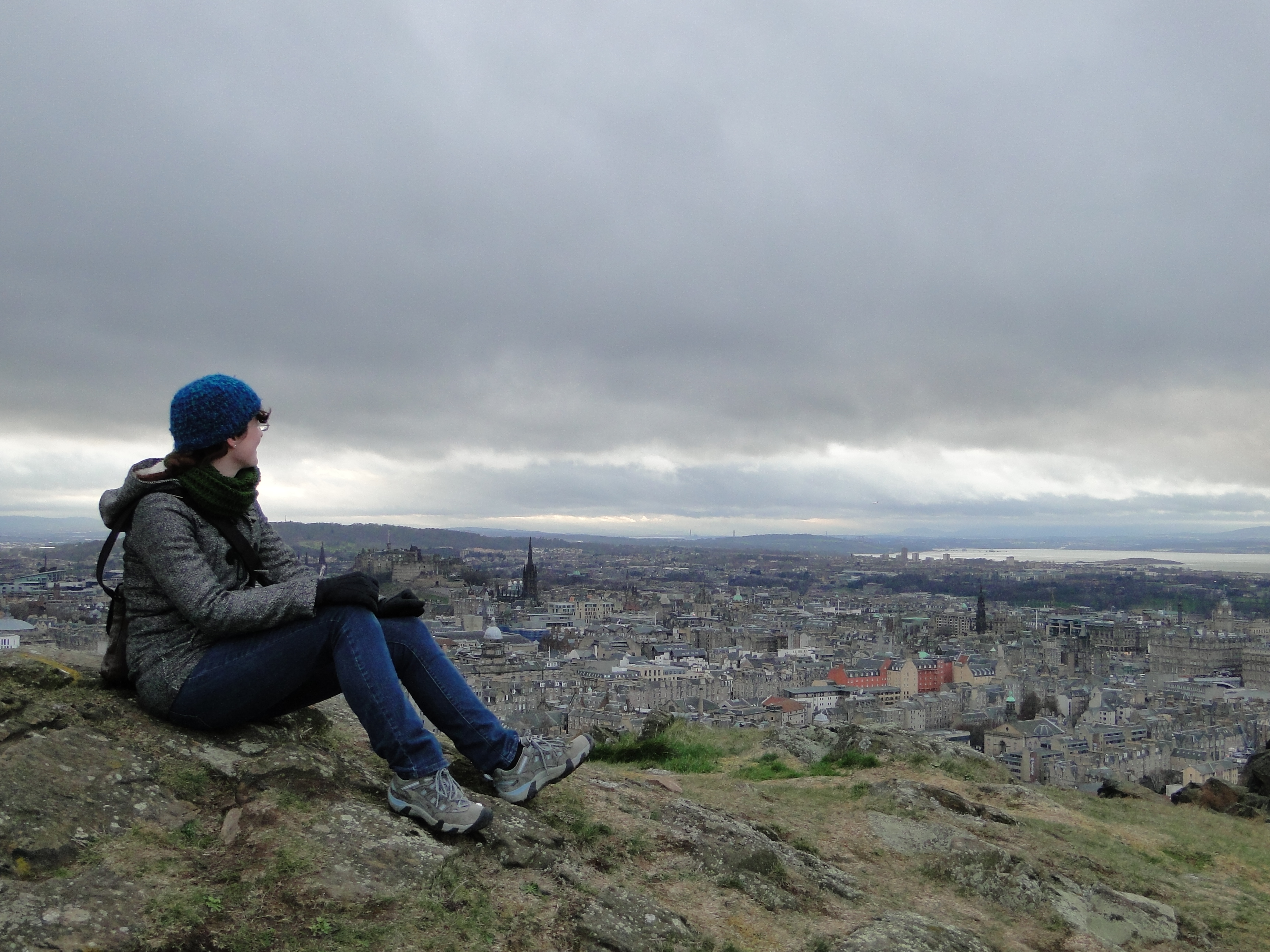
The wind got so bad I had to sit for this…
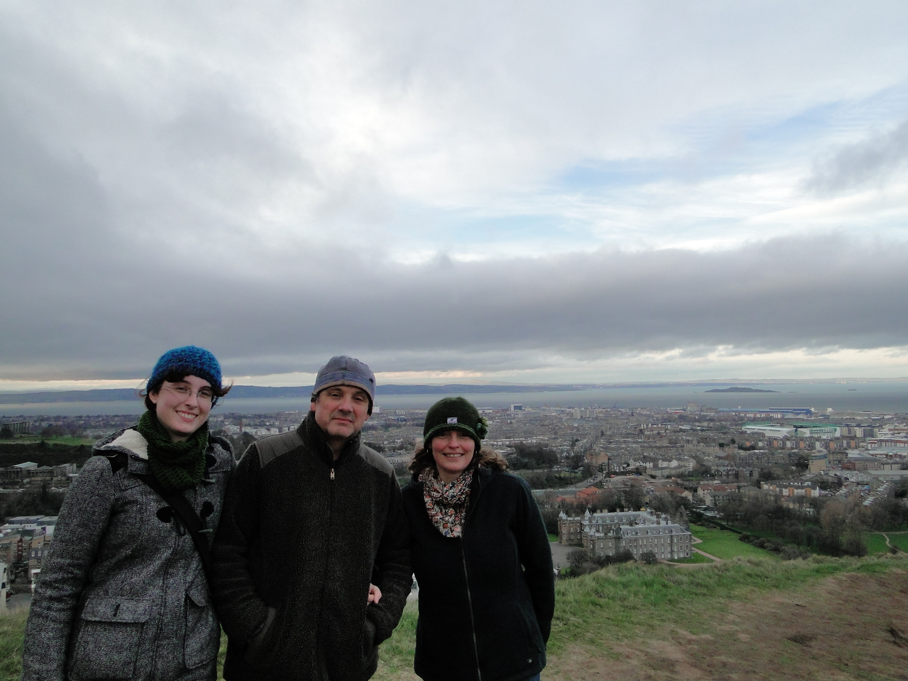
Three doctors!
After getting our fill of the volcanic features, we made a special stop at the Camstone Quarry to look at the other rock type in abundance, and check out some beautiful sedimentary features.
My advisor amid the sandstone
This is a great location to remind you that the Arthur’s Seat volcano formed on a continental margin where coastal processes were still going on. There are lovely ripple marks and some fantastic ‘mud’ cracks in the sandstones here.
Who would have expected such great mud cracks at a volcano?
On the non-geologic side of things, my advisor showed me the gorse bushes growing on the volcano’s slopes. Gorse looks very lush and pretty and even has beautiful yellow flowers that smell like coconut, but it is the nastiest, prickliest bush you could possibly imagine. I couldn’t even hold onto a branch to get close to the flowers, it was so spiky.
Looking south at the volcano, with lots of gorse.
Holyrood Park also has features for the archaeologist; this is St. Anthony’s Chapel, built in 1450 as a hermitage (a kind of isolated religious retreat). It’s supposed to be mostly made of basalt from the surrounding environs, and stands on one of the older lava flows in the sequence. It makes a lovely brooding ruin for photos.
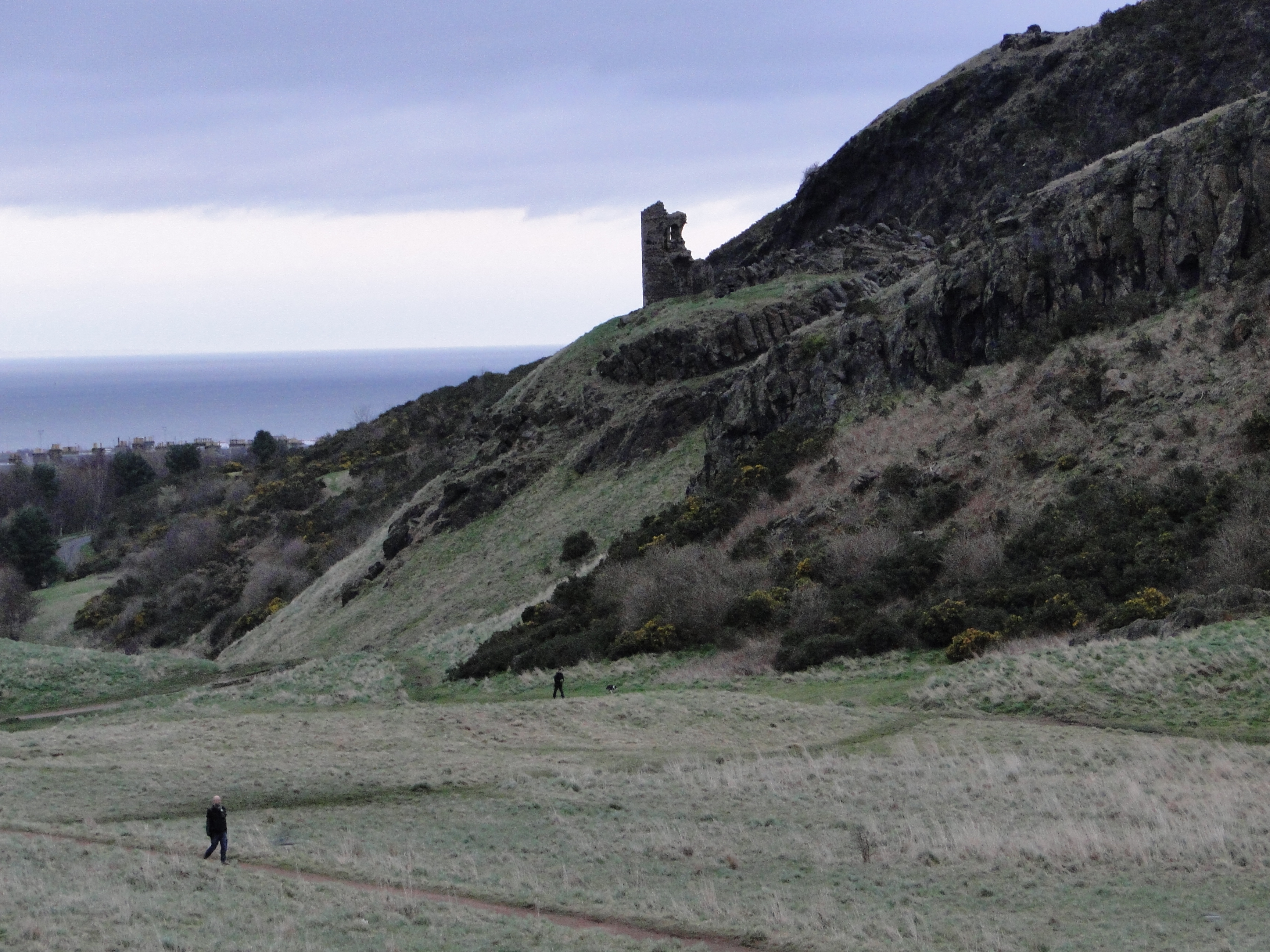
St. Anthony’s chapel
On the hike back, we got to see a couple of the native birds having a battle over something. The pheasant won, and the crow eventually gave up and flew off. (We may have helped it on its way a bit, since we all expressed our indignance over seeing the harassment of the national bird of Scotland [apparently not the national bird officially].)

The national bird of Scotland A feisty pheasant fending off a crow. (“Feisty Pheasants” would be an awesome name for a rock band…)
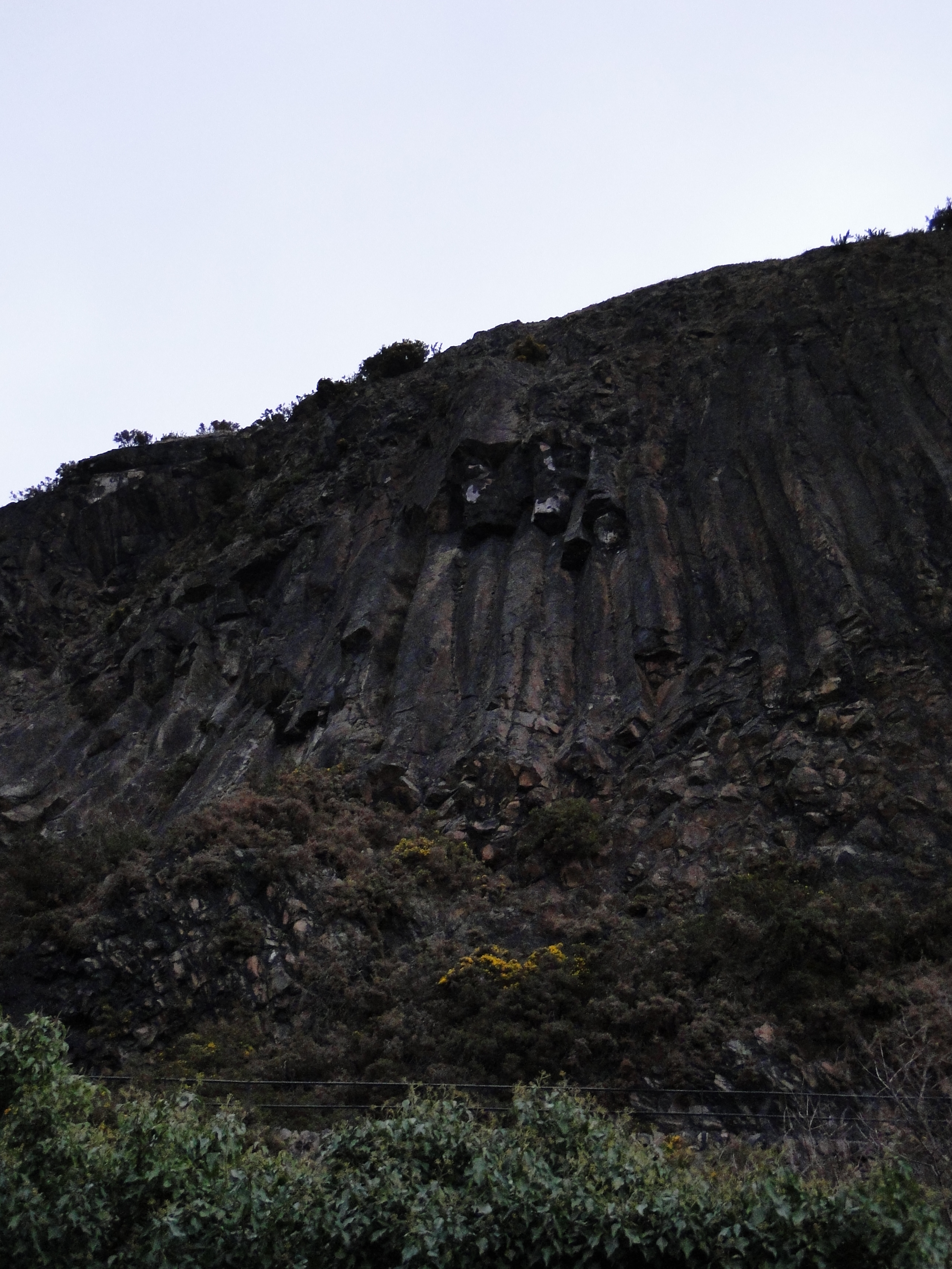
On the way out of the park, we stopped at the southern end of the volcano to look at Samson’s Ribs, a beautiful exposure of columnar-jointed basalt. The guide says that this was an intrusion on the edge of the crater-fill agglomerate in the Lion’s Haunch Crater; if so, this marks one of the crater margins.
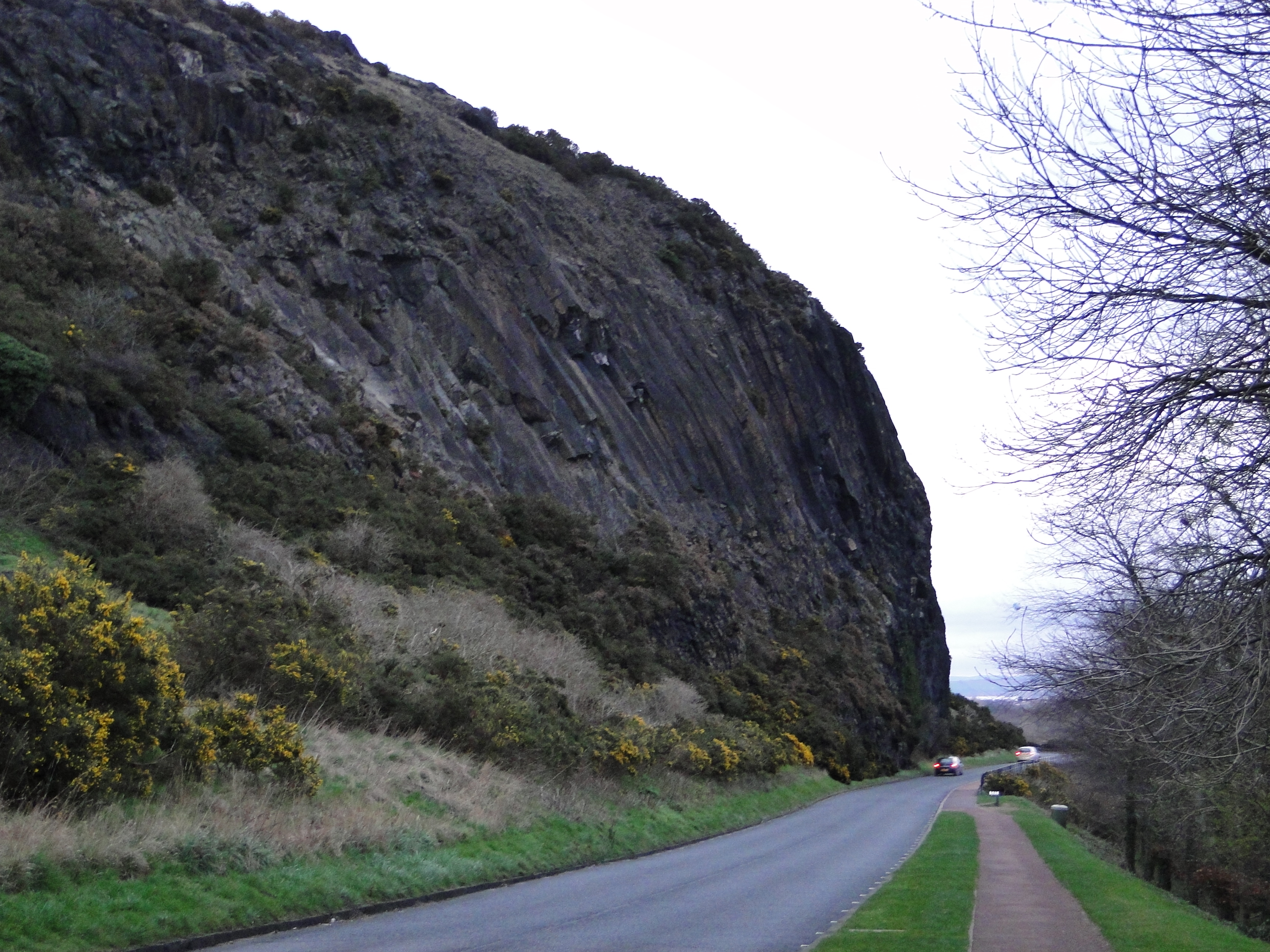
Columnar jointing on the flank of Arthur’s seat, with cars for scale.

A closer view

From the base of the cliff
More jointing, with gorse (the yellow-flowering bushes).
Columnar jointing is always a good way to end a field trip, in my opinion!
Next in the Edinburg series will be bits and bobs from my walks around town, and the field trip Dr. Caco and I took to Rosslyn Chapel (yes, that Rosslyn!)
 Jessica Ball is a volcanologist at the U.S. Geological Survey, researching volcanic hydrothermal systems and stability, and doing science communication for the California Volcano Observatory. She previously worked at the Geological Society of America's Washington DC Policy Office, learning about the intersection of Earth science and legislative affairs. Her Mendenhall postdoc and PhD focused on how water affects the stability of volcanoes, and involved both field investigations and numerical modeling applications. Her blogging covers a range of topics, from her experiences in academic geosciences to science outreach and communication to her field and lab work in volcanology.
Wonderful tour! Your pictures brought back memories of my one and only visit back in 2001. I was able to climb Arthur’s Seat and look down on a “garden party” hosted by the queen (7,000 in attendance). Of all the stereotypes of visiting Scotland: all the men were wearing kilts that day! It was a great hike, and you got some great pictures.
Given that the site in question was a quarry, I wonder if the artist did, in fact, mess with the scale, or if there really was a rip-up that big on the day he was there sketching, and that part has long since been removed. I know that the quarry workers left a chunk of important outcrop behind at Hutton’s request, but much of the rest of the cliff had its face moved backwards a number of meters…
I have to wonder. I suppose it’s possible that the bit of the quarry that extended ‘forward’ from the outcrop could have had a bigger version of the feature, but in the actual outcrop both the underlying sandstone layers and the overlying sill are preserved at a scale that so much smaller than the illustration that I have trouble believing there could have been that much of a size disparity, especially within just a few meters. I expect the artist got a little carried away with exaggerating the section for the engraving, although Hutton should have said something about the scale before it got published 🙂
It looks like there are some nice ripple marks in the sandstone just above center in the picture of your adviser amid the sandstone.
I love A|rthur’s Seat and it’s totally fascinating from a geological point of view.
Pheasants aren’t native to Scotland btw…. we’ve got the grouse (4 species)
Noted and edited!
http://www.geological-assessments.com/Erie_County__NY_Geology.html
Enjoy the recent NASA photo of the Mt. Sheveluch dome in GIS stuck in the middle of this website page.
[…] day I had sun, rain and a snow blizzard–all within an hour. I planned to hike to Arthur’s Crag. To get there I first had to battle blinding snow. I thought it better to see what the cafe […]
[…] Hutton’s Section in Detail […]
Please may I have your permission to use your photographs at https://blogs.agu.org/magmacumlaude/2014/04/06/edinburgh-arthurs-seat-and-salisbury-crags/ ?
I am transcribing my grandfather’s diaries so that my cousins can read them (terrible, small writing, many abbreviations). On 1893_03_05 Sun he wrote: . Out behind Salisbury Crags on Arthur’s Seat.
Diaries can be very monotonous and repetitive so it helps to have some photos the enliven them.
You have so many lovely photos, but I am not sure which would show “behind Salisbury Crags”. Could you help me out here, please?
My grandfather had more than a passing interest in geology as a young man, and my father was a geologist so I am enjoying reading the parts where you point out the differences in the rocks. Love the one about note being deceived about the depth of the layer of rock. Had to smile.
Hope you can help. thanks in advance
Veronica in Ontario, Canada