26 October 2012
October 25, 1902: Santa Maria Erupts!
Posted by Jessica Ball
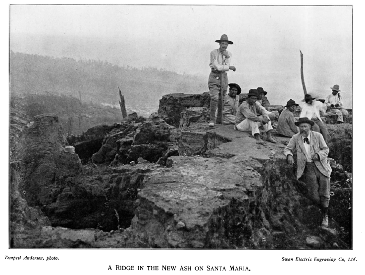
Today is the 110th anniversary of the second-largest eruption of the twentieth century – and if you don’t normally read this blog, it’s a good bet you’ve never heard of it. I’ve written about it before, but never on the date of the event! The culprit? Volcan Santa Maria in Guatemala. In October of 1902, following several months of significant earthquakes, Santa Maria experienced a VEI 6 Plinian eruption that completely devastated the countryside for miles around (much of it was, as it is now, covered with coffee plantations and small farms). The first accounts are all by Karl Sapper, a German scientist who visited the area immediately following the eruption, but as I don’t speak German it’s easier for me to pull from the account of Tempest Anderson, an opthalmic surgeon and amateur volcanologist who published an account of Guatemalan volcanoes in 1908. It begins in the evening of October 24, 1902:
Slight earthquakes were felt in the neighbourhood during the day, and about 5 p.m. a loud and increasing sound was heard…from the direction of the mountain. It was compared by some to the noise of a waterfall, by others to a gigantic boiler blowing off. The noise lasted half an hour. About this time dark clouds were noticed from Quezaltenango [a large city to the northwest] and elsewhere in the direction of the mountain. They were first ascribed to a thunderstorm. Towards evening a slight sprinkling of sand occurred at Qeuzaltenango, which soon covered the landscape with white. The wind changed from south to east, and ashes began to fall at Helvetia, a coffee plantation 6 miles to the south-west.
About 7 p.m. a glow began to appear, and lightning was noticed in the neighbourhood of the present crater, and roaring sounds were heard. About 8 p.m. the air had sufficiently cleared for an enormous black cloud to be visible to persons at a distance from the mountain. It was seamed with countless curved lines of red and green electric discharges; violent claps of thunder were noticed (but it is not mentioned at what distance they were best heard).
About 1 a.m., October 25, stones began to fall at Sabina, a bathing establishment at the foot of the mountain towards the south-east. At 3 p.m. pumice-stones fell abundantly in Helvetia. They measured 15-25 centimeters, and weighed 1/2 to 3/4 lb. They were first cold, then hot, and later were mixed with stones of heavier material as big as the fist. Lapilli the size of peas fell at Quezaltenango, 10 miles north-north-east. The eruption increased in violence, and the whole district was enveloped in darkness. The maximum intensity was reached at about 11 a.m. on Sunday the 25th, though it remained severe till nightfall. It was not until midday on the 26th that the air began to clear a little and the light to return. The eruption continued with varying severity for most of the week. Towards the end of the eruption…outbursts of whitish steam began to preponderate over the dark ash-laden clouds….
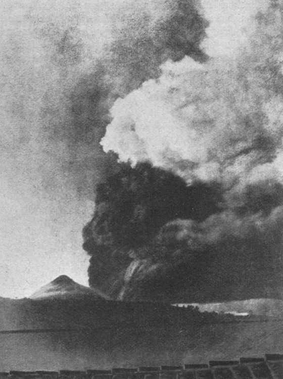
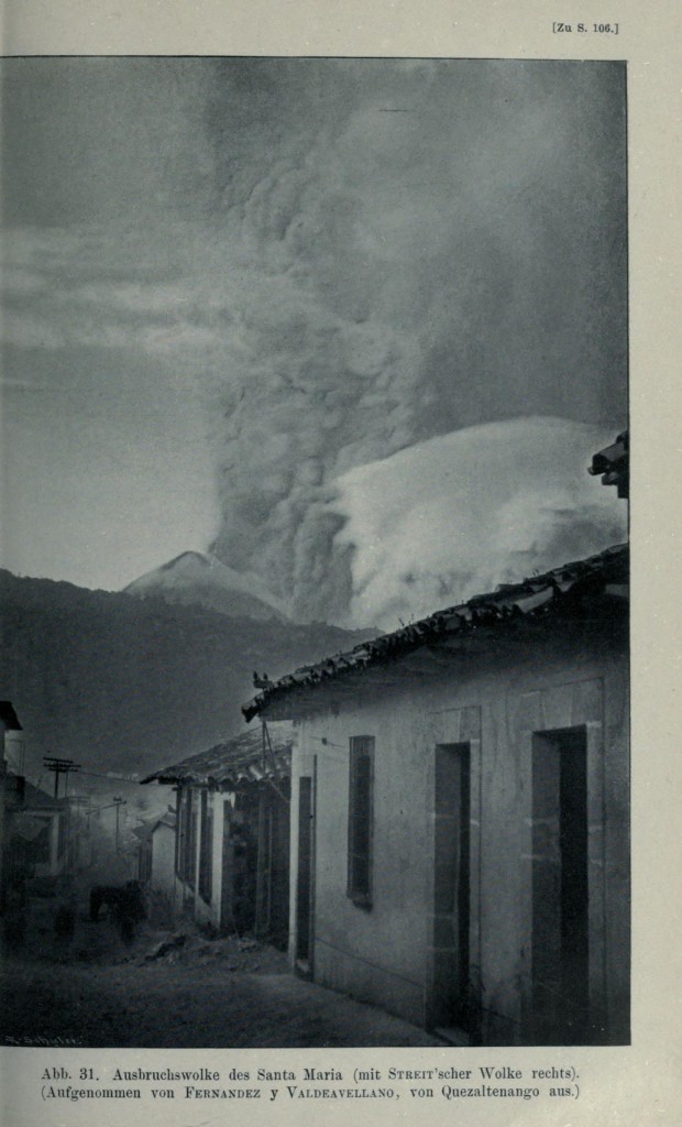
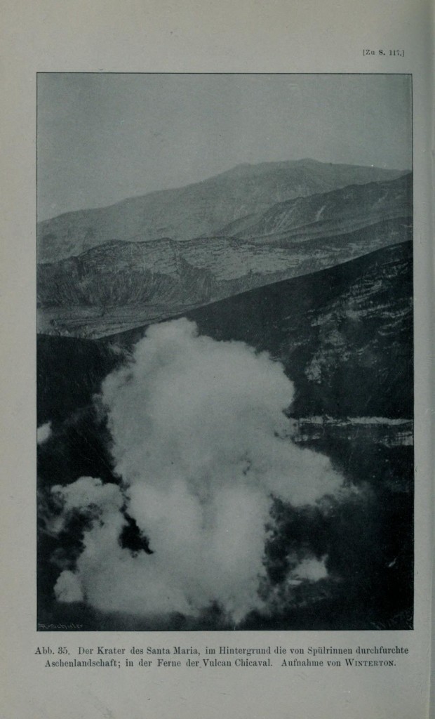
White and black eruption plumes (the former probably containing greater amounts of water vapor and less ash and lithics than the latter.) Probably from Sapper (1903 or 1905)
When all was clear again, it was seen that an entirely new crater had been formed at the base of the mountain, and that the whole surrounding country was devastated and deeply covered in ashes.
This crater is oval in form, with the long diameter parallel to the coast…and measures from 3/4 to 7/8 of a mile. The shorter diameter is not very much less, probably from 1/2 to 5/8 of a mile. The whole side of the mountain was blown away, exposing a section of several thousand feet in height, in which dip of the strata…is very evident. Owing to the dip being with the slope, landslides almost constantly take place, and are gradually filling up the crater, thought the latter is still apparently from 1000 to 1500 feet in depth.
It has a lake at the bottom and two very active fumaroles, or perhaps rather hot springs, from which steam and hot water escape with a violence almost worthy of the name geyser. These fumaroles issue from the foot of the cliff, at a point where traces of a great radial crack in the mountain are visible.
The eruption killed more than 5,000 people and destroyed most of the country’s coffee crop that year. The eruption column reached 28 km high, releasing more than 10 cubic km of material and blowing an 0.5 cubic km crater in the side of the volcano. Deposits from the eruption were more than 5 m thick in some places, and it’s still easy to see them in riverbeds and outcrops in the valleys below the volcano.
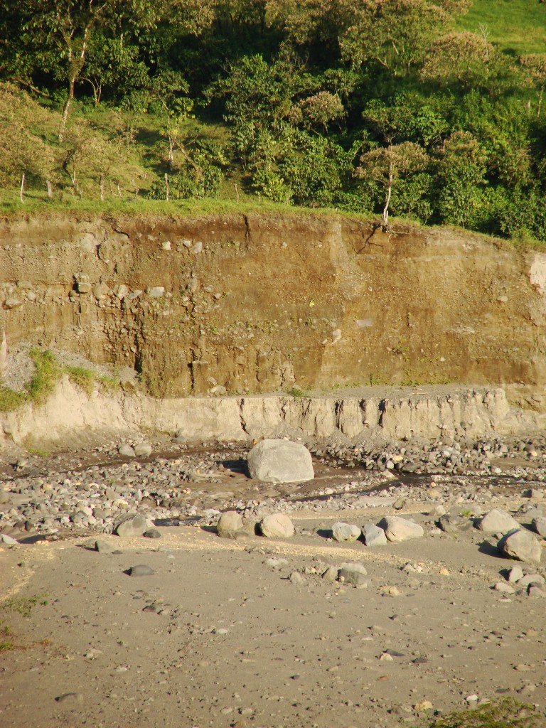
The light-colored 1902 eruption deposit at the base of a sequence of lahar and(?) block and ash flow deposits in the Tambor riverbed. (The largest boulder is approximately the height of a person.) Photo from February 2010.
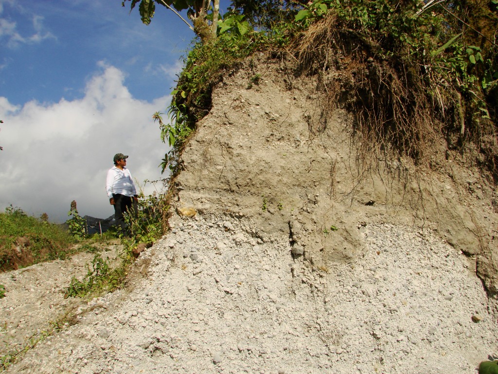
A close-up of the eruption deposit in a quarry. Volcanologist in the background is out-of-scale with the outcrop, the visible portion of which is about 1 m thick. Photo from February 2010.
The crater lake eventually drained away or boiled off, and activity settled to a lull until 1922, when the Santiaguito lava dome began forming in the 1902 crater (I’ve written a bit about this elsewhere). The 1902 eruption was second only to the Alaskan eruption at Novarupta in 1912, and occurred in a banner year for volcanoes (the devastating eruption of Mount Pelee on the West Indies island of Martinique occurred in April and May of 1902). Interestingly, it is often overlooked, perhaps because there weren’t many Westerners in that part of Central America at the time. I’ve come across quite a bit of information in the course of doing my research on the Santiaguito domes, and it’s a fascinating look at the early years of volcanology.
References:
Anderson, T., 1908, The Volcanoes of Guatemala. The Geographical Journal, v. 31, n. 5, p. 473-485
Sapper, K., 1903, Der ausbruch des vulkans Santa María en Guatemala, Centralblatt f. Mineral., Geol., und Palaont, p. 33-44.
Sapper, K., 1905, In den vulcangebieten Mittelamerikas und Westindiens: Reiseschilderungen und studien über die vulcanausbrüche der jahre 1902 bis 1903, ihre geologischen wirtschaftlichen und socialen folgen. E. Schweizerbartsche verlagsbuchhandlung (E. Nägele), 334 p.





 Jessica Ball is a volcanologist at the U.S. Geological Survey, researching volcanic hydrothermal systems and stability, and doing science communication for the California Volcano Observatory. She previously worked at the Geological Society of America's Washington DC Policy Office, learning about the intersection of Earth science and legislative affairs. Her Mendenhall postdoc and PhD focused on how water affects the stability of volcanoes, and involved both field investigations and numerical modeling applications. Her blogging covers a range of topics, from her experiences in academic geosciences to science outreach and communication to her field and lab work in volcanology.
Very interesting post. That must have been quite the nightmare for those who lived close to the volcano! I wonder if this eruption would have happened today, could it have been forecasted?
That’s an interesting thought! If we had the monitoring capabilities in place that could let us know the source of some of that pre-eruption seismicity, and maybe something to measure changes in edifice shape, maybe we’d have a shot (I’m imagining a St. Helens scenario, although there’s no telling if anyone near the volcano noticed anything like the St. Helens flank deformation before the 1902 eruption).
I had never seen photos of this eruption before, thanks for digging these up!
[…] that nestle in the crater formed by the explosive destruction of Santa Maria volcano, Guatemala, in 1902, in one of the largest eruptions of the last century. View of the lava domes of Santiaguito volcano, […]
I was delighted to find this post. I work with the Quetzaltrekkers in Quetzaltenango (Xela) and we climb Santa Maria on a regular basis, raising close to $200,000 annually for EDELAC, a school for K-5 and an orphanage for 35 kids up to 17 years old.
I have climbed Santa Maria about 80 times myself (I keep a permanent apartment in Xela, and spend a few months there each year).
It isn’t on our tourist schedule, but the (volunteer) guides all like to make at least one trip into the Santiaguito complex itself. I have done so one time, but didn’t take the plunge into the active crater.
Here is a video of someone who did … https://youtu.be/OfNvyN9shs8 (you may be interested in the comment from Ricardo Lopez).
Once again – thanks!
[…] White and black plumes. Probably from Sapper (1903 or 1905). https://blogs.agu.org/magmacumlaude/2012/10/26/october-24-1902-santa-maria-erupts/ […]
Very interesting post. You should check on recent news. We had a similar event a couple of weeks ago in Guatemala…
Fascinating post. I have a first hand account written by my great grandfather Arthur Gehrke who reached Finca Helvetia a few days after the eruption.
Thats nice ur smart jessica 🙂
can you make me a timeline in the matter of about 13 minutes for my biology class about the stuff that it affected and occured after and during the eruption. I am not an intellect i am only a peasant in the biology world.
this is a great source. It probably was scary!