22 July 2013
Landslides and liquefaction from the Cook Straits earthquake yesterday
Posted by Dave Petley
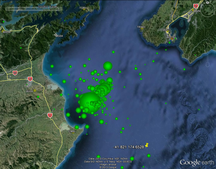
Since Friday the Cook Strait in New Zealand has been experiencing a series of moderate but shallow earthquakes. The map below, from Geonet, shows the locations of the various events:
..
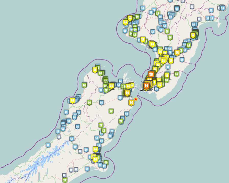
The largest event, which occurred at 5:09 pm yesterday (Sunday), was a magnitude 6.5 earthquake at a depth of 13 km. This generated a large number of felt reports across central New Zealand and beyond on the Geonet website:
..
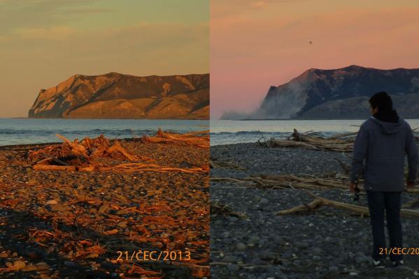
Of course the large number of felt reports in the southern part of North Island reflects the presence of the City of Wellington, which is located on a major fault system and is considered to be vulnerable to a large earthquake event. Fortunately, this was a small earthquake, and it was some distance away, but nonetheless the city suffered some damage. There is a good gallery of images on the stuff.co.nz website, some of which show damage from landslides and liquefaction failures. Probably the best of these is this pair of images taken by French tourist Luca Zappula of the White Bluffs from the Wairau Bar. The left image was taken just before the earthquake, the right just after. The dust indicates a slope failure has occurred:
..
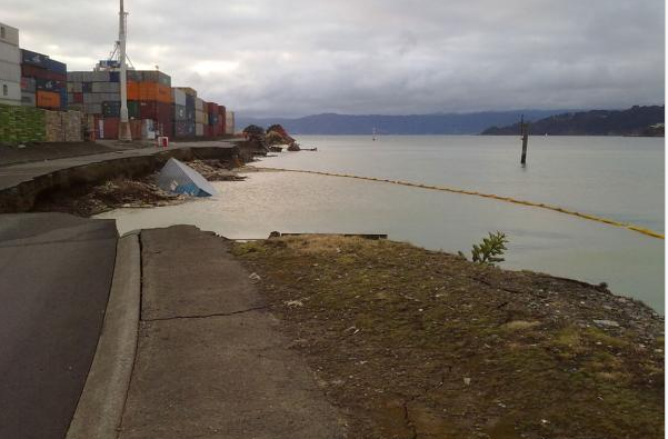
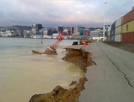
There also seems to have been some damage from liquefaction failures of the harbour area, as these images from Mike Pryce show.
..
Meanwhile the M=6.6 earthquake in Minxian and Zhangxian counties in Gansi Province this morning occurred in terrain that is landslide prone. Earthquake-reports is currently indicating 56 deaths, 14 missing and over 400 injured. Given that this earthquake has occurred in the rainy season it would be unsurprising to find that landslides have been a problem here, but at the moment even Xinhua has little information.


 Dave Petley is the Vice-Chancellor of the University of Hull in the United Kingdom. His blog provides commentary and analysis of landslide events occurring worldwide, including the landslides themselves, latest research, and conferences and meetings.