7 February 2022
An unusual embankment failure near to Northampton
Posted by Dave Petley
An unusual embankment failure near to Northampton
In the late autumn of in 2021 I was driving south from Sheffield to visit my daughter near to London in the UK. I was on the M1 motorway close to the town of Northampton, in heavy traffic, when I fleetingly spotted what appeared to be surprisingly large, very new landslide in an embankment. The location was very close to junction 15A; the landslide was in a newly constructed, steep berm around a new warehouse site.
Of course, it wasn’t possible to stop to take a look, so my view of the site was very brief. I drove the same road this weekend – the failure has now been excavated.
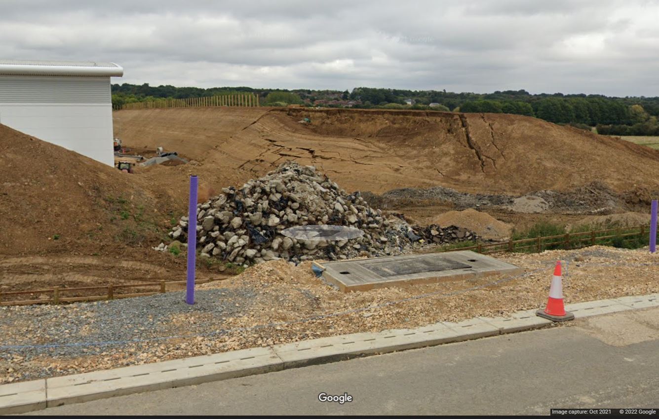
However, interestingly, the landslide has been captured on Google Street view, from several perspectives. This image was collected in October 2021:-

The embankment failure near to Northampton. Image from Google StreetView.
.
The location is 52.207, -0.933. The most recent Google Earth image shows the embankment under construction in September 2021.
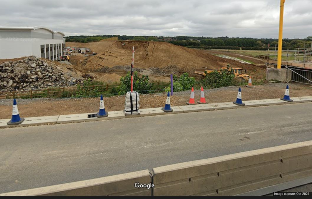
This is an alternative view from a few metres further along the road:-

Another view of the embankment failure near to Northampton. Image from Google StreetView.
.
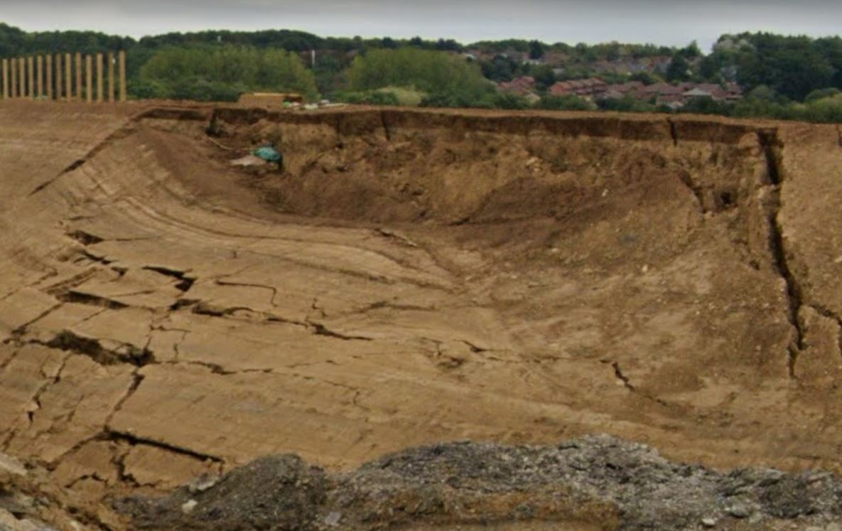
This appears to be a rotational failure / slump in the embankment. The mechanisms of failure are quite complex, with considerable plastic deformation on the margins of the failed block:-

Detailed view of the embankment failure near to Northampton. Image from Google StreetView.
.
Unsurprisingly, there is nothing online about this landslide. I’m quite intrigued by two aspects of it though. First, what caused this section of the embankment to fail whilst the remainder of the embankment remains intact? Was it built to a different specification (for example different materials or drainage), or using a different method, or is there something about the ground conditions that meant that it was susceptible to failure?
And second, the remaining embankment is remarkably steep and high. How confident can the designers be that a similar failure won’t happen at another location on this embankment?


 Dave Petley is the Vice-Chancellor of the University of Hull in the United Kingdom. His blog provides commentary and analysis of landslide events occurring worldwide, including the landslides themselves, latest research, and conferences and meetings.
Dave,
I also saw it and thought the same – I can send you another picture from the motorway (I was a passenger) if you want.
Thanks Dave for that,
Interesting failure and a large one too. (Thanks for using decimal Lat Long too.)
I couldn’t see anything on GE that might help. Going back quite a long time now when there was a spate of M way cuttings, I got the impression that in some terrains, the engineers would just leave the slopes, let them fail wherever they occurred (as there was no means of predicting) and then tidy them up with suitable drains.
But there again, when we were looking at the till/Lias slopes in Antrim, we instrumented a flowslide area. And then the next event was not there but where there was no eviudent history/indication of a failure. Pore water moves in mysterious ways.
Interesting how well it shows that the left side of the slump flowed towards the building and low point, and folded under the sheath of grey rock put around the base as an apron. Not sure what that was supposed to do.. prevent toe failure I suppose It looks as if the interior of the slope was composed of amorphous gelatinous clay or easily dissolved gypsum. the materials were readily fluidizes under pore pressure it appears… Does not look promising for the rest of the slope depending on if the fill came from all the same sources. Thanks for sharing. Could they have some fill loads of susceptible weak fill. Here is would be weather volcanic tuff or pumice but what would it be at North Hampton..all I could think of was Gypsum or chalk.
I tuned out when I saw the word plastic