13 June 2023
First satellite imagery and seismic data from the 11 June 2023 Flüchthorn rock avalanche
Posted by Dave Petley
First satellite imagery and seismic data from the 11 June 2023 Flüchthorn rock avalanche
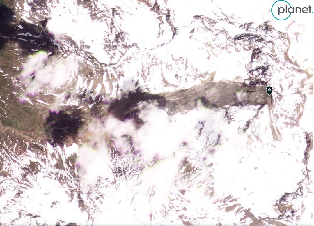
Scientific data is now starting to emerge about the 11 June 2023 Flüchthorn rock avalanche in Austria. Planet has captured a satellite image of the site, although it is partially cloudy:-

PlanetScope image dated 12 June 2023 showing the 11 June 2023 Flüchthorn rock avalanche in Austria. Image copyright Planet, used with permission.
.
Better imagery will emerge in the coming days.
There is an interesting interview with the chief geologist of the Tyrol, Thoms Figl, online in German. He notes that:
“[He] sees disappearing permafrost as a possible trigger for the massive landslide – for which climate change is said to be responsible. That would not be a good sign for the future, because the ice is urgently needed as ‘glue’.”
The landslide is estimated to have a volume of at least 100,000 cubic metres, but this will be refined using both photogrammetry and inversion of the seismic data in due course. The seismic data has been published online by Micha Dietz – the density of the alpine seismic network means that this is an excellent dataset. The seismic data gives a precise timeframe for the event – it started at 15:05:30 local time and the run out of the landslide took two and a half minutes. Micha notes that there are distinct peaks in the seismic signal, the first of which probably relates to the impact of the rock mass with the valley floor.
Loyal reader Jan Beutel (@Jan Beutel) of the University of Innsbruck has also kindly highlighted that the landslide is recorded as an event in the Geosphere Austria catalogue.
Land Tirol has a page about the Flüchthorn rock avalanche, which includes a gallery of images of the source zone and track.
.
Reference and acknowledgement
Planet Team (2023). Planet Application Program Interface: In Space for Life on Earth. San Francisco, CA. https://www.planet.com/


 Dave Petley is the Vice-Chancellor of the University of Hull in the United Kingdom. His blog provides commentary and analysis of landslide events occurring worldwide, including the landslides themselves, latest research, and conferences and meetings.
Here are links to Sendinel-2 and Landsat-8-9, false color near maximum resolution (10m/px for Sentinel, 15m/px for Landsat), [46.891, 10.227] is near screen center. At this time I see snow and clouds. Increment the date in the configuration pane to see earlier and future imagery. Note the 3D capability with the button on the right.
Sentinel-2:
https://apps.sentinel-hub.com/eo-browser/?zoom=15&lat=46.89224&lng=10.22518&themeId=DEFAULT-THEME&visualizationUrl=https%3A%2F%2Fservices.sentinel-hub.com%2Fogc%2Fwms%2Fbd86bcc0-f318-402b-a145-015f85b9427e&datasetId=S2L2A&fromTime=2023-06-10T00%3A00%3A00.000Z&toTime=2023-06-10T23%3A59%3A59.999Z&layerId=2_FALSE_COLOR&demSource3D=%22MAPZEN%22
Landsat-8-9:
https://apps.sentinel-hub.com/eo-browser/?zoom=15&lat=46.89224&lng=10.22518&themeId=DEFAULT-THEME&visualizationUrl=https%3A%2F%2Fservices.sentinel-hub.com%2Fogc%2Fwms%2Ffa073661-b70d-4b16-a6a9-e866825f05fd&datasetId=AWS_LOTL2&fromTime=2023-06-03T00%3A00%3A00.000Z&toTime=2023-06-03T23%3A59%3A59.999Z&layerId=3_FALSE_COLOR&demSource3D=%22MAPZEN%22
Airborne Lidar executed on behalf of the Tyrolean Government showed, that the mobilized volume of the rock slide was pretty exactly 1 million m³.
Data will be available for scientific use on request.
Good and quick work by local government, nice touch that data will be provided for interested scientific community, which is not for granted in Europe.
3D model of detached rock-mass nicely visualized in article (in German):
https://www.tt.com/artikel/30857277/fluchthorn-in-galtuer-nach-felssturz-vermessen-abbruch-entspricht-120-000-lkw-ladungen?slide-id=1