2 December 2022
BR-376: a deadly highway landslide in Brazil
Posted by Dave Petley
BR-376: a deadly highway landslide in Brazil
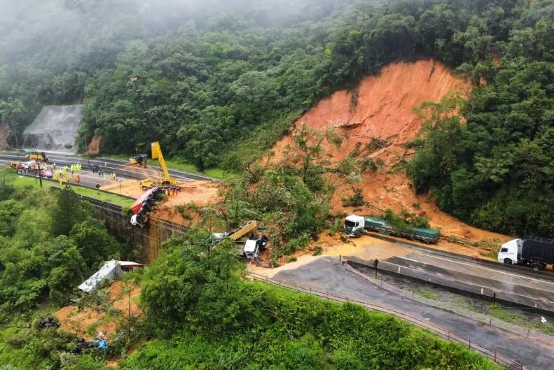
On Monday 28 November 2022 a large landslide occurred on the BR-376 highway in western Brazil. The image below captures will the aftermath of the landslide:-

The aftermath of the 28 November 2022 landslide on the BR-376 highway in Brazil. Image by CBMSL via MetSul.
.
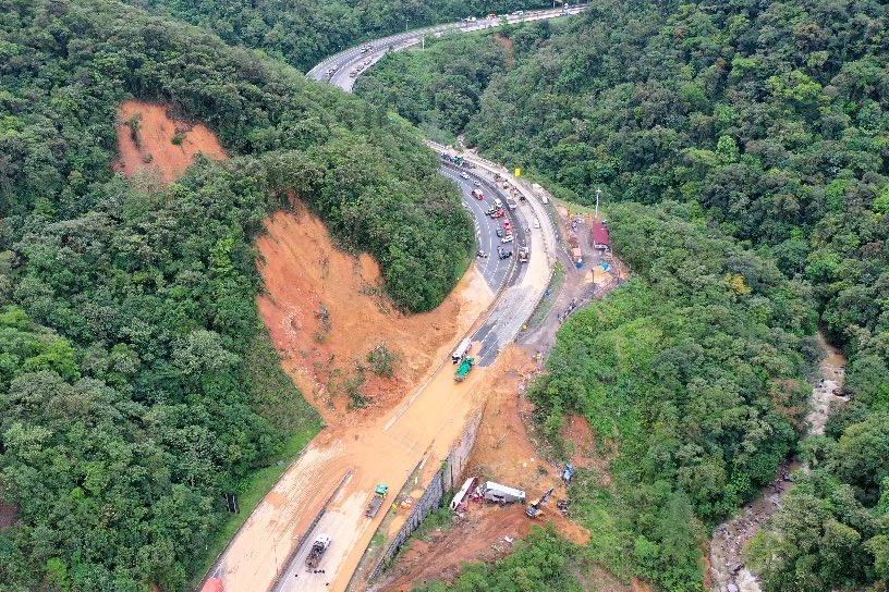
The image below, from the state news agency of Parana, shows the general set up of the slope that failed. This image was collected after much of the debris had been removed from the slope:-

An alternative view of the aftermath of the 28 November 2022 landslide on the BR-376 highway in Brazil. Image by Albari Rosa / AEN via Parana Governo do Estando.
.
There is a good gallery of images on the MetSul website. Reports indicate that there were two failures. The first occurred at about 3:30 pm on Monday, blocking one side of the BR-376. Four hours later a second, larger, failure occurred whilst traffic was queueing to pass the spot. This is the reason why so many vehicles were caught up in the failure.
At the time of writing two fatalities had been confirmed, whilst rescue operations continue. Early fears were that there might have been as many as 30 fatalities, but thankfully this now seems unlikely.
The site was known to have stability issues, and reports indicate that work had been ongoing. The failure was triggered by heavy rainfall – MetSul reports about 200 mm on the day of the failure.
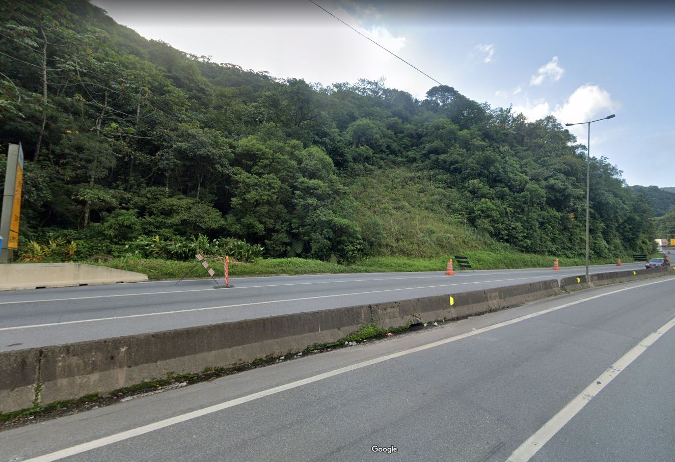
I believe that the site of the failure is -25.874, -48.937. This is the Google Street View image of the location, taken in March 2022:-

Google Street View image of the likely location of the BR-376 landslide in Brazil.
.
It is notable that works were ongoing when this image was captured, although these appear to have been focused on a site a little further along the road. The images in the aftermath of the landslide appear to show a temporary building (with a red roof), which is not present in the images from earlier this year. Is this an indication of ongoing engineering works?
The rescue and recovery operations at this site are very complex. Much of the debris and the vehicles are located off the road, below a large retaining wall. Perhaps more importantly, there is a large displaced but stalled mass on the slope that is potentially unstable. This is sufficiently large to pose a very substantial hazard to those in the debris field.


 Dave Petley is the Vice-Chancellor of the University of Hull in the United Kingdom. His blog provides commentary and analysis of landslide events occurring worldwide, including the landslides themselves, latest research, and conferences and meetings.
Location confirmed. The overhead highway sign girder, seen downed at the slide’s north edge in the early MetSul drone photos, was centered at -25.874097, -48.936132, just off the right edge of your Street View screenshot.
The temporary buildings that you mention are located on a straightened curve of the former highway alignment.
It is probably significant that Google Satellite View shows what appears to be the trace of an abandoned road that enters the slide source zone from the north, at about 80m WNW of BR-376. However none of the posted MetSul photos were taken from a location that could confirm that this feature was actually involved in triggering the slide.