
9 June 2022
The Black Lake landslide at Thetford Mines in Quebec
Posted by Dave Petley
The Black Lake landslide at Thetford Mines in Quebec
In the last few days a video captured by a drone of the aftermath of the 2009 Black Lake rockslide at Thetford Mines in Quebec, Canada, has gone viral. The video was captured by Optique video in 2021, and a very dramatic backing track has been added. You should be able to view the footage below:-
.
This landslide is located at 46.026, -71.363, and is very clear on Google Earth:-
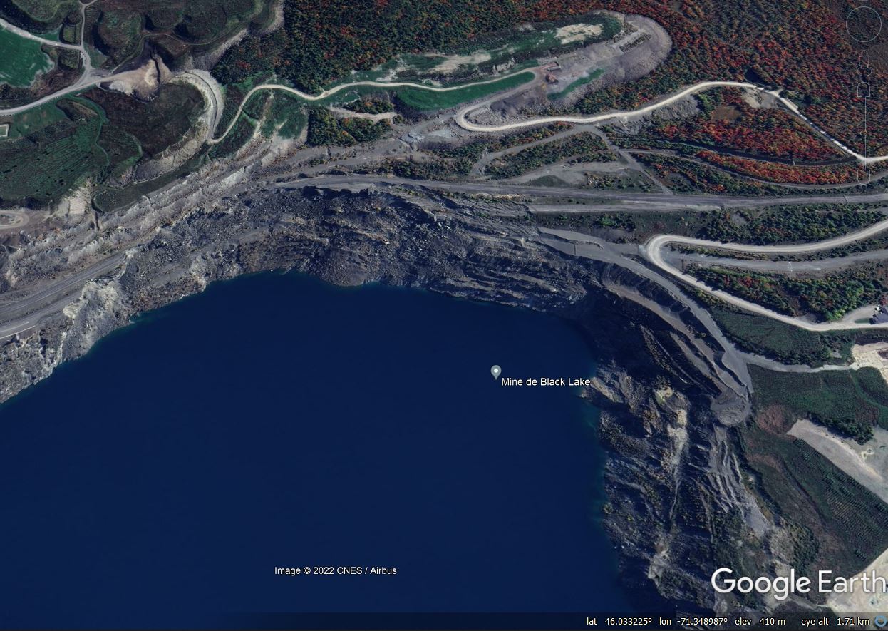
Google Earth image of the Black Lake landslide at Thetford Mines in Quebec, Canada.
.
The landslide destroyed a section of Route 112 in the area of the Lac d’amiante asbestos (serpentinised peridotite) mine, which closed in 2011. The road was rerouted, with a new section opened in 2015.
The development of the landslide is quite interesting. A Google Earth image from May 2009 shows the road in an intact state, but some of the benches below the highway in the pit wall had collapsed:-
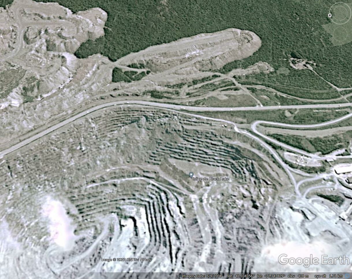
Google Earth image from May 2009 showing the site of the Black Lake landslide at Thetford Mines in Quebec, Canada.
.
By January 2012 the slope failure had retrogressed and damage to the road was evident. In one location a section of the side of the road had collapsed, and in others large tension cracks had developed:-
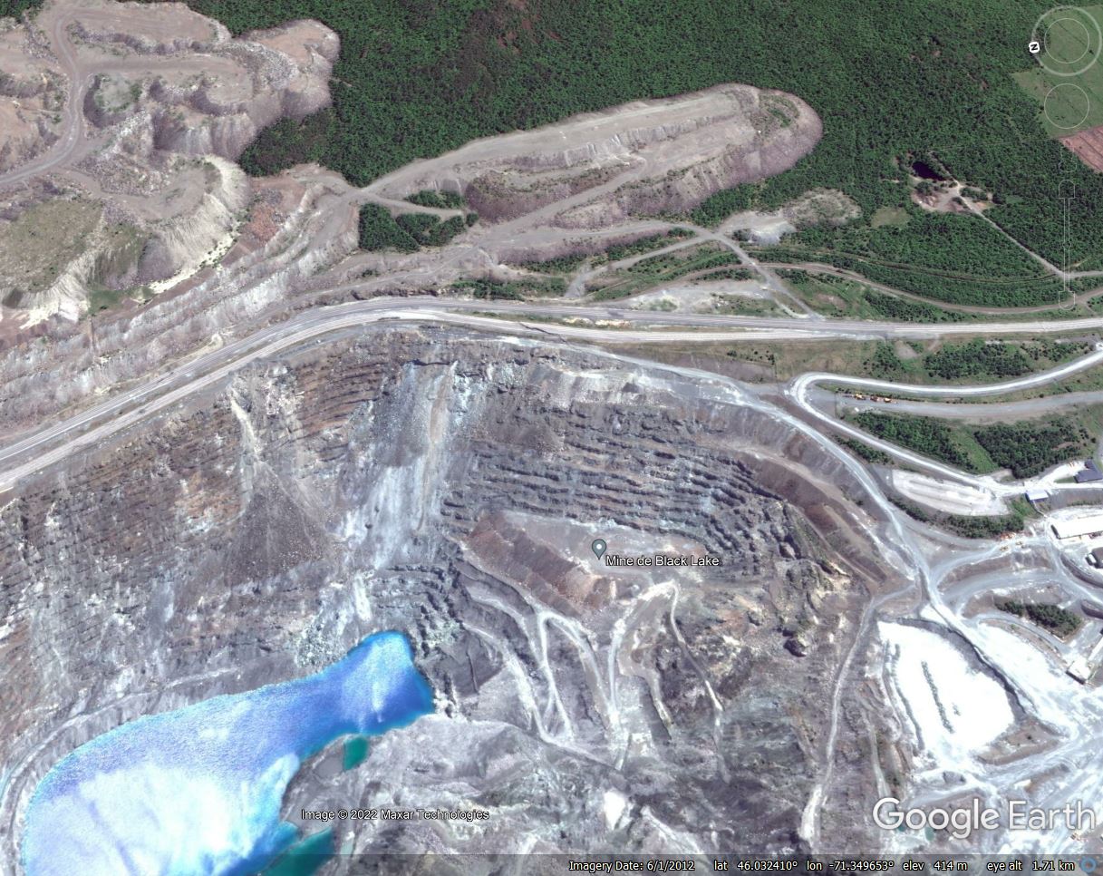
Google Earth image from June 2012 showing the site of the Black Lake landslide at Thetford Mines in Quebec, Canada.
.
The image from October 2016 shows that complete failure had occurred, whilst the mine was flooded at the end of operations:-
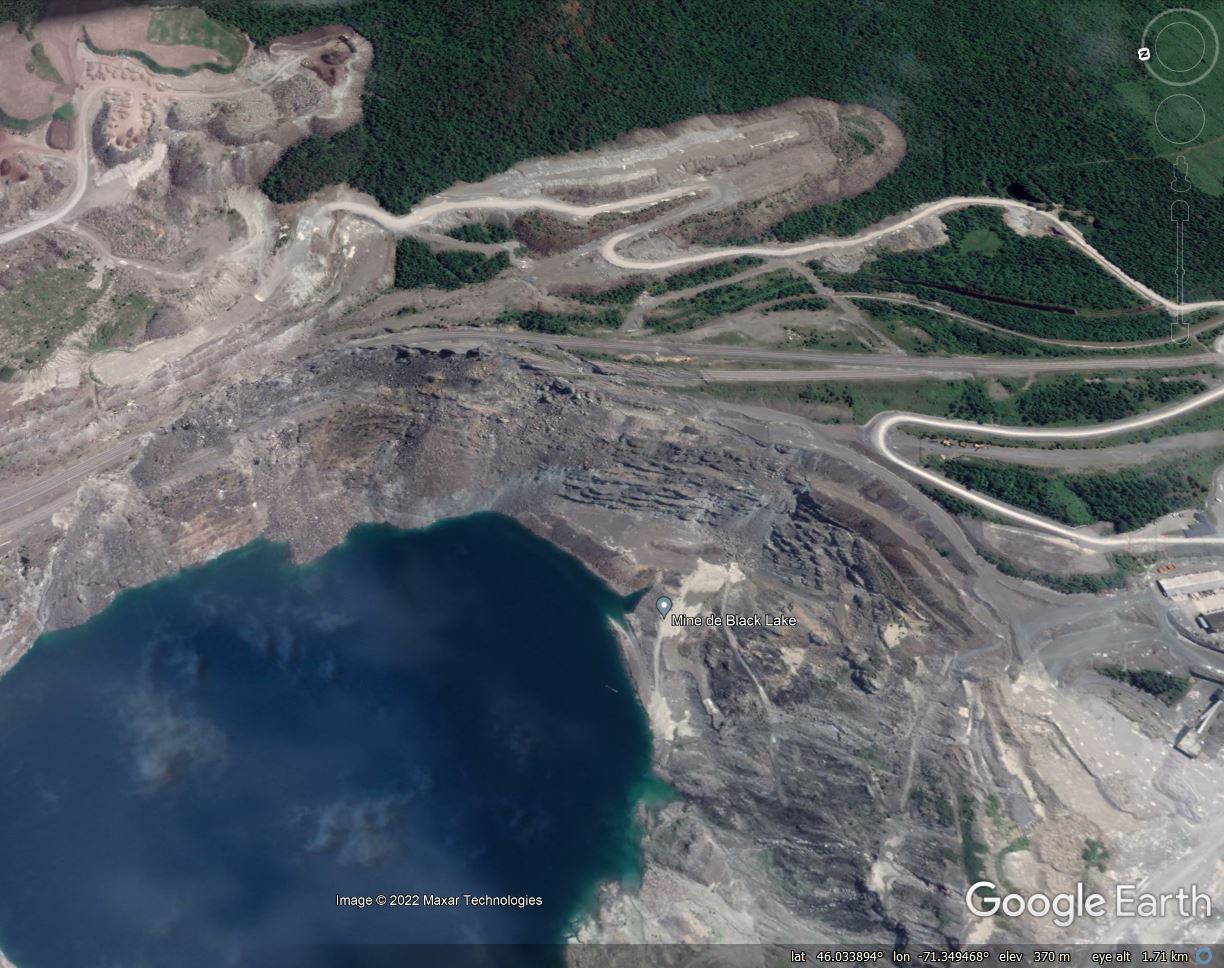
Google Earth image from August 2016 showing the fully developed Black Lake landslide at Thetford Mines in Quebec, Canada.
.
The Black Lake landslide is described in a paper (Amoushahi et al. 2018) published in the Canadian Geotechnical Journal, which analysed the stability of the slope. The study, and others, indicated that about 50 million cubic metres of rock slipped over a lateral extent of about 1,100 metres. Approximately 70 m of vertical movement was observed at the crown of the slope.
.
Reference
Amoushahi, S., Grenon, M., Locat, J. and Turmel, D. 2018. Deterministic and probabilistic stability analysis of a mining rock slope in the vicinity of a major public road — case study of the LAB Chrysotile mine in Canada. Canadian Geotechnical Journal. 55 (10): 1391-1404. https://doi.org/10.1139/cgj-2017-0298
 Dave Petley is the Vice-Chancellor of the University of Hull in the United Kingdom. His blog provides commentary and analysis of landslide events occurring worldwide, including the landslides themselves, latest research, and conferences and meetings.
What will be the quality of the water and will fish in the future be edible?