8 June 2022
San Carlos de Bariloche: a deadly slope failure in Argentina
Posted by Dave Petley
San Carlos de Bariloche: a deadly slope failure in Argentina
On Monday 6 June 2022 a slope failure struck a hotel located close to the town of San Carlos de Bariloche in Argentina, killing at least one person. According to reports, the slope impacted on the rear of Hotel Villa Huinid, killing a 78-year-old tourist, injuring three other people and leaving two missing. The person who lost his life, and the two that are missing, were reportedly in rooms at the rear of the hotel. There is good drone footage of the site, and some images of the aftermath, on Youtube.
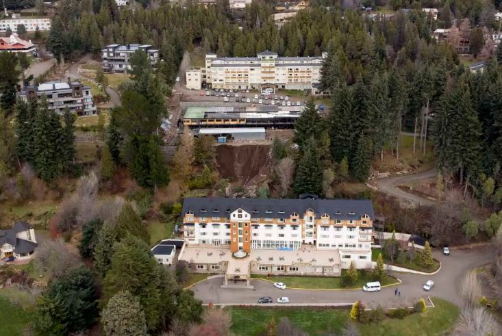
The best image that I have found of the site has been posted by Rio Negro:-

The aftermath of the landslide at Hotel Villa Huinid near to San Carlos de Bariloche in Argentina. Image by Marcelo Martinez via Rio Hegro.
.
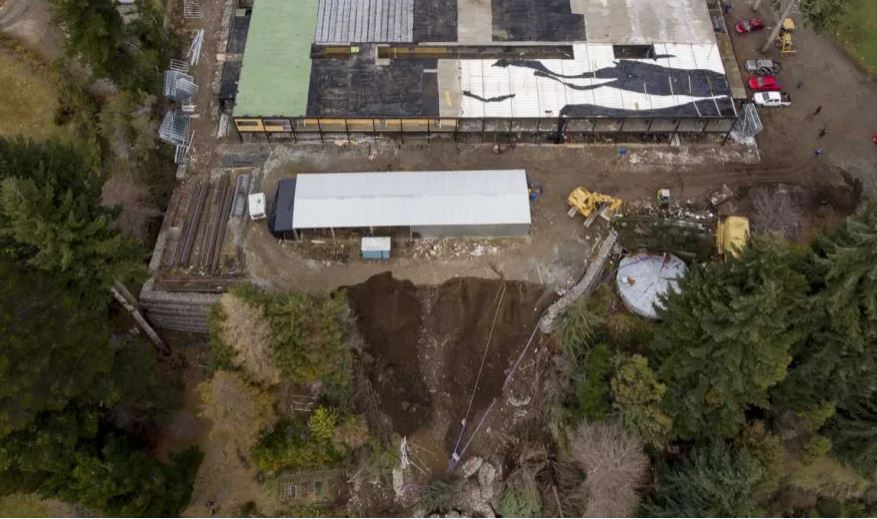
The same source has also posted a view of the landslide crown:-

The crown of the landslide at Hotel Villa Huinid near to San Carlos de Bariloche in Argentina. Image by Marcelo Martinez via Rio Hegro.
.
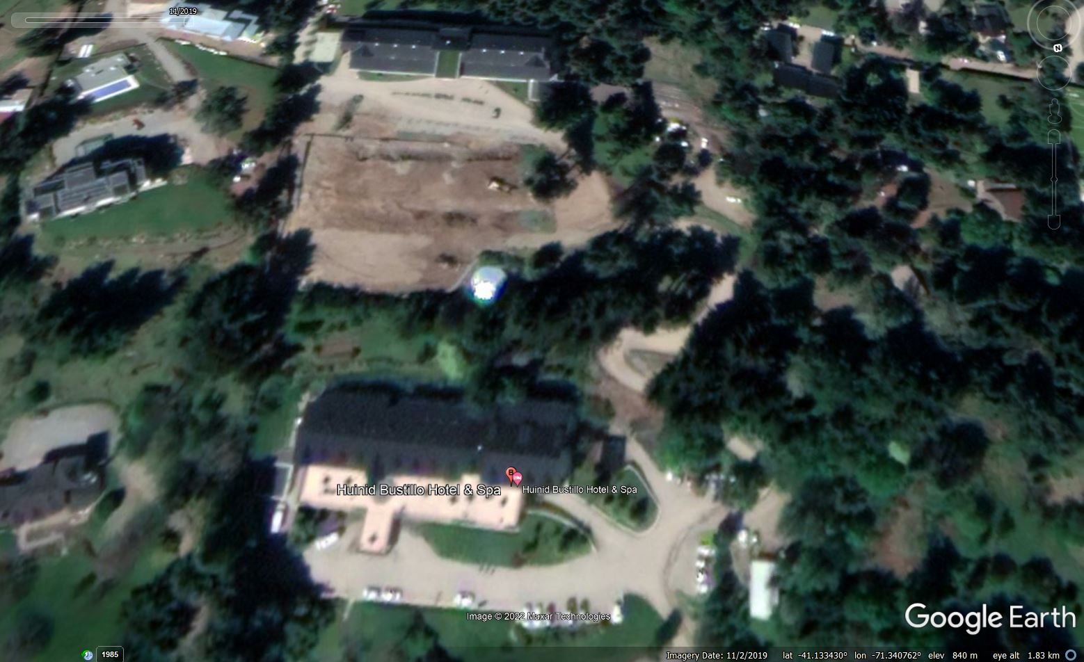
In the second image note the wall of gabian baskets on the left side, and also on the right side of the landslide crown. On first inspection the material looks like fill, although this needs confirmation. The site is located at -41.133, -71.341, for which there is a really good archive of images on Google Earth. The image below, from 2019, appears to show significant works being undertaken on the slope:-

Google Earth image from November 2019 showing the site of the landslide at t Hotel Villa Huinid near to San Carlos de Bariloche in Argentina. It appears that works were underway on the slope.
.
My initial and of course speculative interpretation is that a new platform was constructed to allow a new building to be built. It appears to be the edge of this platform that has failed. It is intriguing to note that it appears that there might have been some construction occurring at the time of the landslide.


 Dave Petley is the Vice-Chancellor of the University of Hull in the United Kingdom. His blog provides commentary and analysis of landslide events occurring worldwide, including the landslides themselves, latest research, and conferences and meetings.
In the first two pictures, there looks to be a retaining wall to the left of the slide. Maybe the construction vehicles were building it? It would make sense with how the equipment is laying and the fallen cables.
This looks (on the left) like a considerable wall. Wondering if they used any tie-back system to anchor everything together. I also wonder about any back-drain system. Gabions at this height by themselves will not be particularly strong. They’ll serve more as a fill facing unless the fill was internally reinforced using a “GeoGrid” equivalent, which doesn’t appear to the case.
Probably is the collapse of an existing gavion structure about 5 meter height. Probably an rotational shape landslide involving the base, foundation of the gavion structure, producing a general collapse. May be that the cause of the collapse is a gavion structure design error an of course some threshold conditions, as excessive rainfall an its infiltration in the backfill. Or may be a excessive runoff concentration and infiltration in the backfill.
But from images available, also in Google earth, is not possible tell much more. Mostly speculations..
Best regards
Lorenzo Borselli
http://www.lorenzo-borselli.eu