12 November 2019
The 2019 Cotabato earthquakes: the Barangay Bato landslide cluster
Posted by Dave Petley
The 2019 Cotabato earthquakes: the Barangay Bato landslide cluster
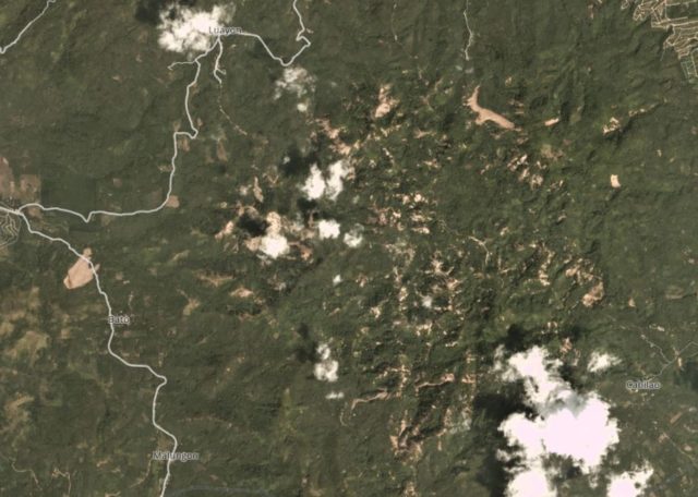
Yesterday I highlighted a significant landslide cluster triggered by the 2019 Cotabato earthquakes, at Barangay Buhay. I indicated that there is another cluster on the imagery, located at Barangay Bato (6.84, 125.16).
This is a Planet Labs satellite image, collected on 8 November 2019, providing an overview of this significant landslide cluster:-

The Barangay Bato landslide cluster, triggered by the2019 Cotabato earthquakes. Planet Labs PlanetScope image, captured on 8 November 2019. Copyright Planet Labs, used with permission.
.
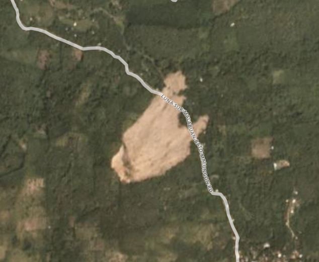
There are several hundred landslides in this cluster, located over an approximately 5 x 5 km area. Most of the landslides appear to be shallow disrputed slides on steeper terrain. There are two larger landslides in the cluster. On the west side there is a large rockslide close to Barangay Bato itself:-

Planet Labs image of the large rockslide located close to Barangay Bato, triggered by the Cotabato earthquakes. Planet Labs PlanetScope image, captured on 8 November 2019. Copyright Planet Labs, used with permission.
.
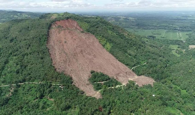
This landslide was extensively photographed in the aftermath of the earthquake:-

An aerial photo of a massive landslide close to Barangay Bato, triggered by the 2019 Cotabato earthquakes.Photo courtesy of Pfc. Jacil Joe Tupa 10th ID-ERC, via the Manila Bulletin.
.
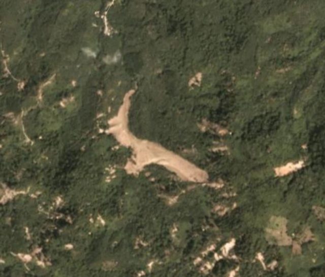
In the northeast of this cluster, there is another largish (approximately 300 m long) landslide, although it is difficult at present to fully understand this slide:-

Planet Labs image of a large rockslide located in the Barangay Bato landslide cluster, triggered by the Cotabato earthquakes. Planet Labs PlanetScope image, captured on 8 November 2019. Copyright Planet Labs, used with permission.
.
The other landslides are much smaller, but there are large numbers throughout this cluster. The next step is of course to relate these two clusters to the actual locations of the earthquakes that occurred in the sequence. It will be interesting to see which earthquakes triggered landslides, and which did not.
Reference
Planet Team (2019). Planet Application Program Interface: In Space for Life on Earth. San Francisco, CA. https://www.planet.com/


 Dave Petley is the Vice-Chancellor of the University of Hull in the United Kingdom. His blog provides commentary and analysis of landslide events occurring worldwide, including the landslides themselves, latest research, and conferences and meetings.