5 July 2018
Cadia gold mine: Planet Labs imagery of the sequence of events of the tailings dam failure in March 2018
Posted by Dave Petley
Cadia gold mine: Planet Labs imagery of the sequence of events of the tailings dam failure in March 2018
Back in March I blogged about the tailings dam failure at Cadia Gold Mine on Friday 9th March 2018. This failure involved the collapse of a structure between two tailings ponds; fortunately on this occasion there was no release of tailings to the environment. This is the best image of the failure site that I have seen, posted on the website of Mining Journal:
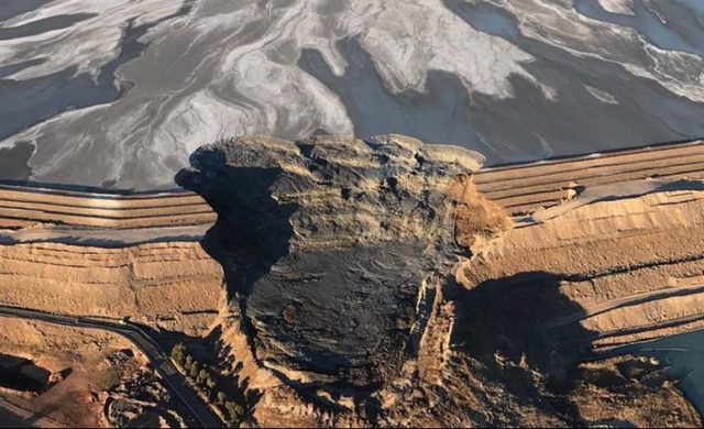
The tailings dam failure at Cadia Gold Mine, courtesy of Mining Journal.
Prompted by a recent exchange about this event, I have been back to take a look at the Planet Labs archive of imagery of this event. It’s quite interesting. This is an image collected on 9th March (the day of the failure) at 01:14 UTC. In this image the structure is intact:
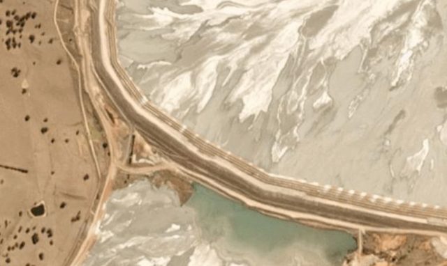
Planet Labs image of the site of the Cadia gold mine failure in March 2018. Image collected at 01:14 UTC on 9th March 2018. Image used with permission.
.
This image was collected on the same day, but about 22 hours later at 23:32 UTC on 9th March. The failure has now developed:
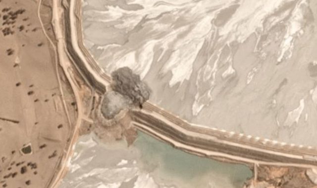
Planet Labs image of the tailings dam failure at Cadia gold mine. Images collected at 23:32 UTC on 9th March 2018. Image used with permission
.
An image collected on 11th March 2018 at 01:13 UTC shows no change, but one collected on the same day at 23:31 UTC shows that a secondary failure has developed:-
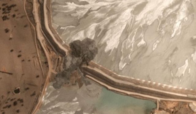
Planet Labs image of the secondary failure of the tailings structure at Cadia gold mine. Image collected at 23:31 on 11th March 2018. Used with permission.
.
The most recent images show little change bar the construction of a new haul road:-
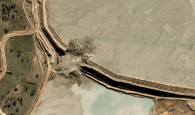
Recent Planet Labs image of the site of the tailings dam failure at Cadia gold mine. Image dated 00:57 UTC on 26th June 2018. Used with permission.
.
So, interestingly, this was a two phase failure event. Newcrest, the mining company responsible, are now storing their tailings at another site in the old Cadia Hill open pit mine.
Reference
Planet Team (2017). Planet Application Program Interface: In Space for Life on Earth. San Francisco, CA. https://api.planet.com


 Dave Petley is the Vice-Chancellor of the University of Hull in the United Kingdom. His blog provides commentary and analysis of landslide events occurring worldwide, including the landslides themselves, latest research, and conferences and meetings.
same scenario as at Mt. Polley, 1-2 punch …..
This recent photo jogged a memory: If you have time, take a look at the west side of Summer Lake, OR on Google Earth. West Coast Basin and Range province.
Circular crown scarps in layered basalt 1.5 – 2 miles across. Most of the slide debris from these is “missing” and thought to have sunken over time into the lake bed and been entombed. Southwest end of the lake sports topo reminiscent of that amazing valley on Skye.