
30 November 2016
Earthquake induced landslides in the Himalayan mountains – new evidence for earthquake potential in Bhutan
Posted by Dave Petley
Earthquake induced landslides in the Himalayan mountains – new evidence for earthquake potential in Bhutan
In terms of large earthquakes Bhutan has always been something of a conundrum. The ongoing collision between the Indian and Eurasian plates that has generated the Himalayas occurs along a huge set of faults that run through the frontal range of the mountains and then dip below them. It is this fault that generated the 2015 earthquake in Nepal. Considerable work has been done to understand the palaeoseismology of this fault system, which has yielded a long history of large earthquakes – except for the Bhutan segment. There has been some very slender evidence of an earthquake in the early 18th Century, but nothing very detailed. This has led to speculation that this section of fault might behave differently in some way – perhaps that it undergoes slow slip to release the stress.
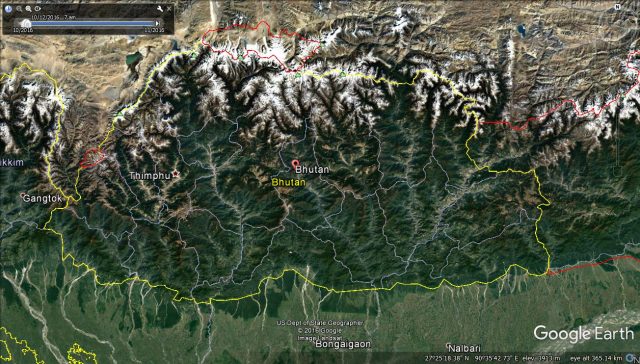
Google Earth image of Bhutan
.
When I was in Bhutan a few years ago I raised the issue of earthquake triggered landslides with a range of people, to be told that there was no problem as Bhutan does not get large earthquakes. I found that this troubling. The country is very landslide prone, and the problem is becoming worse as the country develops. Everything about the landscape suggests that earthquake triggered landslides would be a big problem during a large seismic event, and issue that has been emphasised by the Nepal and New Zealand earthquakes. So understanding whether Bhutan suffers major earthquakes really matters.
I am glad to say that this problem appears to have been resolved at last. In a paper published last month, Hetenyi et al (2016) reported archive and field work, and resultant modeling, that they have undertaken that has unearthed details of a large earthquake, likely to have been approximately M=8.0 (the range is 7.5-8.5), in Bhutan in 1714 AD. The evidence includes a series of documentary accounts of the damage caused by the earthquake, and data from trenches across the fault that provide evidence of the movement. From this information Hetenyi et al (2016) have modeled the earthquake to get an estimate of its likely magnitude.
To me this feels like a really important study. We now know that the entirety of the Himalayan Arc has the potential to generate devastating earthquakes, and thus to suffer earthquake-induced landslides. The implications for hazard management in Bhutan are clear.
Reference
, , , , , , and (2016) Joint approach combining damage and paleoseismology observations constrains the 1714 A.D. Bhutan earthquake at magnitude 8 ± 0.5, Geophysical Research Letters, 43, 10,695–10,702.
 Dave Petley is the Vice-Chancellor of the University of Hull in the United Kingdom. His blog provides commentary and analysis of landslide events occurring worldwide, including the landslides themselves, latest research, and conferences and meetings.