19 November 2015
Lefkada: dramatic landslides from the earthquake on 17th November
Posted by Dave Petley
Lefkada landslides
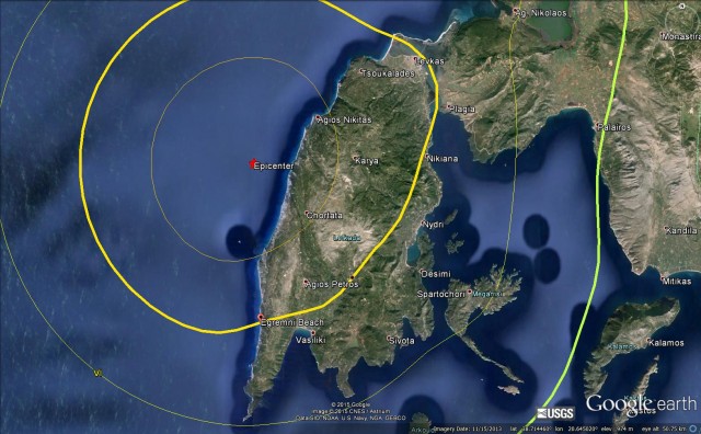
On Tuesday western Greece was affected by a shallow (depth = 14 km) M=6.5 earthquake centred close to Nidri. This is the USGS location of the earthquake on Google Earth, with the intensity contours:
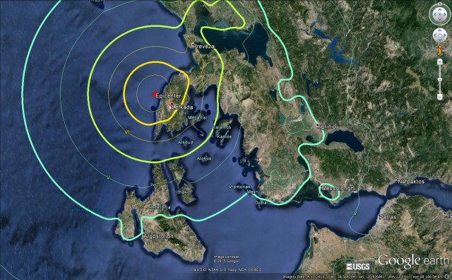
USGS epicentre and intensity contours for the earthquake near Lefkada, plotted on Google Earth
.
The nearest piece of land is the island of Lefkada. On the west coast of the island is a famously beautiful beach at Egremni:
.
The Pappas Post has a very nice article about landslides triggered by the earthquake that have affected the beach. This is the beach prior to the earthquake, from Flickr:
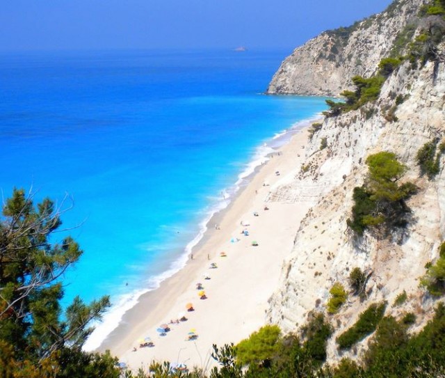
Egremni beach before the earthquake via Flickr
.
The landslides that affected Egremni Beach were captured on a video by a fisherman who was located on a boat just off the coast:-
.
The aftermath is a series of large landslides that have left very large volumes of debris on the beach. This oblique aerial shot, from The Pappas Post, shows the largest of the landslides (note the smaller ones at the top of the image too):
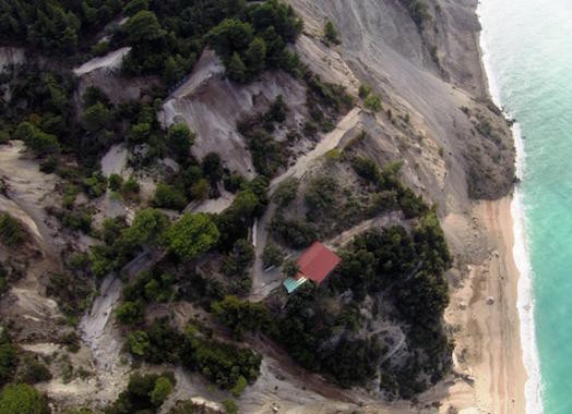
The major landslide on Egremni Beach on Lefkada, via The Pappas Post
.
And this image, also from The Papas Post, shows the landslide from a more traditional near-vertical perspective:
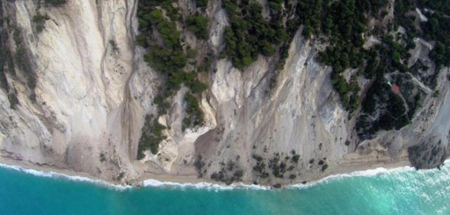
The major landslide on Egremni Beach on Lefkada, via The Pappas Post
.
If this earthquake had occurred on a summer day then there would have been a large number of fatalities on the beach at Lefkada, so in a sense this was very lucky escape. However, it is also likely that the debris from these landslides will take a long time to clear, such that Egremni Beach has been changed in perpetuity.
According to the Washington Post, there were two fatalities in the earthquake. One of these, a 69 year old woman, was killed by a rockfall that struck her house.


 Dave Petley is the Vice-Chancellor of the University of Hull in the United Kingdom. His blog provides commentary and analysis of landslide events occurring worldwide, including the landslides themselves, latest research, and conferences and meetings.
http://www.latimes.com/local/lanow/la-me-ln-santa-clarita-road-closed-landslide-20151120-story.html
https://www.youtube.com/watch?v=fwBUwU3tgsI