21 February 2014
Emergency assessment of wildfire debris flow potential
Posted by Dave Petley
Post wildfire debris flows
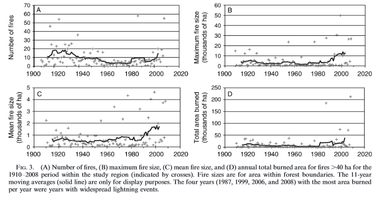
In recent years wildfires have become more common in many locations. For example, in northern California Miller et al. (2012) (available as a pdf online) have shown that whilst the frequency of wildfire events there has not increased, the size of the largest fires and the total area burnt has risen dramatically:
..
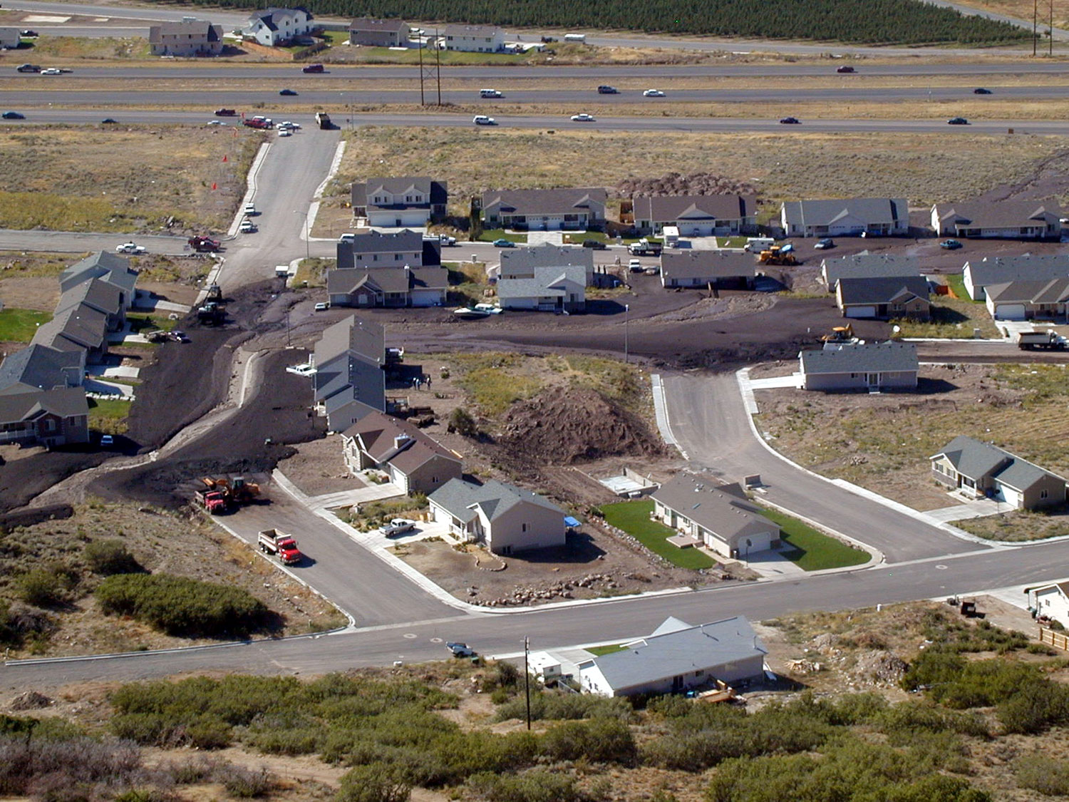
One of the consequences of wildfires is that the incidence of landslides, and in particular of debris flows, can dramatically increase. The USGS has a good primer on this topic, and this report provides an interesting summary of debris flow potential after a wildfire in Fort Collins in Colorado. The image below, from the Utah Geological Survey, shows the aftermath of a debris flow in Santaquin after a wildfire in 2002:
..
Emergency assessment of post wildfire debris-flow hazards
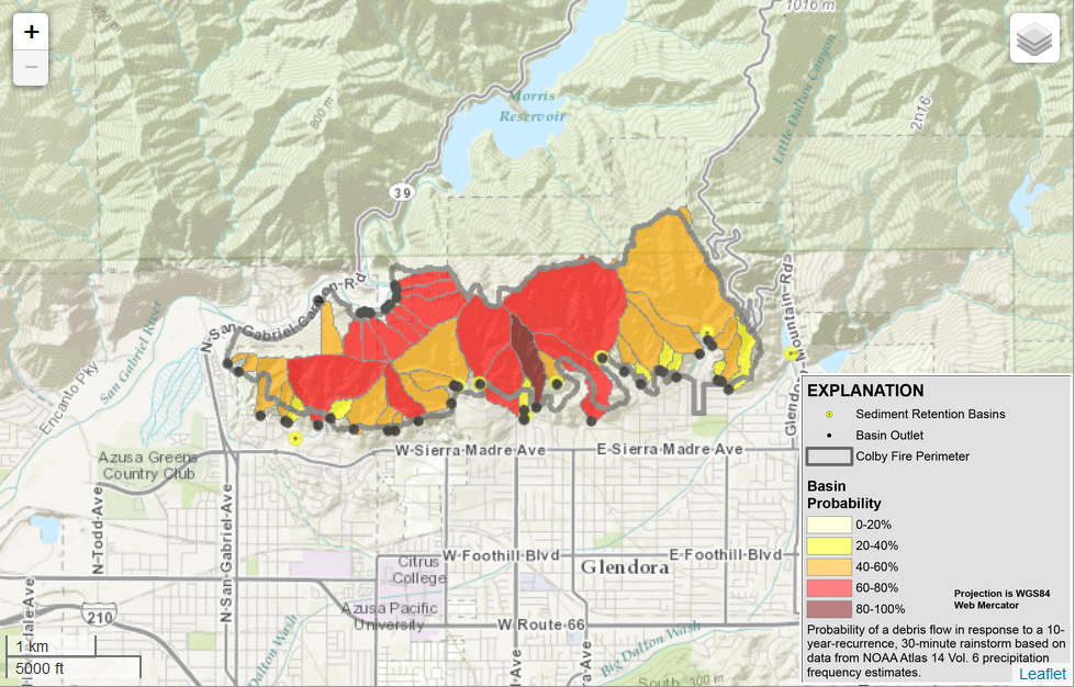
Clearly such debris flows represent a very substantial hazard for those living in upland areas that have been affected by wildfires. The USGS has always led the way in the assessment and management of these landslides. Recently, Jason Kean and Dennis Staley have built a website for the USGS that provides an interactive map to distribute hazard assessments for areas affected by wildfires. The assessments use (in their words) “geospatial data related to basin morphometry, burn severity, soil properties, and rainfall characteristics to estimate the probability and volume of debris flows that may occur in response to a design storm”.
At present the only data online is for the Colby Fire, which occurred in mid-January this year in Angeles National Forest in California in mid-January. The assessment suggests that the debris flow potential is some of the sub-catchments is rather high:
…
Whilst this tool is still in an early stage of development, it will undoubtedly prove to be extremely helpful in terms of the dissemination of information posed by debris flows in wildfire areas.
Reference
Miller, J.D., C.N. Skinner, H.D. Safford, E.E. Knapp, and C.M. Ramirez. 2012. Trends and causes of severity, size, and number of fires in northwestern California, USA. Ecological Applications, 22: 184-203.


 Dave Petley is the Vice-Chancellor of the University of Hull in the United Kingdom. His blog provides commentary and analysis of landslide events occurring worldwide, including the landslides themselves, latest research, and conferences and meetings.
Interesting post and pretty sound connection between the fires and landslides, particularly when associated with high rainfall.
Here in Australia several cases of bushfires with subsequent flooding have led to landslide / debris flow activity.
One of note was a major event at the Grampians National Park a few years ago. Severe bushfires occured across the Park in 2006 during a decade long drought in the region, with vegetation reduced significantly. Subsequently when the drought broke, major flooding occurred in 2011 (two 1 in 100 year rainfall events within 3 days). This resulted in more than 190 landslides / debris flow events accross the Park. Some debris flows were over 1km in length (typically following minor watercourses). This was in an area where there was basically no record of landslides having occured in the past 50 years.
A similar sequence of events happened at Mt Hotham last year.