
April 3, 2023
Sierra Nevada, California Glaciers Rapid Decline 2018-2022
Posted by Mauri Pelto
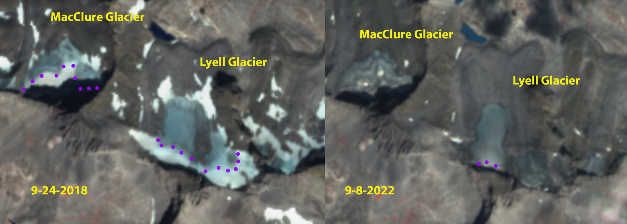
MacClure and Lyell Glacier in 2018 and 2022 Sentinel images illustrating a decline from 0.09 to 0.06 km²
The Sierra Nevada, California has a number of small glaciers that have clung to the north facing slopes of the High Sierra. An inventory of these glaciers completed by Basagic and Fountain (2011) identified glacier area in 2004, which had declined by 55% since 1903. At that time the MacClure Glacier had an area of 0.15 km², the West Lyell Glacier an area of 0.42 km², Conness Glacier an area of 0.16 km² and Darwin Glacier an area of 0.12 km². The Palisade Glacier is the largest glacier, with an area of 0,84 km² in 1984. Yosemite NPS has been assessing area change of Lyell and MacClure Glacier, they found a rapid acceleration of area loss beginning in 2012, noting a thickness loss of 3-4 m per year during the 2012-2015 drought. These losses are similar to those observed on Whitney Glacier, Mount Shasta. The NCEI NOAA Division 5 climate data for this area indicates that meltseason temperatures have been the primary cause of the recent decline, though declining accumulation season precipitation has been as well, see bottom.
The thickness loss of 2012-2015 has been matched during the 2020-2022 drought. Area decline from 2018-2022 on West Lyell Glacier has been from 0.18 to 0.13 km², on MacClure Glacier from 0.09 to 0.06 km², on Conness Glacier from 0.08 to 0.05 km² and on Palisades Glacier from 0.62 to 0.48 km². In September of 2021 and 2022 all of these glaciers were completely bare of snowcover, even in areas of avalanching. A glacier requires 50-60% snowcover at the end of summer to be in equilibrium and cannot persist without a consistent accumulation zone. This illustrates the glaciers cannot survive the climate of the last decade. The area has declined ~30% in just five years from 2018-2022 on West Lyell, MacClure, and Conness Glacier, they each lost all of their snowcover both years by late August. Fiske (0.02 km²), Dana (0.04 km²), Darwin (0.05 km²), Matthes (0.01 km²) and Powell Glacier 0.04 km² no longer qualify as glaciers. The next glaciers to join this class will be MacClure and Conness Glacier. The only glacier with even a small persistent accumulation zone has been Palisades Glacier.
The lost of glacier thickness in just 2021 and 2022 is 5-6 m w.e. ice thickness. To replenish this loss requires 5 m w.e of snowpack to be retained at the end of the melt season in early October. This equates to 8-9 m of snowpack remaining. This will not happen in a single season even a record snowfall year such as 2023.
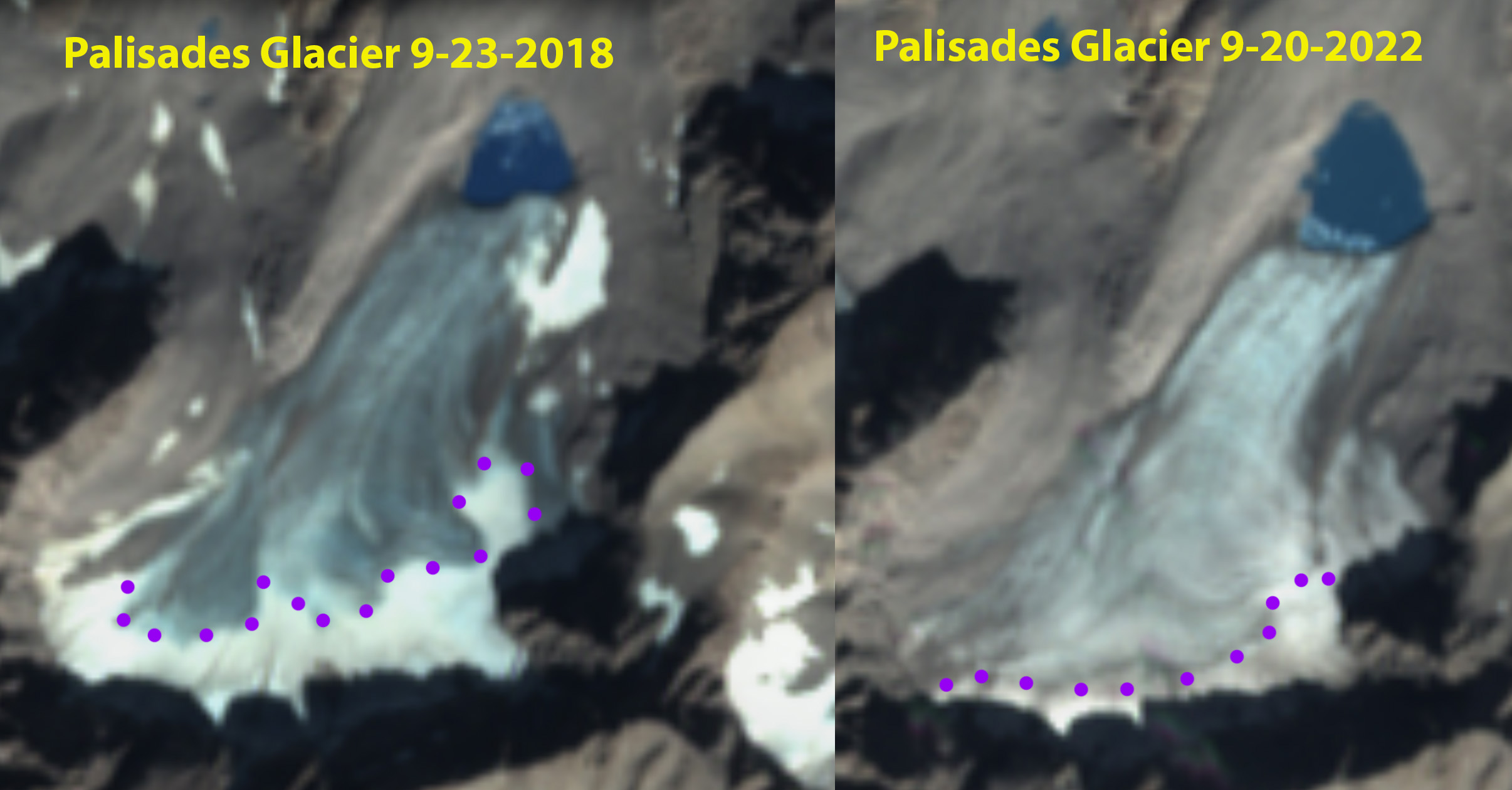
Palisades Glacier in 2018 and 2022 Sentinel images, retreat indicated by lake expansion. Purple dots indicate area of firn indicating region where some snow from recent years has remained, but less than 10% of glacier area in 2021 and 2022. Note marginal recession along east and west edge of glacier.
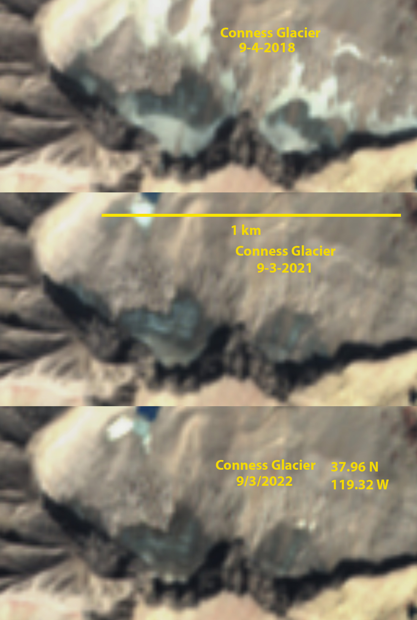
Conness Glaciuer diminishing and darkening from 2018 to 2022 in Sentinel images. Area declined from 0.08 to 0.05 km². If it is hard to pick out the glacier on high resolution imagery like this, that is telling.
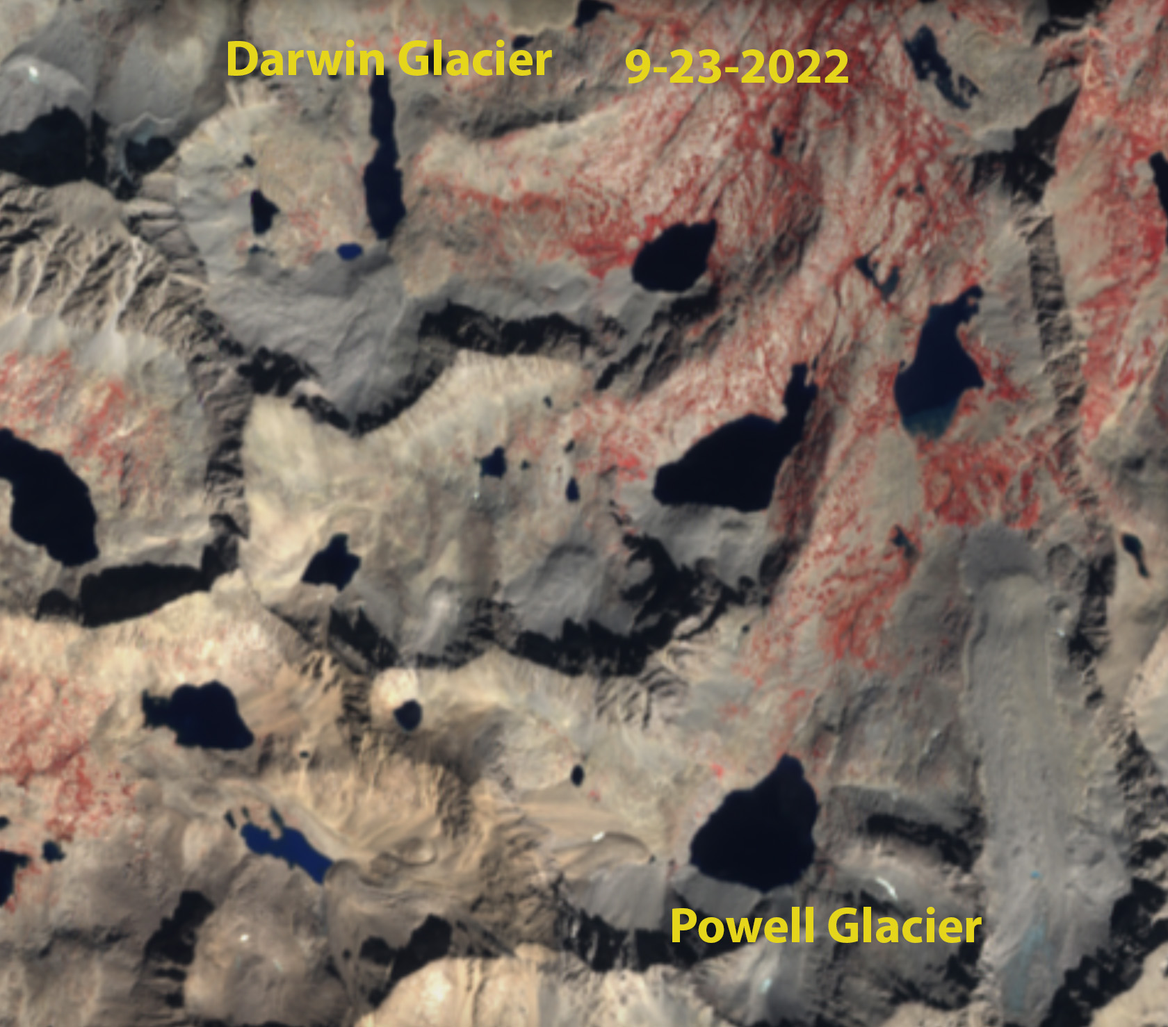
Darwin and Powell Glacier no longer have sufficient area to qualify as glaciers at 0.05 km² between two perennial ice masses for Darwin Glacier and 0.04 km². No retained snowcover in 2021 or 2022. That they are hard to discern is visual evidence of their current insignficance as ice masses.
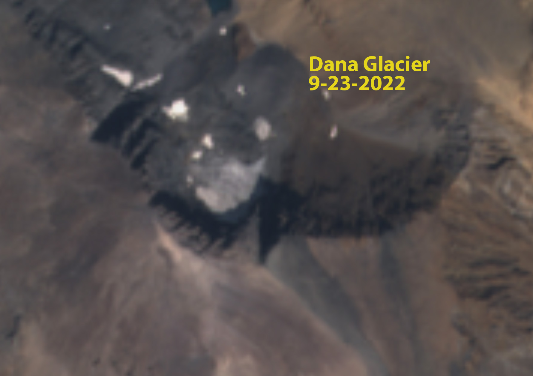
Dana Glacier has an of perennial ice of 0.04 km². No retained snowcover in 2021 or 2022.
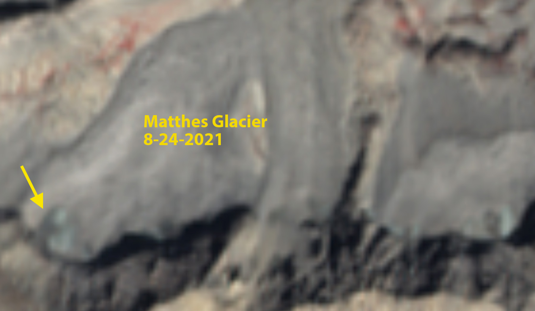
Matthes Glacier in 2021 with no retained snowpack and an area of perennial ice of 0.015 km².
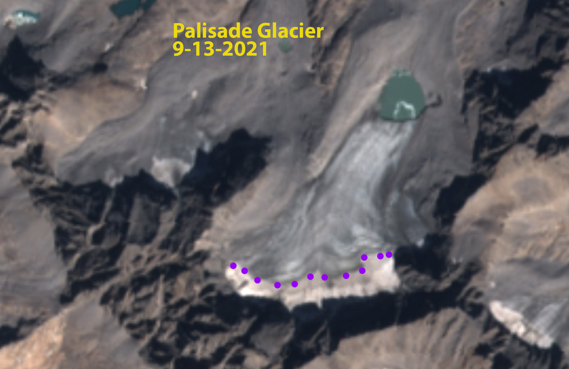
Palisade Glacier with narrow fringe of snow and firn in 2021.
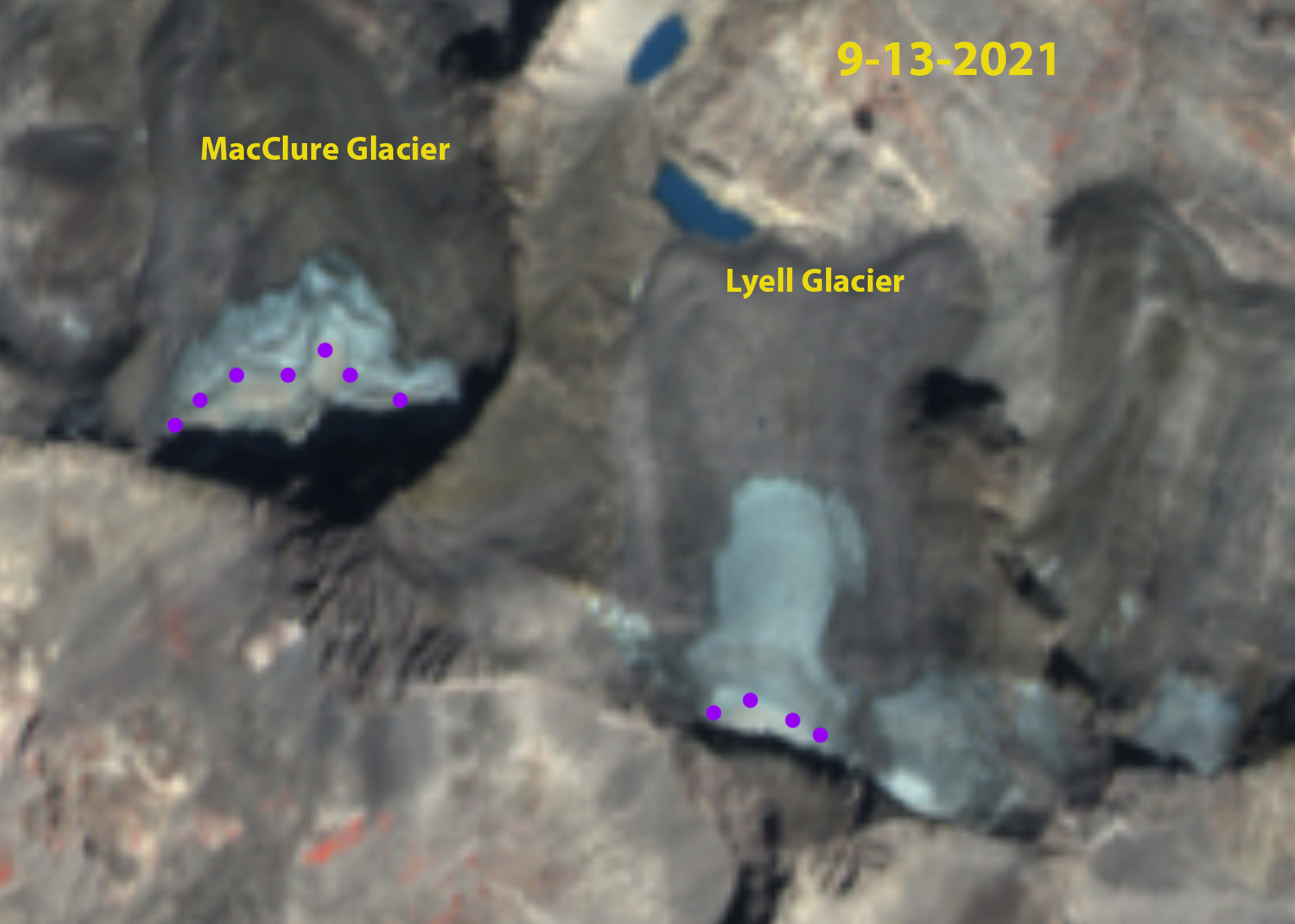
Lyell ad MacClure Glacier in 2021 with no retained snowpack.
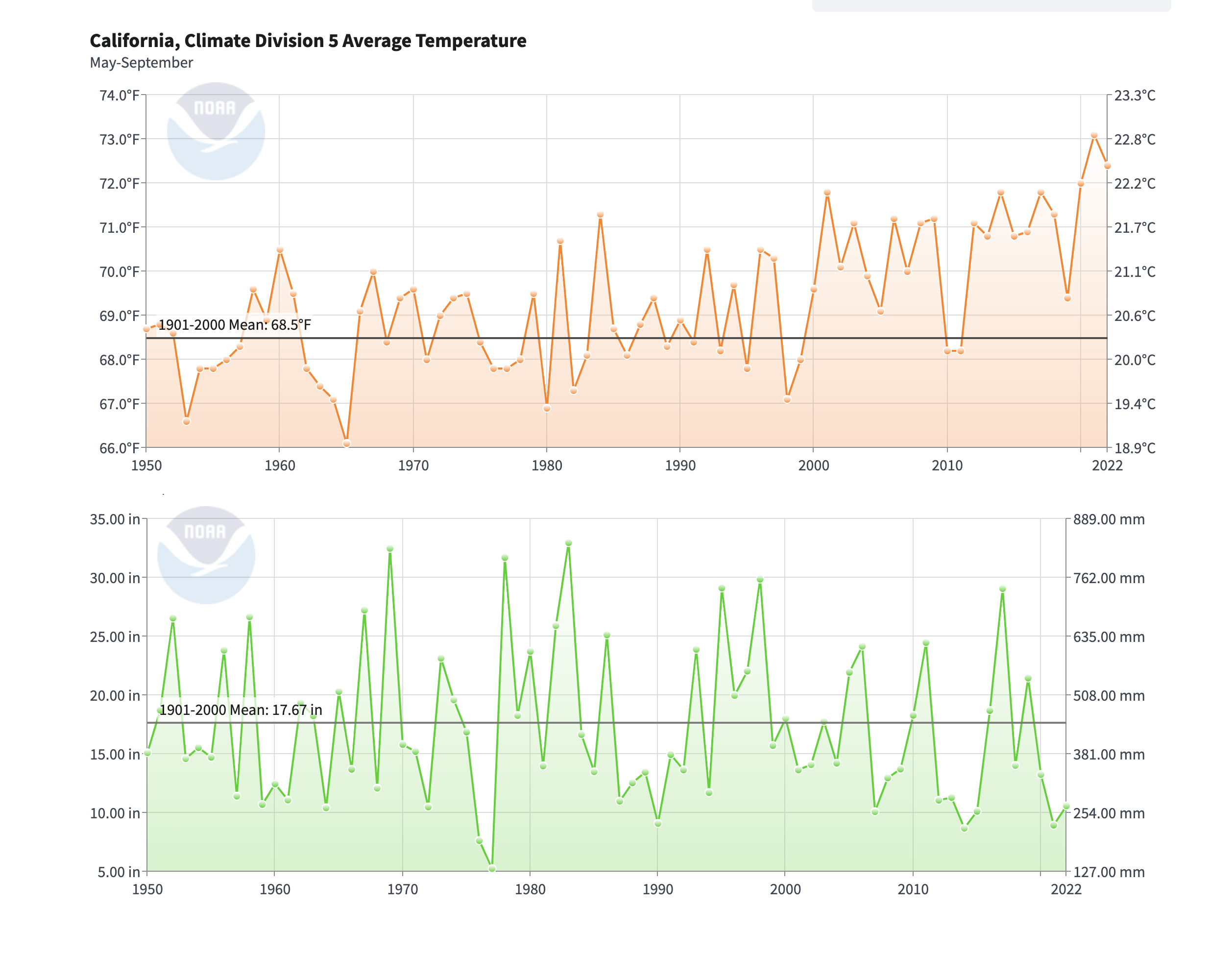
NCEI NOAA Division 5 climate data for melt season temperatures (May-Sept.) and accumulation season precipitation (November-April)
 Dean of Academic Affairs at Nichols College and Professor of Environmental Science at Nichols College in Massachusetts since 1989. Glaciologist directing the North Cascade Glacier Climate Project since 1984. This project monitors the mass balance and behavior of more glaciers than any other in North America.