November 21, 2017
Bridge Glacier, Southeast Alaska Retreat & Lake Formation
Posted by Mauri Pelto
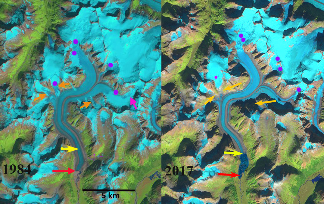
Bridge Glacier in Landsat image from 1984 and Sentinel image from 2017. The red arrow indicates the 1984 terminus where no lake exists, yellow arrow is 2017 terminus, orange arrows are selected tributaries and purple dots the snowline.
Bridge Glacier drains the same icefield as the Wright and Speel Glacier 45 km southeast of Juneau, Alaska. Here we examine the changes in this glacier from 1984-2017 using Landsat and Sentinel imagery.
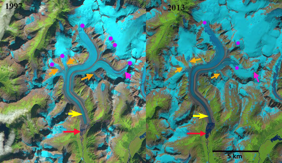
In 1984 the glacier ended on an outwash plain at the head of a branch of Speel River. The red arrow indicates the 1984 terminus for each image, the yellow arrow the 2017 terminus and the orange arrows three tributaries feeding the glacier. The purple dots indicate the snowline at 1200 m. In 1984 all three tributary glaciers fed Bridge Glacier and the glacier has no proglacial lake at the terminus. In 1997 a lake basin is beginning to develop, though it is still largely filled by ice. The eastern tributary pink arrow, has lost all of its snowpack. The three tributaries at the orange arrows are connected to Bridge Glacier still and the snowline is at 1250 m. In 1999 the proglacial lake has formed and has length of 1 km, the lake has expanded south and north of the 1984 terminus position, and does not entirely represent glacier retreat. In 2013 the glacier has retreated 1200 m from the 1984 position and the lake is still expanding. The orange arrows indicate that none of the three tributaries are still connected to the main glacier. The glacier in a sense is losing its income flow from these subsidiaries. The eastern tributary has retained some snowcover with six weeks left in the melt season in 2013, but this is mostly gone a month later, the snowline is at 1100 m. nbsp; Total retreat from 1984 to 2017 is 1900 m. In 2017 the snowline is at 1300 m, and the separation of the tributaries is by more than 500 m in each case. The snowline has been high by the end of each summer from 2014-2017 indicating retreat will continue. The retreat of this glacier is the same story as seen at nearby Patterson, Gilkey and Norris Glacier.
Bridge Glacier in Landsat images from 1997 and 2013. The red arrow indicates the 1984 terminus , yellow arrow is 2017 terminus, orange arrows are selected tributaries and purple dots the snowline.
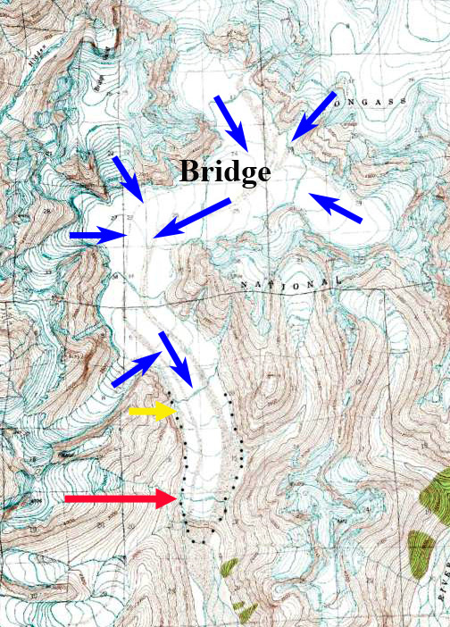
Bridge Glacier in USGS map when it ended on the outwash plain in 1948.


 Dean of Academic Affairs at Nichols College and Professor of Environmental Science at Nichols College in Massachusetts since 1989. Glaciologist directing the North Cascade Glacier Climate Project since 1984. This project monitors the mass balance and behavior of more glaciers than any other in North America.