
May 16, 2016
Frostisen Ice Cap Svalbard, Ongoing Defrosting 1990-2015
Posted by Mauri Pelto
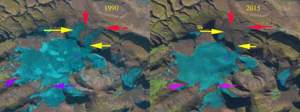
Frostisen Ice Cap in 1990 and 2015 Landsat images. Red arrow is the 1990 terminus location, yellow arrow the 2015 terminus location. Purple arrows indicate thinning on the upper margin of the ice cap, and the letter A indicates an outcrop of rock emerging through the ice.
Frostisen is an ice cap in Dickson Land of Central Svalbard. The World Glacier inventory of 1960 listed the area of the ice cap at 19 square kilometers, by 2007 the Randolph Glacier Inventory indicated the ice cap area at 13.4 square kilometers. Malecki (2013) examined seven glaciers in this region and found an acceleration in losses from 1990-2011 compared to 1960-1990 due to an increase in summer temperature post-1990 which led to higher annual equilibrium line altitudes. The seven glacier lost 39% of their volume from 1960-2009. Here we compare 1990 and 2015 Landsat images to indicate changes in the ice cap . Malecki (2013) also noted evidence of a rapid increase in thinning rates in the upper parts of the studied glaciers, linked to decreasing albedo in former accumulation zones.
In 1990 two outlet glaciers on the east side of the icefield, Skandalsbreen and Studentbreen, after dropping over a prominent sill at 475 m extended approximately 2 km downvalley. At Point A there is no sign of bedrock. There are limited snowpatches 10% of the ice cap with three weeks left in the melt season. In 2015 the eastern outlet glaciers have a limited extent after descending the sill, Skandalsbreen has retreated 975 m and Studentbreen 1300 m since 1990. At Point A bedrock has emerged, this is easier seen in the image below. This is an indication of thinning in the midst of what should be the accumulation zone. In 2013 and 2015 and many other years the ice cap has lost all of its snowcover indicating it has no accumulation zone and cannot survive (Pelto, 2010). The purple arrows indicate thinning at the upper margin of the glacier near 650 m, this would not happen if this area was acting as an accumulation zone. Nuth et al (2013) noted a 7% loss in glacier area in the last 30 years in Svalbard. The tidewater glaciers of Svalbard get most of the attention, but Frostisen like other inland terminating glaciers such as Belopolskijbreen is losing volume rapidly. .

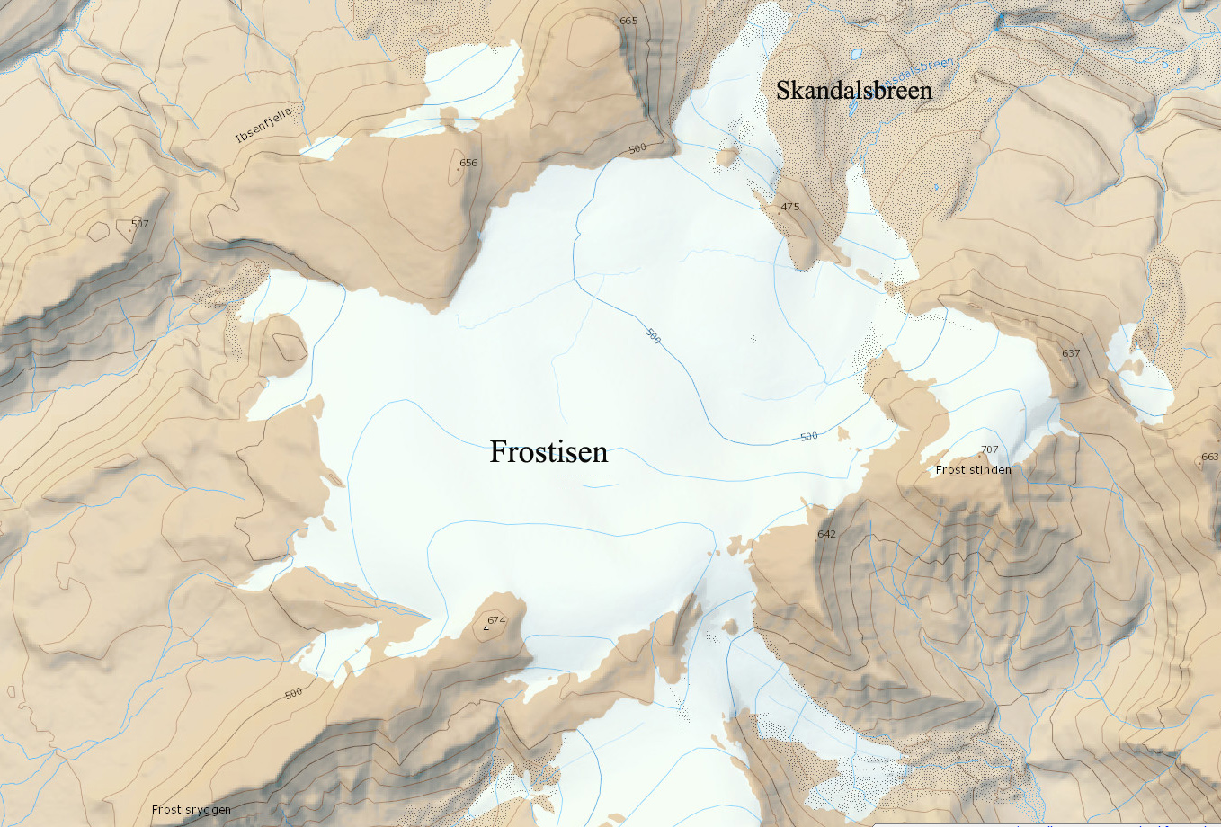
TopoSvalbard satellite view above and map view below of Frostisen Ice Cap. The maximum elevation of 650 m has been below the regional snowline many recent years.
 Dean of Academic Affairs at Nichols College and Professor of Environmental Science at Nichols College in Massachusetts since 1989. Glaciologist directing the North Cascade Glacier Climate Project since 1984. This project monitors the mass balance and behavior of more glaciers than any other in North America.