
February 13, 2015
Eiriksjökull Retreat, Iceland
Posted by Mauri Pelto
Eiriksjökull is an ice cap just west of Langjökull In central Iceland. Here we examine its main western outlet the Braekur using Landsat imagery from 1989 to 2014. The Icelandic Glaciological Society website on terminus variations is the source of the map for the glacier. The IGS program monitors 50 glaciers, all of them are currently retreating. Eiriksjökull , is not one that is in this monitoring program. 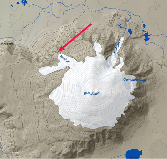
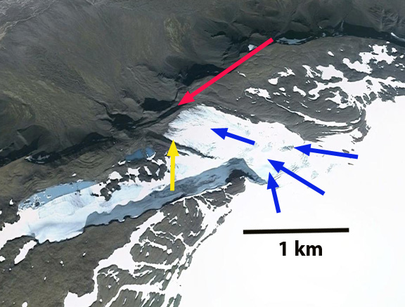
In 1989 the Braekur outlet flowed over the edge of a lava cliff at the red arrow. The glacier terminated on the bench between the upper and lower cliff. In 1994 the glacier still extended to the edge of the cliff. By 2010 the Google Earth images indicates a retreat from the edge of the cliff. In 2014 the glacier has receded 200 m from the edge of the cliff and 300 m from is 1989 position and terminates at the yellow arrow. The high snowlines in recent years will lead to continued retreat. The retreat and area loss of Eiriksjökull is less than on nearby Norðurjökull a primary outlet of Langjökull or on Porisjokull a small ice cap just south of Langjökull.

1989 Landsat image

1994 Landsat image
2010 Google Earth image

2014 Landsat image
 Dean of Academic Affairs at Nichols College and Professor of Environmental Science at Nichols College in Massachusetts since 1989. Glaciologist directing the North Cascade Glacier Climate Project since 1984. This project monitors the mass balance and behavior of more glaciers than any other in North America.