
September 16, 2013
Brúarjökull Retreat, Iceland
Posted by Mauri Pelto
Brúarjökull is a major, 1600 square kilometers outlet glacier on the northeast side of the Vatnjokull Ice Cap in Iceland. Brúarjökull is a surging glacier that has surged n 1810, 1984 and 1964. During a surge a glaciers basal water pressure increases leading to reduced basal friction, a sharp velocity increase and terminus advance. Surges do not typically reflect climate change. In recent years Brúarjökull has been retreating at about 100 m/year. The glacier advanced 8-10 km during the 1964 surge. In this case an additional factor has been added, with the completion of a dam and the filling of the Hálslón Reservoir in 2007 that is now in contact with the terminus of Brúarjökull. Kárahnjúkar hydro power plant is Europe’s largest dam and a $2 billion project that produces 690 MW of power. Unfortunately with the dam now in operation it has not proved profitable for the Landsvirkjun, Iceland’s national energy company. In 2013 the surface level of the Hálslón Reservoir reached 625 meters above sea level at the end of August which is the spillway elevation.
The Brúarjökull Project has examined the glacier terminus and newly exposed landscape by retreat in recent years. The terminus they observe is quite stagnant. The elevation range of Brúarjökull is 600–1750 m a.s.l. with an equilibrium line altitude of 1200 m and accumulation area ratio AAR of 60%. The mass balance of Brúarjökull measured since 1994 and has been consistently negative, losing 10 m of ice thickness overall, with greater much greater thinning near the terminus. Here we examine Landsat images from 1999, 2008, 2012 and 2013 and Google Earth imagery from 2005 and 2009. The contorted medial moraines, red arrows are indicative of a surging glacier. The purple arrows indicate the snowline which leaves much too large an area of glacier in the ablation zone for equilibrium balances. In 2013 the ELA in late August is 1300 m, it will rise a bit more which will mean a negative mass balance of at least 1 m. 
Landsat 2013 image
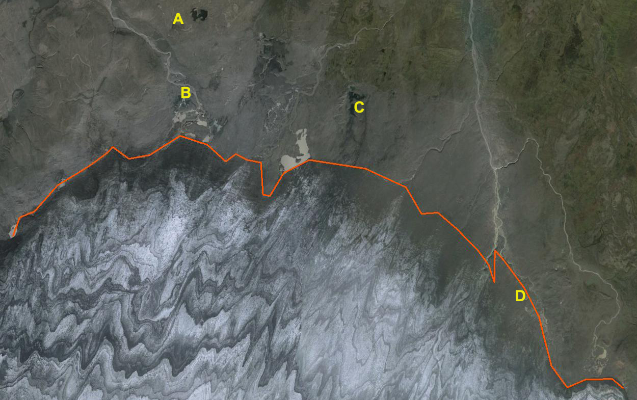
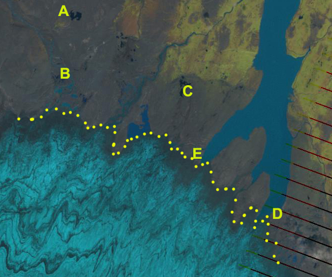
The terminus in each image is indicated by yellow dots with Points A-E being consistently located for comparison. The first image is a Landsat image from 1999, the Hálslón Reservoir does not exist. The distance from Point B to the ice front is 1 km, from Point C 1.75 km and Point D is 0.75 km upglacier of the ice front to the immediate west. By 2005 Google Earth image the Hálslón Reservoir is still not present. By 2008 the terminus has retreated with Point B now 1.5 km from the ice front, Point C 3.5 km and Point D at the ice front to the immediate west. The reservoir exists and frontage in the reservoir 1.75 km. This is better illustrated in the 2009 Google Earth image of the immediate ice front in Hálslón Reservoir. Numerous small icebergs are seen, read arrows. By 2013 the Landsat image indicates the glacier front is 2.5 km from Point B, 5.25 km from Point C and 0.75 km from Point D. The retreat from 1999-2013 is then 1.5 km at Point B, 3.5 km at Point C and 1.5 km at Point D. In 2013 the glacier frontage in the lake has decreased to 1.5 km, and will quickly diminish to where calving is not longer occurring. This retreat is similar to that of draining the Tungnaarjökull west side of Vatnajokulland Skeiðarárjökull Glacier on the south side 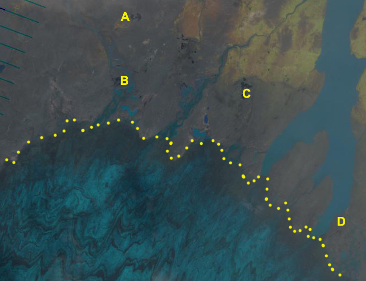
Landsat 1999 image
Google Earth 2005 image
Landsat 20008 image
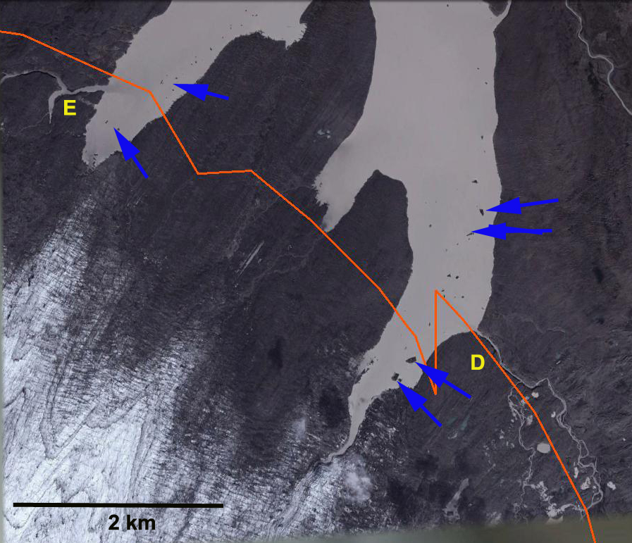
Google Earth 2009 image
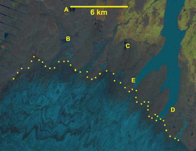
Landsat 2013 image
 Dean of Academic Affairs at Nichols College and Professor of Environmental Science at Nichols College in Massachusetts since 1989. Glaciologist directing the North Cascade Glacier Climate Project since 1984. This project monitors the mass balance and behavior of more glaciers than any other in North America.