
April 27, 2013
Viltragenkees Glacier Retreat, Austria
Posted by Mauri Pelto
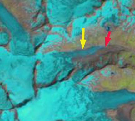
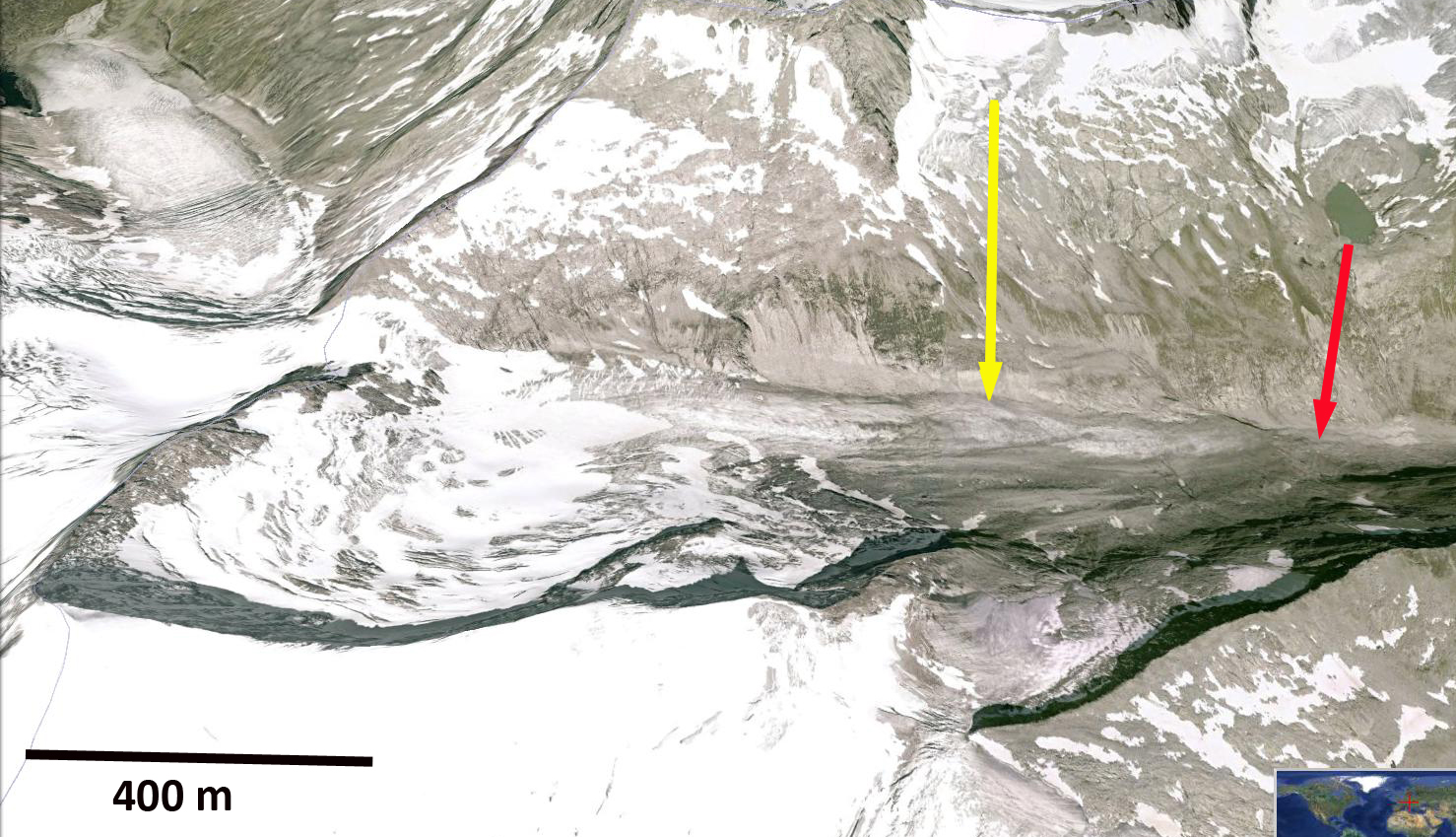
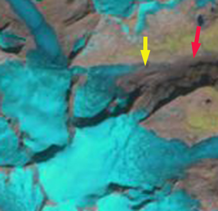
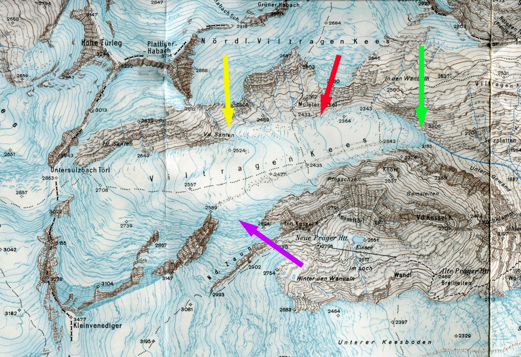
The Austrian Alpine Club published the results of its annual terminus survey program on April 13, 2013. Out of the 95 glaciers measured, 93 retreated an average 17 meters in 2012, two were unchanged. Here we examine one of the those glaciers Viltragenkees. This glacier flows east from the Grosvenediger Massif into the Drau River. In 1988 the glacier was 3 km long beginning at 3200 m and ended at 2340 m. Lambrecht and Kuhn (2007) noted that Austiran glaciers lost 17% of their area from 1969-1998. Abbermann et al (2009) noted that this rate of retreat continued up to 2006 with a further 8% loss. Viltragenkees has been noted by the World Glacier Monitoring Service as having retreated 92 m from 2001-2005 and 157 m from 2006-2010. Here we examine Landsat and Google earth imagery from 1988, 1998, 2000, 2011 and 2012 to illustrate the retreat and then compare a 1929 map to the 2000 terminus position. The red arrow indicates the 1988 terminus the yellow arrow the 2012 terminus on each image. The retreat from 1988-1998 is minor. By 2000 in the Google Earth image the retreat is still minor from 1988, but the terminus section has thinned and is stagnant (see last image in post). In 2011 there is a small segment of residual ice between the 1988 and 2012 terminus position, the glacier has retreated most of the way to the 2012 position otherwise. In 2012 the relict ice is gone and the glacier has completed a 400 m retreat since 1988. However, 90% of the retreat occurred since 2000, indicating a rate of 35-40 m per year. In fact from 2006-2012 the glacier retreated 35-50 m in five of the seven years.


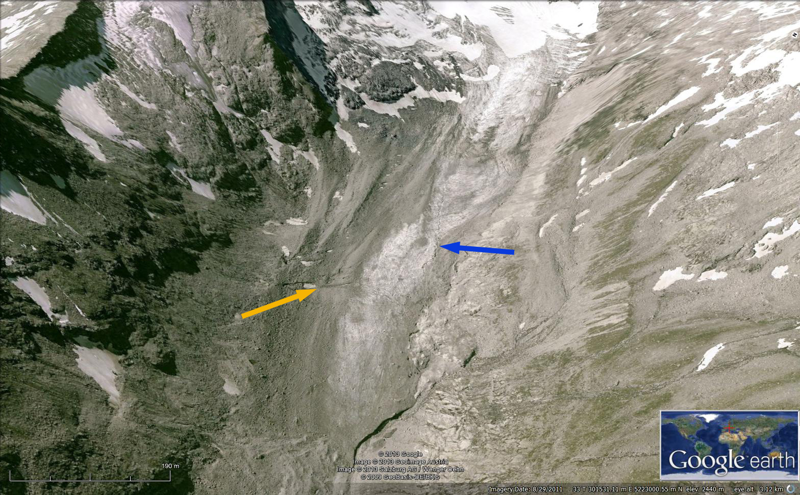
The Austrian Alpine Club noted a retreat of 47 m for Viltargenkees in 2012. Viltragen Glacier is 10 km east of Obersulzbach Glacier that has had a similar retreat. The terminus area in 2000 is quite stagnant, a deeply incised suprglacial stream indicates this fact, blue arrow. The orange arrow indicates a region with a couple of melt ponds, again indicating stagnation. The debris covered terminus has no crevassing in 2000 in the lowest 400 meters again indicating the thin and hence stagnant nature of the lower section of the glacier that was at that point preconditioned for rapid retreat. Below the 2000 terminus image is the full glacier in 2000 compared to the 1929 map of the region provided by Nicholas Fisher. The green arrow indicates the 1929 terminus and the purple arrows where the Schlaten Kees formerly joined Viltragenkees. The retreat over the 70 year period was 700 meters.

 Dean of Academic Affairs at Nichols College and Professor of Environmental Science at Nichols College in Massachusetts since 1989. Glaciologist directing the North Cascade Glacier Climate Project since 1984. This project monitors the mass balance and behavior of more glaciers than any other in North America.