12 June 2017
Anargyroi: an 80 million cubic metre mining-induced landslide in Greece this weekend
Posted by Dave Petley
Anargyroi: an 80 million cubic metre mining-induced landslide in Greece this weekend
Over the weekend, the village of Anargyroi, in northern Greece, has been permanently evacuated as a result of a huge mining-induced landslide. The village, which is located at 40.603 21.612, was home to 182 people. It will now be demolished.
The landslide appears to have been triggered by the collapse of an open case lignite mine. Media reports suggest that the landslide is exceptionally large – 80 million cubic metres is being quoted by a number of sources.
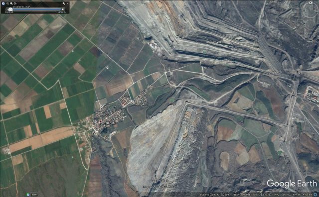
This is a Google Earth image of the village and the mine, taken in 2014:

Google Earth of the village of Anargyroi and the adjacent lignite mine
.
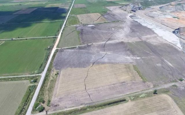
Ekathimerini has this dramatic image of the edge of the mine showing enormous cracks extending across the landscape:

Tension cracks extending from the margins of the mine at Anargyroi in Greece. Image via ekathimerini.com
.
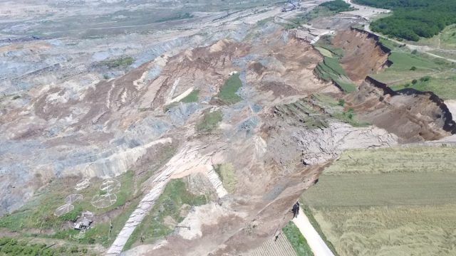
Meanwhile the best image that I have seen of the landslide itself is one the newsit.gr website, which has a fantastic gallery of views of the landslide:-

The huge mining-induced landslide at Anargyroi in northern Greece, via newsit.gr.
.
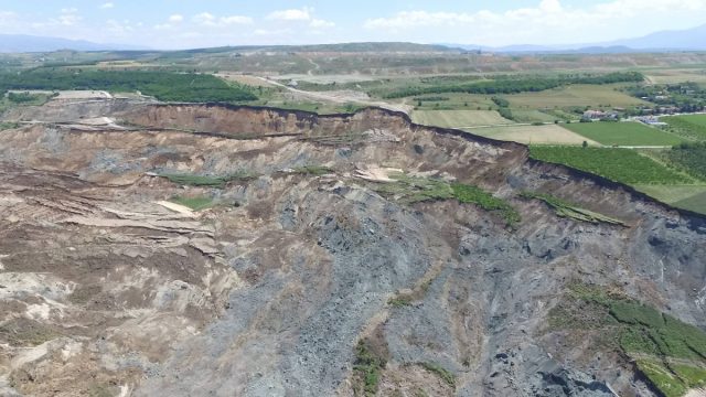
Meanwhile, this image (from the same source) gives an idea of the scale of the Anargyroi landslide:

The extraordinary scale of the Anargyroi landslide in Greece, via newsit.gr
.
A translation of the report on Newsit.gr yesterday suggests that the landslide is expected to continue for at least another 48 hours. Movements started on 3rd June, but have clearly accelerated in the last few days. This is an interesting part of the article (via Google Translate):
As a result of the landslide, cracks and damage occurred in about ten houses that are on the side of the mine front and were ordered by authorities to evacuate in order not to endanger human lives. Michalis Kavvadas Deputy Professor of Geotechnical Engineering, NTUA Polytechnic, who visited the area of the mine and the Anargyroi area three days ago, stated in statements that the movements of soils at the mine of Amynousis activate the tectonic fault that passes through the village, causing larger cracks in the streets and in its homes.
This landslide is reminiscent of the enormous Collolar coal mine landslide in Turkey in 2011.


 Dave Petley is the Vice-Chancellor of the University of Hull in the United Kingdom. His blog provides commentary and analysis of landslide events occurring worldwide, including the landslides themselves, latest research, and conferences and meetings.