12 January 2016
A major rockslide on US2 near Wenatchee
Posted by Dave Petley
A major rockslide on US2 near Wenatchee
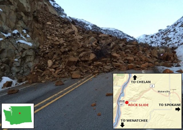
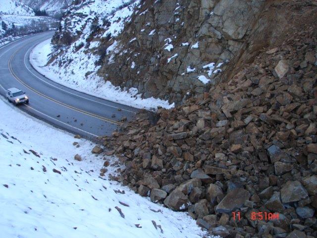
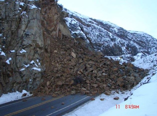
The Washington State (USA) Department of Transport twitter account (@wsdot) has images of a major rockslide that occurred in US2 west of Waterville near to Wenatchee. This is not a trivial event by any means:

Landslide on US2 near to Wenatchee courtesy of Washington State DoT
.

Landslide on US2 courtesy of Washington State DoT
.

Landslide on US2 courtesy of Washington State DoT
.
Looking at the third image, this is a complex wedge type failure on existing joints. There appears to be weathering on the newly exposed surfaces. Looking at the rest of the rock mass, the joint pattern is very complex, so this is a difficult slope to manage and mitigate.
Moving some of the large boulders is going to be a major task.


 Dave Petley is the Vice-Chancellor of the University of Hull in the United Kingdom. His blog provides commentary and analysis of landslide events occurring worldwide, including the landslides themselves, latest research, and conferences and meetings.
The 100k landslide map for this area shows a large, deep-seated landslide immediately uphill from this rockslide. Based on a cursory view of the topography, I think the deep-seated landslide may extend all the way down to the creek (contrary to the large-scale landslide map), encompassing the rockslide source area. The location of the slide can be viewed in google maps here:
https://www.google.com/maps/@47.631563,-120.180448,14z/data=!5m1!1e4
The slide occurred along the apex of the road curve in the center of the map. GPS coordinates for the rockslide are: 47.631563 ° N, 120.180448 ° W
WA state DNR online geologic map:
https://fortress.wa.gov/dnr/protectiongis/geology/?Theme=wigm
The rockslide occured in Swakane gneiss:
http://geomaps.wr.usgs.gov/parks/noca/t7swakane.html
But, the most puzzling thing about these photos… who still has a camera that puts the date and time in the corner???