29 October 2015
The amazing Tonzang landslides in Burma – NASA images
Posted by Dave Petley
Tonzang landslide event in Burma
In late July and early August extreme rainfall in the Tonzang area of Burma triggered extensive landslides and floods. Whilst there were some media reports of these events (and a good blog site has reported upon them), and a few weeks ago I posted some images, details of this event have remained sketchy. This event has been particularly intriguing as Goran Ekstrom and Colin Stark from Columbia University picked up two landslide seismic events, and of course these are only generated by the largest landslides. Unfortunately the summer is monsoonal in Burma, meaning that it has not been possible until now to obtain good quality satellite imagery. In the last few days NASA kindly tasked the EO-1 satellite to image the area, and Colin has equally kindly provided some images and information.
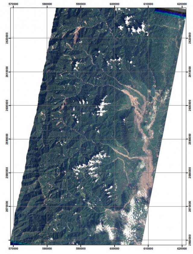
What is now clear is that this was a most unusual landslide event. The satellite image below shows and overview of the landslides triggered by the rainfall. Note that this image does not cover the entire area, so there are more landslides to be found as yet. The brown areas in the mountains are the multiple landslides triggered by the rainfall – note just how many there are:-
.
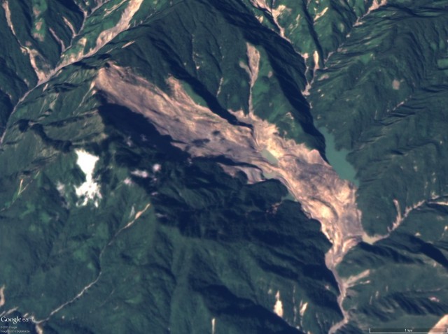
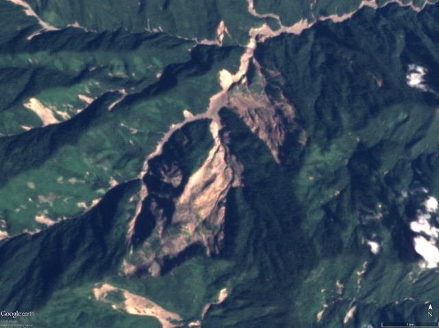
I have posted before on the largest of the landslides, which is clearly visible in the image above, based upon the UNOSAT mapping of a part of the slide. We now have decent imagery of this event – and it is truly enormous:-
.
It is hard to get a scale on this from the image, but from the crown of the failure to the toe it is 5.9 km. This is a genuinely remarkable event – without doubt one of the largest rainfall induced landslides in recent years. It is clear that the landslide has blocked the valley and a lake has developed upstream, although this is not very large. Note the many other landslides visible on the image, also triggered by this rainfall event. These are very diverse, including channelised debris flows and translational failures.
However, the two seismic events that Goran Ekstrom detected do not appear to correspond to this landslide. These are the two velocity / trajectory graphs for those two slides, generated through the inversion of the seismic data:-
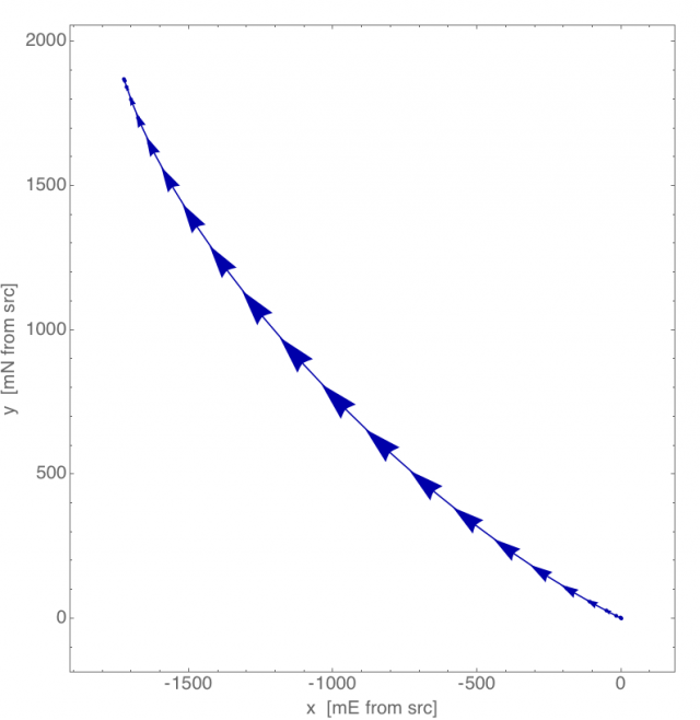
Velocity – trajectory graph for one of the Tonzang landslides, courtesy of Colin Stark and Goran Ekstrom
.
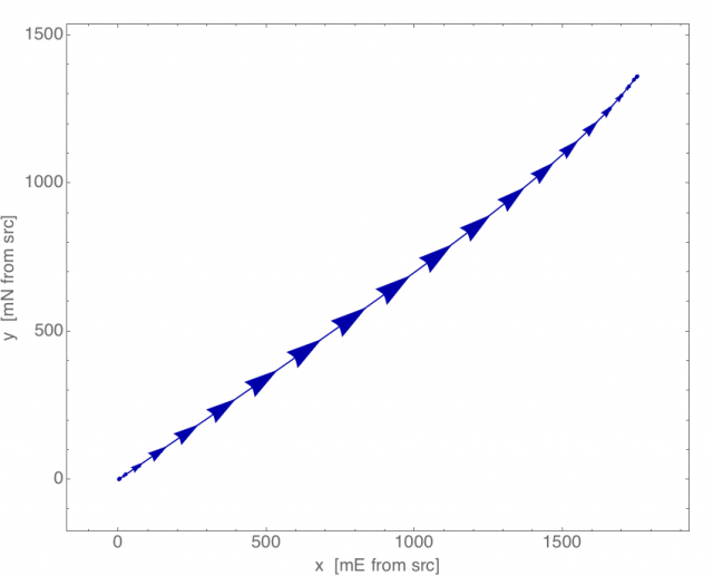
Velocity – trajectory graph for the second of the Tonzang landslides, courtesy of Colin Stark and Goran Ekstrom
.
These are both large landslides, but neither the trajectory nor the runout distance correspond to the large event shown above. The only potential candidates on the imagery lie in this area of landslides to the south of the largest event:-
.
It is not clear to me that these landslides are the correct candidates, which may mean that there are further large landslides that have yet to be captured on the satellite imagery. There is clearly more work to be done, and it will be very interesting to see what emerges when the rest of the area is captured on satellite imagery in the coming weeks.
Acknowledgement
Many thanks to Colin Stark and Goran Ekstrom and Columbia University and Stuart Frye at NASA for their help with this post.


 Dave Petley is the Vice-Chancellor of the University of Hull in the United Kingdom. His blog provides commentary and analysis of landslide events occurring worldwide, including the landslides themselves, latest research, and conferences and meetings.