25 June 2013
Before and after NASA satellite imagery of the debris flow events at Kedarnath
Posted by Dave Petley
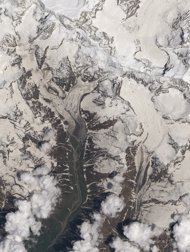
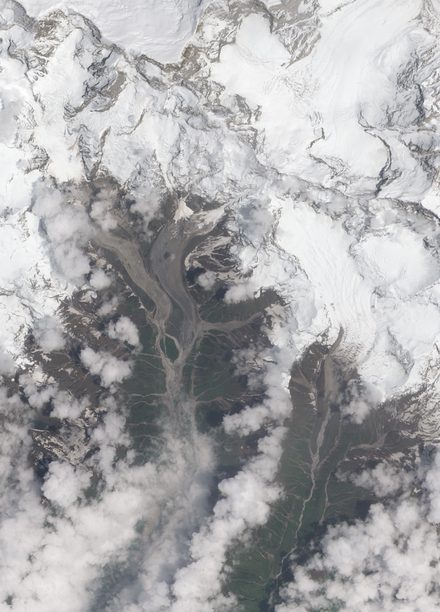
Robert Simmon of the Earth Observatory at NASA has very kindly made two Landsat 8 satellite images available to me of the Kedarnath area,, affected by exceptionally heavy rainfall ten days ago. The first was taken on 22nd May 2013 – i.e. before the debris flow – whilst the second was collected on Sunday (23rd June). They are both 15 m resolution, so are very helpful. I should also note that this is the first time that I have used Landsat 8, which was only commissioned last month.
This is the image before the event:
..
And this is the image afterwards:
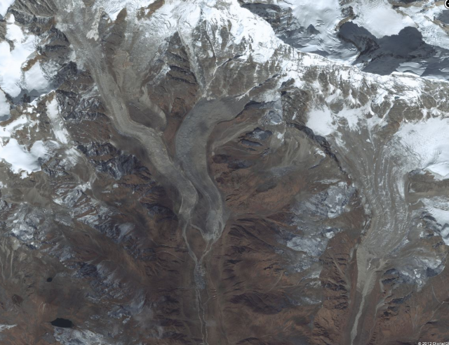
One obvious difference is the amount of snow across the landscape – of course we can just ignore this. It is also helpful to take a look at the Bing image, which was taken in the summer months but much earlier than either of these two:
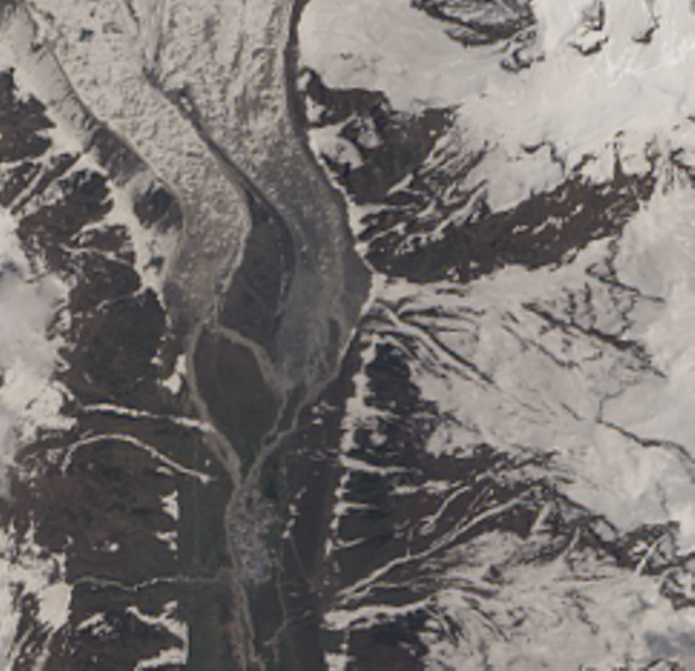
The area of real interest is the zone around and upstream of the Kedarnath temple. This is a zoom into the Landsat 8 image before the disaster:
And this is after the disaster:
There are some dramatic changes. One is that on the post-disaster image the town has almost disappeared. Another is that all of the channels now have fresh sediment in their beds. Although the resolution makes interpreting the processes quite difficult, enough is visible here to get a pretty good idea of what has gone on. First, it doesn’t appear that there has been a mass flow down either glacier. It does appear that on the western glacier, there has been mobilisation of moraine at the end of the ice flow, and that this debris struck the town. I have put the two images of this area side by side below; the northern edge of the town is on the lower portion of the images, just to the right of centre:
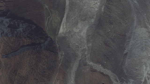
 It is interesting that a new channel opened up in this area. I am not sure what the topography is actually like up here, but this is the very high resolution Bing image of the source area:
It looks to me as if a large amount of sediment in this region failed and transitioned into a debris flow that then ran down slope into the town. However, this is not all. On the other side of the valley we see this feature, again shown in the pre- and post-disaster images:
..
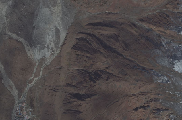
In this case it appears that there is a large area of erosion, or even a landslide, right up the valley side. This has also transitioned into a debris flow that has struck the town – indeed if you look at the location of the town on the left image, it appears that much of the damage may have been from this flow. This is the same area on the high resolution Bing image:
The source area of the erosion / landslide is visible, but it is nothing like as active as it was in the disaster. The route through which the debris from this slide was able to strike the town is clearly evident.
Note also that there was very active erosion in all of the other gulleys, but these do not seem to have been responsible for the disaster.
So, in conclusion, I suggest that the town was struck by debris flows from both the east and the west valleys (see here for my earlier speculation on this). On the west side the main issue seems to have been failure and mobilisation of glacial sediment; on the east side it was active erosion of slope materials. Faced with this sort of onslaught, the town stood little chance.
Comments and thoughts very welcome.




 Dave Petley is the Vice-Chancellor of the University of Hull in the United Kingdom. His blog provides commentary and analysis of landslide events occurring worldwide, including the landslides themselves, latest research, and conferences and meetings.
The topography of the area where a new channel was formed (lower left quarter) can be seen in the Flickr photo by prithishray : http://www.flickr.com/photos/prithishray/6268480590/sizes/o/in/photostream/