11 July 2012
An interesting landslide in Manitoba, Canada
Posted by Dave Petley
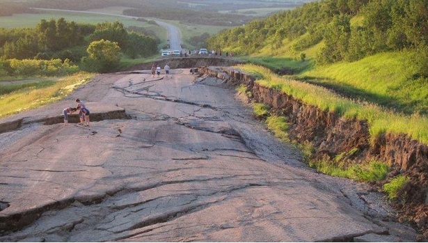
Thanks to a number of people who brought this one to my attention, and apologies for my slow response (a consequence of my new job). A few days ago a large landslide affected Highway 83 between Roblin and Asessippi Provincial Park in Manitoba, Canada. CBC News has a good report on this landslide, if you can forgive the use of the terms “crater” and “sinkhole”, with some really neat images, such as this one:

http://www.cbc.ca/news/canada/manitoba/story/2012/07/03/mb-collapsed-road-assessippi-park-manitoba.html?cmp=rss
The landslide, which appears to have been triggered by a month of heavy rainfall, has for obvious reasons caused the road to be closed. Unfortunately, mitigating this landslide is likely to be quite complex.
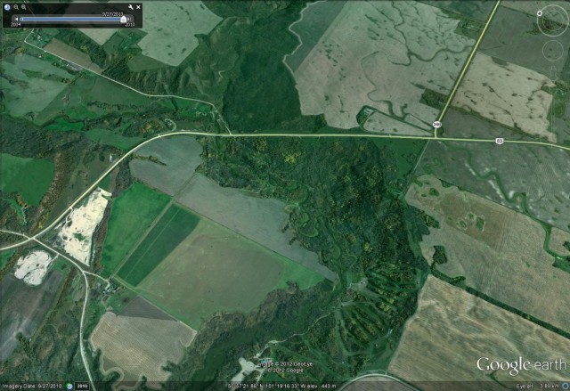
A quick look at Google Earth yields what is I think the location of the landslide:
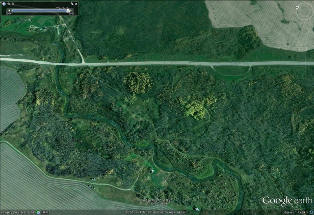
 It appears to be a degraded scarp with active toe erosion. A zoom into what I think is the landslide area itself shows that the area below the road has the characteristic morphology of an old landslide, with hummocky terrain and a contorted water course. if I was investigating this landslide my hypothesis would be that this is a reactivation of an existing landslide. The potentially unstable area is quite large. Not that if you look carefully you can see that this section of road has multiple repairs, perhaps suggesting slow movement before this more recent event:
 Of course all of this is no more than an initial speculation – a more detailed investigation will now be needed to work out what is going on at this site and to plan an effective mitigation strategy.


 Dave Petley is the Vice-Chancellor of the University of Hull in the United Kingdom. His blog provides commentary and analysis of landslide events occurring worldwide, including the landslides themselves, latest research, and conferences and meetings.