22 February 2011
First news of the Mw=6.3 earthquake in Christchurch, New Zealand
Posted by Dave Petley
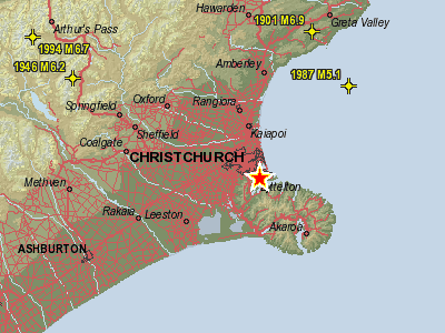
Christchurch in New Zealand was once again hit by an earthquake today, with the event happening at 12:51 pm local time (23:51 UT on 21st Feb). As usual, the Geonet site is the best place for up to date information about this event. At the time of writing (just over two hours after the earthquake, the location report is as follows:
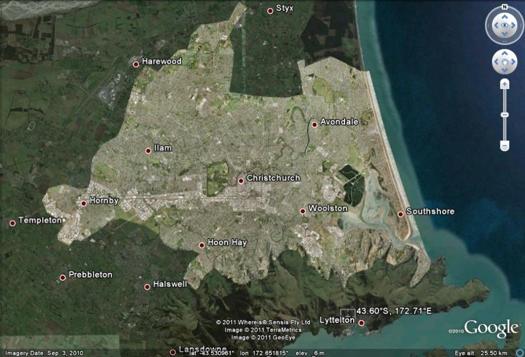
A Google Earth image of the location of the epicentre shows why this earthquake is likely to have had a huge impact:
Note the reported location of the earthquake at the foot of the image. In essence this is a bulls-eye hit of a substantial event on the city. The Geonet reported magnitude is 6.3 (note that this is likely to change over the next few hours as the data improves), but the depth is very shallow (only 5 km). The consequence is high levels of shaking in the city centre. The Geonet shaking intensity map is based upon instrument data and reports by people on the ground. As I write the map looks like this:
The squares are the instrument data, and the circles the eye-witness reports. The red squares indicate MM=8 and the orange ones MM=7. Christcurch itself is in the MM=7 zone, which in terms of buildings is “damaging”.
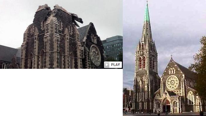
Christchurch is probably the most “English” city in Australasia, which means actually that there are at least some masonry buildings. An example is the cathedral – the picture pair below shows after (from here) and a file image from before the event:
The likely impact of the earthquake is likely to have been exacerbated by the timing in the middle of the day, which means that many people will have been in the street (unlike the September 2010 (Darfield) event, which occurred very late at night). This means that many more people will have been in the way of collapsing buildings, breaking glass, etc. Fatalities are very likely as a consequence. Liquefaction was also a major issue in the Darfield earthquake, and is likely to be a major problem in this case too.
Readers may be interested in my images from the aftermath of the September 2010 (Darfield) event, which can be found here (the famous railway line images), here (the fault rupture) and here (building damage).


 Dave Petley is the Vice-Chancellor of the University of Hull in the United Kingdom. His blog provides commentary and analysis of landslide events occurring worldwide, including the landslides themselves, latest research, and conferences and meetings.
[…] This post was mentioned on Twitter by Yuanrang, Chris Rowan. Chris Rowan said: First news of the Mw=6.3 earthquake in Christchurch, New Zealand http://bit.ly/eyZhM9 […]
I suspect that the pre-existing damage from the September quake may also have contributed to the impact of this one – even quake resistant structures can only take so much shaking, and repairs were far from complete.
For those who are interested, I’ve posted a brief discussion of the tectonic context of this quake, and it’s relation to the one last September.
Last week Robert Parker the Mayor of Christchurch was in Kathmandu where he was interviewed by the Kathmandu Post (18 February) about his experiences in the September 2010 earthquake and its relevance to Kathmandu http://www.ekantipur.com/the-kathmandu-post/2011/02/17/metro/kathmandu-can-learn-from-christchurchs-handling-of-quake/218540.html. On the 20th the Kathmandu Post had an editorial relating to this http://www.ekantipur.com/the-kathmandu-post/2011/02/19/editorial/a-threat-looms/218612.html
Dr. Petley was in Kathmandu last February, although I don’t think it was mentioned in this blog http://www.myrepublica.com/portal/index.php?action=news_details&news_id=14988
Dave,
I was in Christchurch on the way to Antarctica a year ago January. It was easy to see why they call it the garden city. So Sad. Question from some of my viewers- how unusual is it to get an aftershock this long after the initial quake?
Dan
Judging from images of some of the damage, it appears that ground failure played a significant role in the damages experienced by the various structures. A cursory map check indicates that the majority of the city is built upon river bottom alluvial deposits. I wonder if they have experienced much rainfall in the recent past which has raised groundwater levels and softened near surface foundation soils?
[…] the images looked bad, at first the death toll seemed surprisingly low. Then I came across The Landslide Blog in the American Geophysical Union Blogsphere, and the objective scientific description of this […]
A moderate earthquake was felt in Khyber Pakhtunkhwa, Northern Areas, FATA and Punjab.
for more details visit
http://www.dunyanews.tv