
6 June 2016
Looking at Land Use and Informal Settlement in Dar es Salaam
Posted by larryohanlon
This is part of a new series of posts that highlight the importance of Earth and space science data and its contributions to society. Posts in this series showcase data facilities and data scientists; explain how Earth and space science data is collected, managed and used; explore what this data tells us about the planet; and delve into the challenges and issues involved in managing and using data. This series is intended to demystify Earth and space science data, and share how this data shapes our understanding of the world.
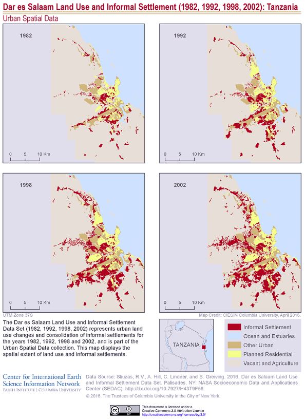
A new data set from the Urban Spatial Data Collection of the NASA Socioeconomic Data and Application Center (SEDAC) operated by the Center for International Earth Science Information Network (CIESIN) depicts urban land use and informal settlements for the years 1982, 1992, 1998 and 2002 in the city of Dar es Salaam, Tanzania.
The land use categories are informal settlement areas, planned residential areas, ocean and estuaries, vacant and agricultural lands, and other urban features such as industrial or recreation areas. The data are based on the World Geodetic System spheroid of 1984 and use the Universal Transverse Mercator Zone 37 South projection.
For more information and to download the data, visit the SEDAC website.
Contributed by the NASA Socioeconomic Data and Applications Center operated by CIESIN.