
November 19, 2015
Dismal Glacier, British Columbia Prospects Match Name
Posted by Mauri Pelto

Landsat image comparison from 1988 and 2015, red arrow indicates 1988 terminus and yellow arrows 2015 terminus. Purple arrows indicate thinning upglacier.
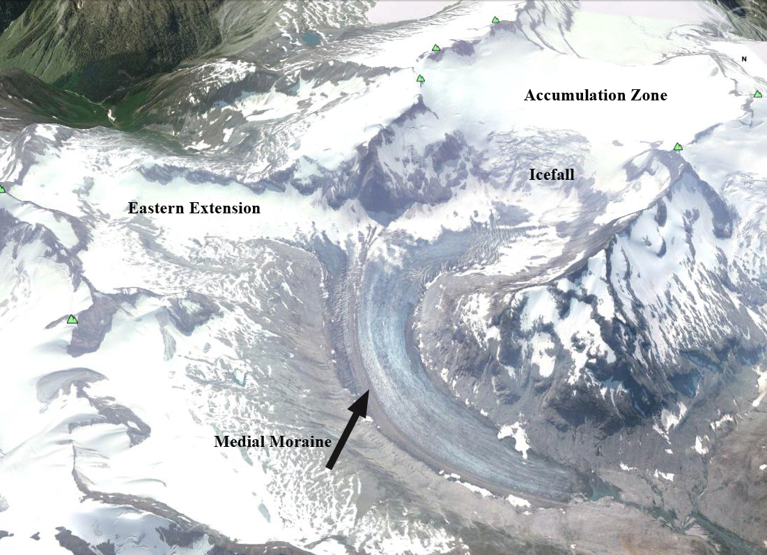
Dismal Glacier flows north from Mount Durrand in the Selkirk Range of British Columbia. It drains from 2500 m to 1950 m and its runoff flows into Downie Creek that is a tributary to the Columbia River and Revelstoke Lake. This lake is impounded by the BCHydro Revelstoke Dam which is 2480 MW facility. Here we examine Landsat images from 1988 and 2015 to identify changes in this glacier. The glacier snowline in the mid-August image of 2015 is at 2400 m just above a substantial icefall. The glacier has retreated 640 m from 1988 to 2015. The eastern extension at 2200 to 2300 m of the glacier noted by a purple arrow, has lost considerable area, indicating thinning even well above the terminus elevation. Note thinning of this section of the glacier by 2015 after it joins the main glacier, it is separated by a medial moraine. The terminus in the 2009 Google Earth image has a low slope and is uncrevassed. This indicates the terminus reach is relatively inactive, but does not appear stagnant. Tennant and Menounos (2012) examined changes of the Rocky Mountain glaciers just east of this region and found between 1919 and 2006 that glacier cover decreased by 590 square kilometers, 17 of 523 glaciers disappeared and 124 glaciers fragmented into multiple ice masses. This will happen at Dimsal Glacier as it has at Cummins Glacier. Bolch et al (2010) observed a 15% area loss from 1985-2005 in this region. The snowline has been above the icefall at 2400+ m in 2013, 2014 and 2015, indicative of negative mass balance that will lead to continued retreat. The glaciers name is not due to its future prospects, but its future prospects are indeed dismal.

BCHydro image of Revelstoke Dam
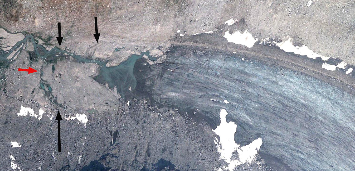
Google Earth image of Dismal Glacier terminus in 2009. Red arrow indicates 1988 terminus position, black arrows various recessional moraine features.
 Dean of Academic Affairs at Nichols College and Professor of Environmental Science at Nichols College in Massachusetts since 1989. Glaciologist directing the North Cascade Glacier Climate Project since 1984. This project monitors the mass balance and behavior of more glaciers than any other in North America.