
16 April 2018
Notes From A Slow Motion Disaster
Posted by Dan Satterfield
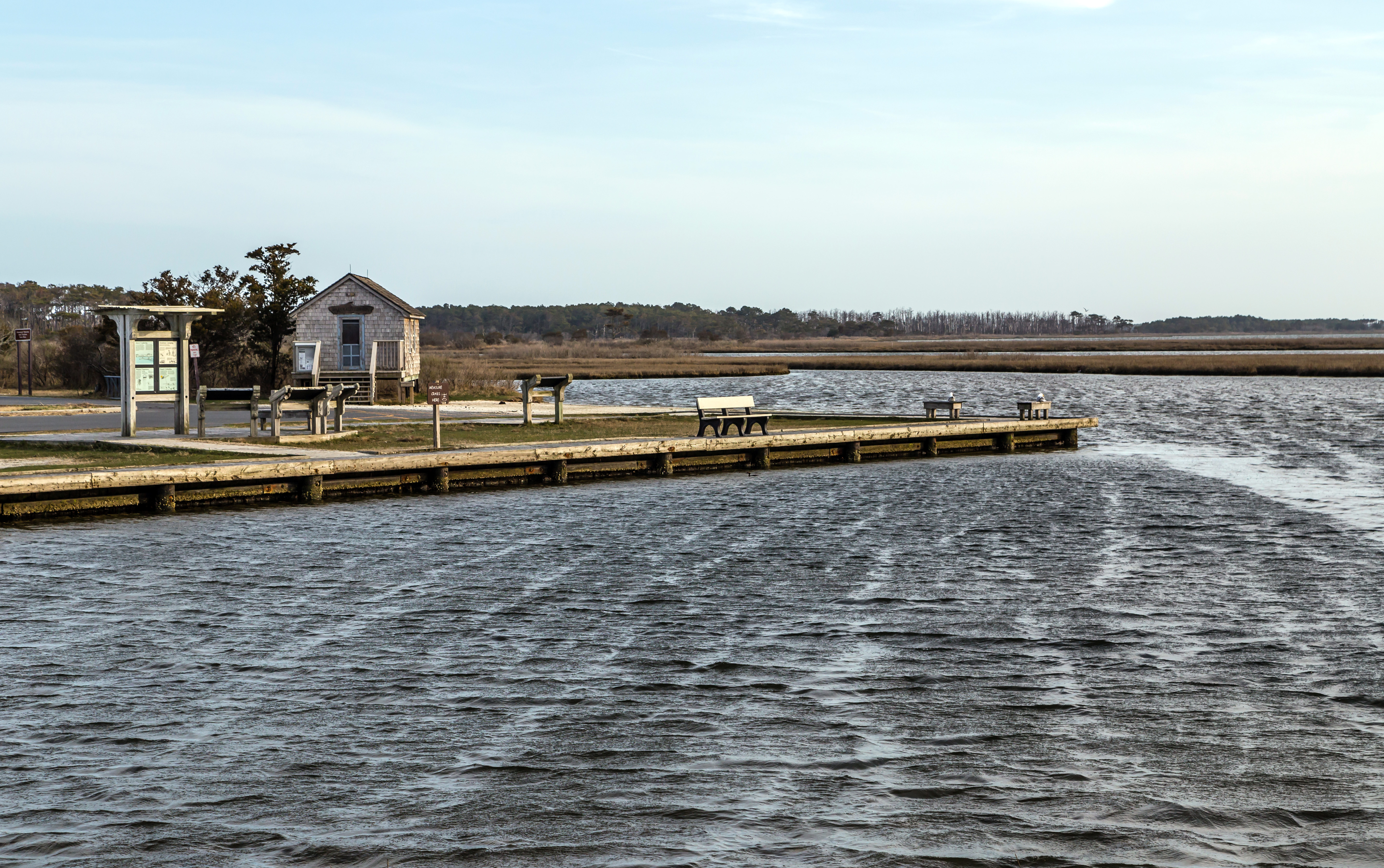
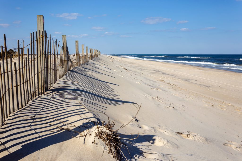
Assateague National Seashore. Note the dead trees on the horizon in the far distance.
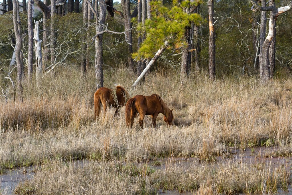
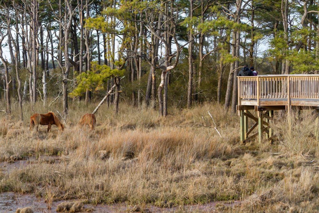
Assateague Nat. Seashore is one of the jewels of Maryland and I never tire of soaking in the beauty of this windswept barrier island at the edge of the continent. This past weekend I grabbed my camera and spent some time with the famous pony’s on the back side of the barrier island away from the beach. While doing so, I noticed something that few visitors would: climate change underway before my eyes.
Now if you look at the sea level records from Assateague, the rising ocean is there in black and white, or should I say salt water blue? The visitors don’t see that though, they soak up the sun at the beach and most don’t even visit the back side of the island where beautiful boardwalks surround saltwater and freshwater wetlands. Not only is this the best place to take photos of the famous ponies it’s where you can see the climate changing.
Look at the picture at the top of this post. See the dead trees on the horizon? Now look at the pictures below that I shot Saturday, April 14, 2018.
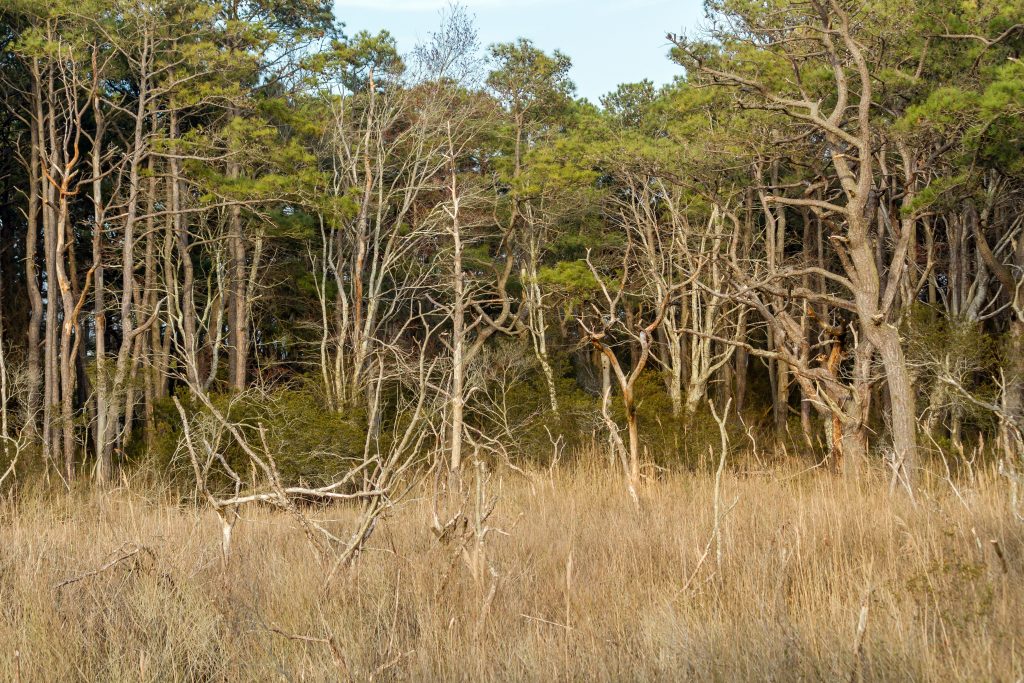
Note the dead trees above with healthy trees behind them. The trees are dead because of salt water. It’s steadily rising and you can see it at Assateague and also at Blackwater NWR about 60 miles away on the Chesapeake Bay. The sea level on the coast from Cape Hatteras to Boston is rising 3-4 times faster than the global average and it’s clearly visible. Most people think this is just the way it looks but that’s why slow-motion disasters are so insidious. You do not realize how drastic a change is underway.
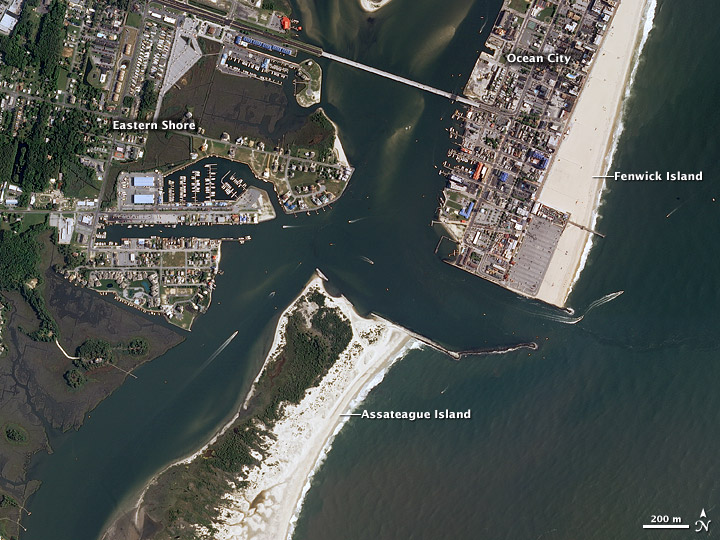 NASA has a good summary of how much Assateague has retreated as the water rises and how the coastline has changed from the jetties at the Ocean City inlet. Note in the image how the jetty has blocked the longshore current and accelerated the retreat of Assateague. North of the jetty sand accumulated, although sand must be dumped to the north in Ocean City to keep the beach and hotels dry.
NASA linked to an EPA report called Coastal Sensitivity to Sea Level Rise in the Mid Atlantic. Guess what happens if you try and get it from the EPA:

They don’t much like uncomfortable facts over there do they…
Don’t sweat it though. Science is based on objective data and testable fact and not a warped worldview. It will win in the end because when you have to hide the science, you’ve already lost the battle. The younger kids ( in 7-12th grade) have grown up with a worldwide library in their hands. They get this. I also suspect some are confused about why their grandparents are so angry about things.
Oh, and below is the beauty of the front side of Assateague.
 Dan Satterfield has worked as an on air meteorologist for 32 years in Oklahoma, Florida and Alabama. Forecasting weather is Dan's job, but all of Earth Science is his passion. This journal is where Dan writes about things he has too little time for on air. Dan blogs about peer-reviewed Earth science for Junior High level audiences and up.
The satellite picture shows the cause: The Jetty has blocked the longsore flow of sand from the North, causing the Assateague Island to retreat. The solution is to remove the jetty, to allow the island to get re-nourished with fresh sand. It isn’t climate change at all.
It’s both sea level rise and the long shore current blockage.
Thank you for your honest reportage! I see the signs of climate change even here in the Midwest, far from the oceans. The size of the storms affecting the Earth, the increasing unpredictability of the weather, the droughts where there has never been any worry about adequate moisture, the confusion of the birds–I could go on and on but you say it better and with more wisdom. Again, thank you for addressing what our government has decided we cannot hear.
As recorded at stations just north and south of Assateague (Ocean City MD and Wachapreague VA), local sea level has risen approximately 8.0 to 8.4 inches since 1980. Part of that is due to land subsidence but more than half of it is climate change (from melting glaciers and thermal expansion of sea water).
As sea level rises, salt water intrudes into the root zone of trees along the shoreline. Trees growing along the edge of the forest, closest to the water, are presumably the ones most sensitive to a change in salinity because they’re growing right on the edge of what is habitable. They are like the canary in the coal mine.