
28 July 2017
Freak Summer Nor’easter Headed for the Mid-Atlantic
Posted by Dan Satterfield
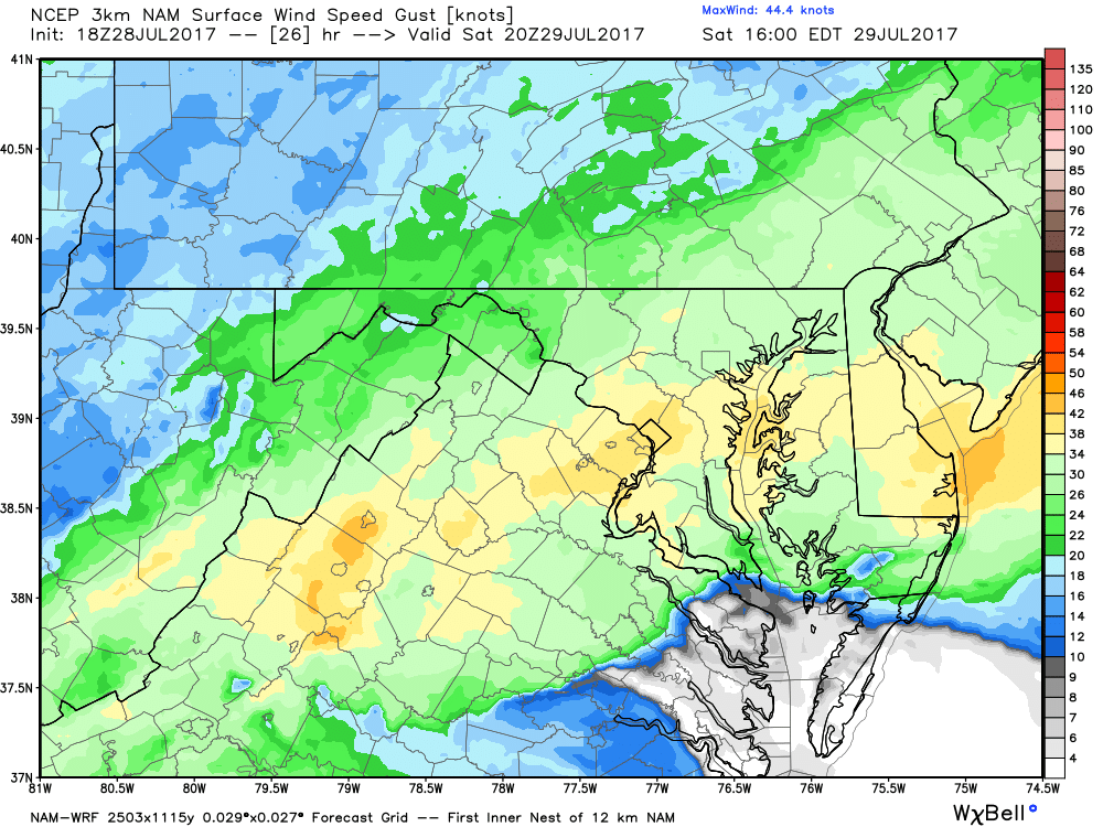
Numerical Weather models are showing a low-pressure center dropping below 1000 millibars offshore Saturday. Winds are forecasted to gust to over 40 mph on the Delaware coast with gusts to nearly 50 possible on the Jersey Shore!
Gale warnings in July are rare along the mid-Atlantic coast, but if a tropical cyclone is nearby, they do happen. But those are rare, and a gale warning for a nor’easter in late July?
That does not happen. No way.
WAY.
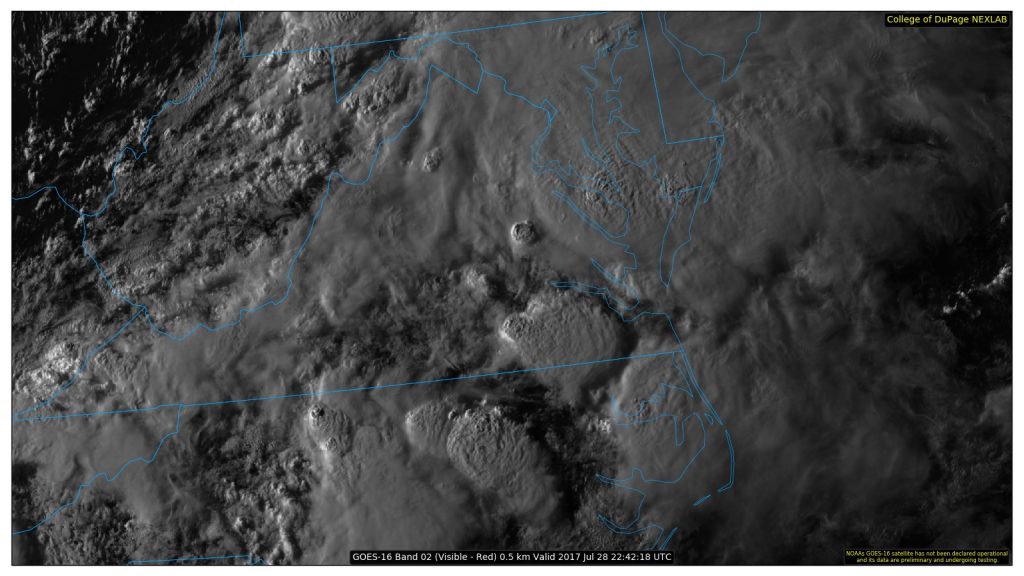
GOES-16 visible image of storm tops over the Mid-Atlantic at 6:42 PM Friday. The setting sun highlights the tops very clearly.
A strong trough in the troposphere is indeed going to bring a real fall-like nor’easter to the Mid-Atlantic this weekend with winds gusting nearly 50 mph on the coast. The bigger threat is flooding rains, however, and model guidance is predicting some rather alarming rainfall totals. At least 50-100 mm (2-4 inches) of rain seems likely in the next 36 hours and much of it may fall tonight. This much rain will cause problems anywhere, but if it falls in an urban area like DC or Baltimore, severe flash flooding will be the result.
The reason for the heavy rain is not just the strong low-pressure system. The atmosphere is soaking wet and it’s not just warm and muggy near the ground. A deep layer of moist air covers the region and one way we measure this is by a parameter called precipitable water. We take a column of air and using physics equations we squeeze all of that water out into rainfall. When you see values of over 2 inches, watch out, and I’m seeing values of 2.5 inches and higher, so there’s real cause for concern.
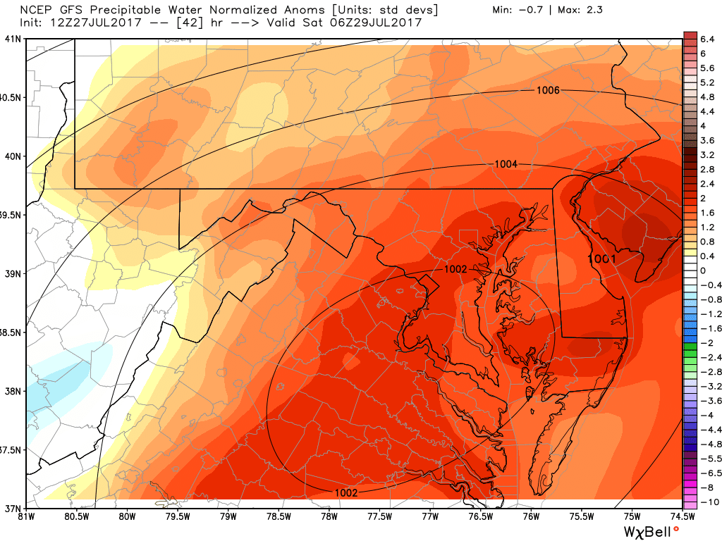
Precipitable water forecast from the NOAA global model.
The heaviest rain will likely fall from DC/Baltimore across Central Delmarva, where some areas may see over 6 inches (150mm!).
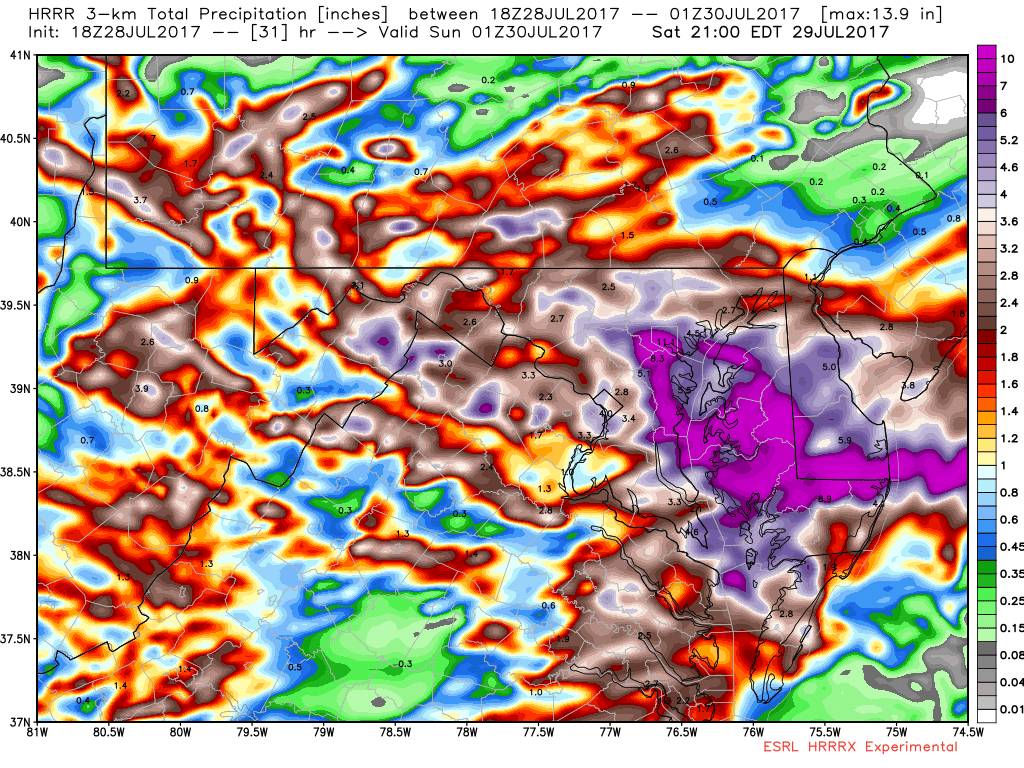
Every model run is a bit different but this is a high-resolution run showing well over 4 inches of rain in the next 18 hours, ending at midday Saturday. All models are wrong, but they sometimes give valuable information.
Flash floods can cause great damage and loss of life, and the threat in urban areas is even higher since heavy rainfall runs down streets instead of soaking into the ground. This event is happening almost a year to the day from the historic flood in Ellicott City, Maryland last July 30.
The only thing left to say is TURN AROUND, DON’T DROWN
 Dan Satterfield has worked as an on air meteorologist for 32 years in Oklahoma, Florida and Alabama. Forecasting weather is Dan's job, but all of Earth Science is his passion. This journal is where Dan writes about things he has too little time for on air. Dan blogs about peer-reviewed Earth science for Junior High level audiences and up.